
Intro 101 or Room 101?
The number 101 can mean an introductory course in a US college. Alternatively, it could be a torture chamber of your worst nightmares in the book Nineteen Eighty-Four. The Digest covers both bases with some horribly complicated plans to try to explain in simple terms.
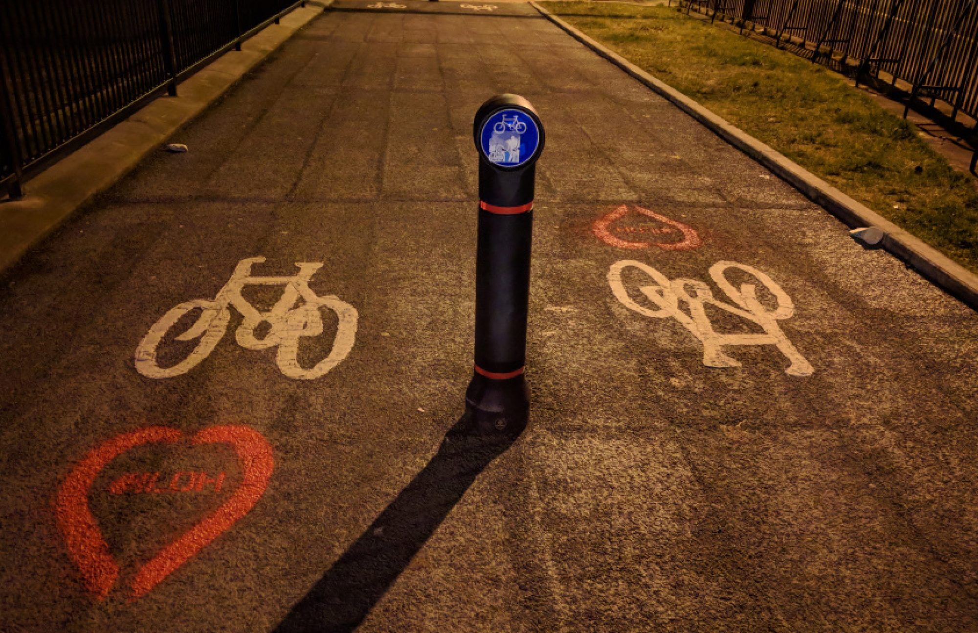
If only this didn’t apply to any of the latest plans from Glasgow’s Avenues Project. While safer routes are welcome, issues with side streets don’t seem to have improved since Sauchiehall St. The lanes on Argyle St west (Central Station end, shown above) seem to be based on a retro movie poster.
Elsewhere, the south-west of Glasgow has the most consultations in this issue (there’s no prize, by the way).
Contents
(new/updated items in bold – link jumps to article)
Section 1: Current Consultations
- Pollok Park: Off Road Parking Places Order 2016 (Variation No.1)
- Braidcraft Rd & Brockburn Rd TROs
- Hyndland, Hughenden And Dowanhill West, Traffic Management/Parking Controls
- Ayr Road (South) Active Travel Improvements
- A803, Kirkintilloch Road (and Side Roads) Bishopbriggs TRO
- Dennistoun to Cranhill Liveable Neighbourhoods
- Govan to Kingston Liveable Neighbourhoods
- Queen Elizabeth University Hospital (QEUH) Green Space Survey
- Langside to Toryglen Liveable Neighbourhoods
- Ruchill to Cowlairs Liveable Neighbourhoods
- Raeberry St Quietway (Connecting Woodside)
- Helensburgh to Garelochhead active travel route
Section 2: Consultation Feedback
- Glasgow City Centre Recovery Plan 2022–24
- Glasgow Avenues Project – Argyle St West/Cambridge St/The Underline
- Cardonald Area TRO
Section 1: Current Consultations
(in date order for responses)
1.1: Pollok Park: Off Road Parking Places Order 2016 (Variation No.1)

Council: Glasgow City.
Subject: Off road car parking in Pollok Country Park. GoBike is happy with car parking being removed from a park but we know it will be replaced elsewhere. See Digest 73, Item 3.4 about the new access road and car park plans. This order affects the current car parks, presumably ahead of work starting. The Burrell Collection is due to reopen after refurbishment in 2022.
First covered: Digest 100, Item 1.5.
Website links: Off road parking plan-Burrell, Off road parking plan-Nether-Pollok, Off road parking plan-Riverside, Off road parking report, Off road parking order, Off road parking notice.
Deadline: 10 December.
1.2: Braidcraft Rd & Brockburn Rd TROs
Council: Glasgow City.
Area: Braidcraft Rd & Brockburn Rd, Pollok (west of Pollok Country Park).
Subject: Traffic Order to help make Spaces for People temporary infrastructure permanent. Both roads are dual carriageways – ‘soft segregation’ was added to a lane each way on both. There’s been a reaction against the lanes including a banner and a petition.
First covered: Digest 100, Item 1.6.
Website links: Braidcraft Rd plan, Braidcraft Rd report, Braidcraft Rd press notice, Brockburn Rd plan-1, Brockburn Rd plan-2, Brockburn Rd report, Brockburn Rd press notice, Braidcraft Rd/Brockburn Rd statement of reasons.
Deadline: 10 December.
1.3: Hyndland, Hughenden And Dowanhill West, Traffic Management/Parking Controls
Council: Glasgow City.
Area: Clarence Drive in the West End (between Crow Rd and Hyndland Rd).
Subject: Traffic Order to help make Spaces for People temporary infrastructure permanent. Existing painted lanes had been plagued by car parking so ‘soft segregation’ was added in late 2020.
First covered: Digest 100, Item 1.7.
Website links: Clarence Dr plan, Clarence Dr report, Clarence Dr notice, Clarence Dr SoR.
Deadline: 23 December.
1.4: Ayr Road (South) Active Travel Improvements
Council: East Renfrewshire.
Area: Ayr Rd south from Newton Mearns.
Subject: Build a replacement shared-use path on the north/west side of Ayr Road, between North Hillhead Road and the M77 overbridge.
(Note: the Ayr Rd, North consultation seems to have ended on 30 November. It had 712 comments, which became more polarised as it went on. See foot of consultation page to access comments like this ‘slice of life’!)
First covered: Digest 97, Item 1.7.
Website link: ERC Ayr Road South consultation page.
Deadline: 24 December.
1.5: A803, Kirkintilloch Road (and Side Roads) Bishopbriggs TRO

Council: East Dunbartonshire.
Area: South Bishopbriggs towards the town centre.
Subject: Parking restrictions on the eastern side of the A803 from the end of Springburn Rd (at Colston Rd) to Bishopbriggs Cross, near the train station. Also, parking restrictions at junctions on side streets along the western side of Kirkintilloch Rd, from Coltpark Ave to Brackenbrae Rd.
Website link: A803 & Side Roads documents (combined PDF of plans and report – GCC, you could do this too!).
Deadline: 7 January 2022.
1.6: Dennistoun to Cranhill Liveable Neighbourhoods
Council: Glasgow City.
Area: From Dennistoun (including the Necropolis but not GRI), Milnbank, Haghill, Riddrie, Carntyne to Cranhill.
Subject: One of four LN consultations using Commonplace maps and the Place Standard tool. Dennistoun had some of a Spaces for People ‘LTN‘ put in then partly removed. The proposed Dennistoun & Royston Restricted Parking Zone – RPZ – has further delays. Haghill and Riddrie seem to have been spared a new dual carriageway despite it being marked on the map. The Connectivity Commission mocked up Edinburgh Rd with a tram and cycletrack in Carntyne but don’t hold your breath for that. Over 300 comments on the map so far. Consultation has started in the community with more events to follow.
First covered: Digest 100, Item 1.9.
Website links: Dennistoun to Cranhill LN Commonplace map, Dennistoun to Cranhill Place Standard survey.
Deadline: No obvious deadline.
1.7: Govan to Kingston Liveable Neighbourhoods
Council: Glasgow City.
Area: From ‘Greater Govan’ (including Cessnock, Kinning Park, Plantation) and Ibrox to Kingston.
Subject: This area has had some redevelopment around Govan bus station. Nearby, work is due to start on the Govan to Partick footbridge (delayed by Peel Group amongst other issues). Also, the Southern General/Queen Elizabeth Uni Hospital is due to get improved greenspace and “active travel areas” (see next item). Paisley Road West is a main artery without bike lanes or proper connection under the M8 to the South West City Way on Shields Rd. There have been over 180 comments on the map so far.
First covered: Digest 100, Item 1.10.
Website links: Govan to Kingston LN Commonplace map, Govan to Kingston Place Standard survey.
Deadline: No obvious deadline.
1.8: Queen Elizabeth University Hospital (QEUH) Green Space Survey

Organisation: NHS Greater Glasgow & Clyde.
Area: The Southern General/Queen Liz hospital site in Govan.
Subject: As mentioned in the above LN item, apparently a survey about greenspace and active travel at QEUH has been open for some time (apologies – better late than never). There are half a dozen survey questions, which include active travel and accessibility as well as greenspace and biodiversity.
Website link: QEUH survey (see also, NHS GG&C article link, above).
Deadline: No obvious deadline.
1.9: Langside to Toryglen Liveable Neighbourhoods
Council: Glasgow City.
Area: From Langside (at edge of Shawlands) across Battlefield, Mount Florida and part of King’s Park to Toryglen (and Polmadie).
Subject: A really random Liveable Neighbourhood area, including busy Langside and empty Polmadie. Plans for Battlefield Rest and the South City Way extension were delayed by local residents. In Toryglen, work to connect up new paths in Malls Mire has been continuing. There’s not much active travel infrastructure in between except the protected bit of Aitkenhead Rd and the very unprotected Spean St path. Over 350 comments so far.
First covered: Digest 96, Item 1.4.
Website links: Langside to Toryglen LN Commonplace map, Langside to Toryglen Place Standard survey.
Deadline: No obvious deadline.
1.10: Ruchill to Cowlairs Liveable Neighbourhoods
Council: Glasgow City.
Area: North of the canal from Ruchill (at edge of Maryhill) across Possilpark, Hamiltonhill, Rockvilla, Craighall, Keppochhill and Port Dundas to Cowlairs (plus Sighthill Park).
Subject: The edges of this area have been redeveloped with active travel routes along the canal. Nearby Sighthill is being completely rebuilt including a segregated cycle route on St Rollox Dr. However, that ends at Cowlairs with many derelict sites nearby in Ruchill and Possilpark (but the latter is hoping to build a new community centre). The Spaces for People lanes on Hawthorn St have added a west-east cycle route (with some gaps). The map has just under 100 comments.
First covered: Digest 96, Item 1.5.
Website links: Ruchill to Cowlairs LN Commonplace map, Ruchill to Cowlairs Place Standard survey.
Deadline: No obvious deadline.
1.11: Raeberry St Quietway (Connecting Woodside)
Council: Glasgow City.
Area: Raeberry St, North Woodside (west of Maryhill Rd).
Subject: Part of Connecting Woodside with junction redesigns at either end of the street and new secure cycle parking. The Maryhill Rd end is narrowed and the crossing moved to make a direct link to Trossachs St (towards Garscube Rd and the canal). Car parking bays are set by the new North Kelvinside/Woodside RPZ.
First covered: Digest 99, Item 1.12.
Website links: Raeberry St Quietway ‘storymap’, Raeberry St plans PDF, Raeberry St survey.
Deadline: No obvious deadline.
1.12: Helensburgh to Garelochhead active travel route
Council: Argyll and Bute.
Area: Gare Loch east shore (A814/B872).
Subject: Active travel route between Helensburgh and Garelochhead (by Faslane naval base).
First covered: Digest 95, Item 1.5.
Website link: Helensburgh to Garelochhead active travel consultation.
Deadline: No obvious deadline.
Section 2: Consultation Feedback
2.1: Glasgow City Centre Recovery Plan 2022–24
Council: Glasgow City.
Subject: Successor to the Glasgow City Centre Strategy 2014–19 (after the intended 2020–25 strategy was derailed by the pandemic). Not strictly consultation feedback (it was done by a City Centre Task Force) but it’s relevant to projects that feature in the Digest like city centre Districts and the Avenues Project (see next item). The plan focuses on getting people back into the centre and doesn’t go into a lot of detail. Also, one action is to support the development of the SEC, which may not help to get the plans for the footbridge changed. However, it mentions Spaces for People and one of the actions is to “prioritise active travel”. Another says “people-focused space reallocation (ongoing)” – maybe a catchphrase for more than just the next few years?
Website links: Glasgow City Centre Recovery Plan (PDF), GCCRP article.
2.2: Glasgow Avenues Project – Argyle St west/Cambridge St/The Underline

Council: Glasgow City.
Area: City centre.
Subject: Following recent consultation events, plans were released for the next set of Avenues. Argyle St west (M8 to Central Station) has unusual angles for a cycle lane –apparently due to rain gardens (and the depth under them) not the car parking in-shots. Cambridge Street’s plans have less cycle lane than the current Spaces for People lanes. The Underline plans for New City Rd include a diagonal crossing at Phoenix Rd where work on the M8 Woodside Viaduct above it has delayed progress. The Avenues Project is wider than just cycling but the plans don’t meet standards in Cycling by Design. At GoBike’s AGM, our convenor Thomas outlined changes to try and improve things.
Website links: Avenues Project page, Argyle St west (AW) plan-1, Argyle St west (AW) plan-2, Cambridge St (CA) plan, The Underline (TU) plan-1, The Underline (TU) plan-2, Avenues phasing map.
2.3: Cardonald Area TRO
Council: Glasgow City.
Area: Cardonald
Subject: A response from the council about the proposed one-way streets, which GoBike objected to. They say: “having gauged the feedback received from residents of Kinross Avenue regarding the proposed one way system, this proposal will now be removed from the TRO.” So, for once we get our way on one-ways (‘by hook or by crook’, as they say).
First covered: Digest 97, Item 1.2.