
Season’s greetings
This time of year is known for excess and there’s a glut of consultations and responses in this issue. Contra-flow cycling is a theme with responses from Glasgow ruling it out while South Lanarkshire have quietly implemented it in East Kilbride.
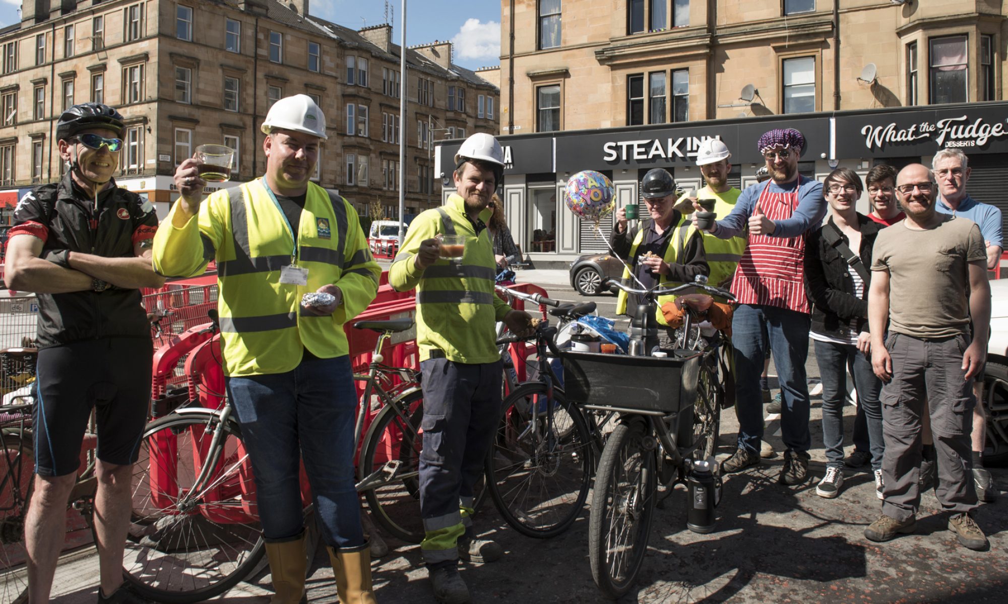
However, EK’s Spaces for People project (as seen in featured image, above) is up for consultation and needs support to counter local criticism.
Without wanting to tread on the toes of our national consultations digest, Transport Scotland’s long-delayed pavement parking consultation has started. Most GoBike members will have experiences to add to that!
Contents
(new/updated items in bold – link jumps to article)
Section 1: Current Consultations
- Hyndland, Hughenden And Dowanhill West, Traffic Management/Parking Controls
- Ayr Road (South) Active Travel Improvements
- A803, Kirkintilloch Road (and Side Roads) Bishopbriggs TRO
- East Kilbride, Spaces for People
- Low Emission Zone – Full proposal
- Dennistoun to Cranhill Liveable Neighbourhoods
- Govan to Kingston Liveable Neighbourhoods
- Queen Elizabeth University Hospital (QEUH) Green Space Survey
- Ruchill to Cowlairs Liveable Neighbourhoods
- Langside to Toryglen Liveable Neighbourhoods
- Malls Mire survey
- Drumchapel Local Development Framework
- Raeberry St Quietway (Connecting Woodside)
- Helensburgh to Garelochhead active travel route
Section 2: Consultation Feedback
- Carmunnock Road (Service Road) TRO
- FOI response on Dennistoun and London Rd SfP projects (GCC)
- Glasgow City Network
- Motherwell train station works
- East Renfrewshire Local Development Plan 2 adoption
- Make Your Way Key Links: Douglas–NCN74 (A70)
- Malls Mire Newsletter
Section 1: Current Consultations
(in date order for responses)
1.1: Hyndland, Hughenden And Dowanhill West, Traffic Management/Parking Controls
Council: Glasgow City.
Area: Clarence Drive in the West End (between Crow Rd and Hyndland Rd).
Subject: Traffic Order to help make Spaces for People temporary infrastructure permanent. Existing painted lanes had been plagued by car parking so ‘soft segregation’ was added in late 2020.
First featured: Digest 100, Item 1.7.
Website links: Clarence Dr plan, Clarence Dr report, Clarence Dr notice, Clarence Dr SoR.
Deadline: TODAY, 23 December.
1.2: Ayr Road (South) Active Travel Improvements
Council: East Renfrewshire.
Area: Ayr Rd south from Newton Mearns.
Subject: Build a replacement shared-use path on the north/west side of Ayr Road, between North Hillhead Road and the M77 overbridge.
(Note: the Ayr Rd, North consultation seems to have ended on 30 November with 712 comments.)
First featured: Digest 97, Item 1.7.
Website link: ERC Ayr Road South consultation page.
Deadline: 24 December.
1.3: A803, Kirkintilloch Road (and Side Roads) Bishopbriggs TRO
Council: East Dunbartonshire.
Area: South Bishopbriggs towards the town centre.
Subject: Parking restrictions on the eastern side of the A803 from the end of Springburn Rd (at Colston Rd) to Bishopbriggs Cross, near the train station. Also, parking restrictions at junctions on side streets along the western side of Kirkintilloch Rd, from Coltpark Ave to Brackenbrae Rd.
First featured: Digest 101, Item 1.5.
Website link: A803 & Side Roads documents (combined PDF of plans and report).
Deadline: 7 January 2022.
1.4: East Kilbride, Spaces for People

Council: South Lanarkshire.
Area: East Kilbride town centre.
Subject: Spaces for People project – protected 2-way cycle lanes on Cornwall St (replacing a road lane and a bus stop) and zebra/cycle crossings. One-way lanes towards the train station on part of Brouster Hill and a short contraflow cycle lane(!) on Torrance Road. The quality is very high in places but dips elsewhere, especially at the Cornwall St taxi rank. The route is due to be extended east to Churchill Ave and west to the Queensway as part of EK’s Active Travel network. Had the Queensway link been done earlier, the lanes would probably have been a lot busier. The project has been criticised locally along with the duration of roadworks at a Places for Everyone project east of the station on West Mains Rd (adding a protected junction, such as those on Victoria Rd). Please support the SfP project – we don’t want another Bearsway or Holmston Rd situation!
First featured: Digest 89, Infrastructure Update.
Website links: EK SfP online survey and South Lanarkshire View article.
Deadline: 16 January 2022.
1.5: Low Emission Zone – Full proposal

Council: Glasgow City.
Area: City centre.
Subject: Phase 2 of the Low Emission Zone in the city centre (Phase 1 was buses only). Older, more polluting motor vehicles would be charged for driving into the zone. The boundary has changed slightly as shown in the image, above. Parts of some streets around the edges of the zone have been added to it and the GSA/Stow building has been left out. The LEZ is due to begin on 31 May 2022 but enforcement won’t kick in until a year later. When fines do come in they escalate for repeat offences. Some ‘grace periods’ and exemptions apply, including for city centre residents, so the full zone wouldn’t be implemented until June 2024.
First featured: Digest 90, Item 1.3.
Website links: Full proposal document, detailed map PDF and further background on the LEZ website.
Deadline: 20 January 2022.
1.6: Dennistoun to Cranhill Liveable Neighbourhoods
Council: Glasgow City.
Area: From Dennistoun (including the Necropolis but not GRI), Milnbank, Haghill, Riddrie, Carntyne to Cranhill.
Subject: One of four LN consultations using Commonplace maps and the Place Standard tool. Transport links include roads like Duke St, Alexandra Parade, Cumbernauld Rd and Edinburgh Rd plus a few train stations. Apart from a few parks most big destinations are towards the city centre end – Necropolis, Tennents brewery and City Park offices. Glasgow Royal Infirmary is just outside western edge of area. Dennistoun has held on to a few Spaces for People measures (from its failed LTN) but there’s very little infrastructure elsewhere. Consultation had started in the community but further events have been postponed. Over 370 comments on the map so far.
First featured: Digest 100, Item 1.9.
Website links: Dennistoun to Cranhill LN Commonplace map, Dennistoun to Cranhill Place Standard survey.
Deadline: No obvious deadline.
1.7: Govan to Kingston Liveable Neighbourhoods
Council: Glasgow City.
Area: From ‘Greater Govan’ (including Cessnock, Kinning Park, Plantation) and Ibrox to Kingston.
Subject: ‘Everyday journeys’ around major transport links including Govan bus station, subway stations, Paisley Road West, Clyde Tunnel, Squinty Bridge/Clyde Arc and the forthcoming footbridge. Major destinations include Ibrox Stadium and the Southern General/Queen Elizabeth Uni Hospital (see next item). There’s some cycling infrastructure around Festival Park/Pacific Quay but no proper links to major routes like the nearby South West City Way. There have been over 190 comments on the map so far.
First featured: Digest 100, Item 1.10.
Website links: Govan to Kingston LN Commonplace map, Govan to Kingston Place Standard survey.
Deadline: No obvious deadline.
1.8: Queen Elizabeth University Hospital (QEUH) Green Space Survey
Organisation: NHS Greater Glasgow & Clyde.
Area: The Southern General/Queen Liz hospital site in Govan.
Subject: A survey about greenspace and active travel at QEUH has been open for a few months. There are half a dozen survey questions, which include active travel and accessibility as well as greenspace and biodiversity.
First featured: Digest 101, Item 1.8.
Website link: QEUH survey, NHS GG&C article.
Deadline: No obvious deadline.
1.9: Ruchill to Cowlairs Liveable Neighbourhoods
Council: Glasgow City.
Area: North of the canal from Ruchill (at edge of Maryhill) across Possilpark, Hamiltonhill, Rockvilla, Craighall, Keppochhill and Port Dundas to Cowlairs (plus Sighthill Park).
Subject: The edges of this area have been redeveloped with active travel routes along the canal. Nearby Sighthill is being completely rebuilt including a segregated cycle route on St Rollox Dr. Cowlairs, Ruchill and Possilpark have a lot of derelict sites. The Spaces for People lanes on Hawthorn St have added a west-east cycle route (with some gaps). The map has just over 80 comments.
First featured: Digest 96, Item 1.5.
Website links: Ruchill to Cowlairs LN Commonplace map, Ruchill to Cowlairs Place Standard survey.
Deadline: No obvious deadline.
1.10: Langside to Toryglen Liveable Neighbourhoods
Council: Glasgow City.
Area: From Langside (at edge of Shawlands) across Battlefield, Mount Florida and part of King’s Park to Toryglen (and Polmadie).
Subject: A really random Liveable Neighbourhood area, including busy Langside and empty Polmadie. There’s not much active travel infrastructure between the proposed SCW extension to Battlefield Rest and Malls Mire at Toryglen, except the protected bit of Aitkenhead Rd and the unprotected Spean St path. Over 350 comments so far.
First featured: Digest 96, Item 1.4.
Website links: Langside to Toryglen LN Commonplace map, Langside to Toryglen Place Standard survey.
Deadline: No obvious deadline.
1.11: Malls Mire survey

Organisation: Urban Roots.
Area: Woodland park between Toryglen Asda, Polmadie Recycling Centre in Glasgow and Rutherglen Glencairn Football Club in South Lanarkshire.
Subject: An evaluation about the newly created park and paths. The site wraps around a regenerated housing estate, linking former wasteground with the woodland and ponds. Trails, outdoor play equipment and a bike pump track have been installed. Also, there are 3m wide shared paths to create a lit, mostly traffic-free route. It links Prospecthill Circus west to Polmadie Rd and east to the corner of Toryglen Rd/Pinkerton Ave in Rutherglen (about half a mile from Bike Town‘s workshop).
First featured: Digest 74, Item 3.4.
Website links: Malls Mire survey.
Deadline: No obvious deadline.
1.12: Drumchapel Local Development Framework

Council: Glasgow City.
Subject: The latest framework consultation, following previous strategic ones for Glasgow North, ‘Inner East’, etc. According to GCC: “The purpose of the Drumchapel Local Development Framework will be to provide a structure for future development in the area. It will act as an overarching framework to identify urban planning priorities for Drumchapel and to help take them forward.”
Website links: Drumchapel Commonplace map, Drumchapel survey link and background.
1.13: Raeberry St Quietway (Connecting Woodside)
Council: Glasgow City.
Area: Raeberry St, North Woodside (west of Maryhill Rd).
Subject: Part of Connecting Woodside with junction redesigns at either end of the street and new secure cycle parking. The Maryhill Rd end is narrowed and the crossing moved to make a direct link to Trossachs St (towards Garscube Rd and the canal). Car parking bays are set by the new North Kelvinside/Woodside RPZ.
First featured: Digest 99, Item 1.12.
Website links: Raeberry St Quietway ‘storymap’, Raeberry St plans PDF, Raeberry St survey.
Deadline: No obvious deadline.
1.14: Helensburgh to Garelochhead active travel route
Council: Argyll and Bute.
Area: Gare Loch east shore (A814/B872).
Subject: Active travel route between Helensburgh and Garelochhead (by Faslane naval base).
First featured: Digest 95, Item 1.5.
Website link: Helensburgh to Garelochhead active travel consultation.
Deadline: No obvious deadline.
Section 2: Consultation Feedback
2.1: Carmunnock Road (Service Road) TRO

Council: Glasgow City.
Area: Carmunnock Road, south-west Glasgow.
Subject: A seriously delayed response to GoBike member Tricia’s objection to the one-way streets in this traffic order (from early 2020!). GCC say:
“I refer to your objection to the above named Traffic Regulation Order and can advise that your objection was reported and considered. However, the Council have decided under its scheme of delegated functions to proceed with the proposal as advertised.The Order was made on 8 December 2021 and an advert will be placed in the Glasgow Times on 14 December 2021 stating that the Traffic Regulation Order has been made.I realise that this may not be the outcome you wished for, however, in terms of road safety, there was insufficient road width at this location to propose contra-flow cycling. Contra-flow cycling is being developed through the current strategies being produced but unfortunately we could not provide it in this instance.”
First featured: Digest 52, Item 1.10.
2.2: FOI response on Dennistoun and London Rd SfP projects (GCC)
Council: Glasgow City.
Area: ‘The Drives’, Dennistoun and London Rd at Celtic Park/Emirates.
Subject: GoBike member Brenda put in a Freedom of Information request to the council about the following:
“Copies of the police advice provided to Glasgow City Council which led to:
1. The removal between December 2020 and April 2021 of the exemptions for cycling (introduced under Spaces for People) at No Entry signs for streets in Dennistoun including Armadale Street, Craiglea Street, Meadowpark Street, Marne Street, Ingleby Drive, Whitehill Street and Craigpark.
2. The removal of the light segregation along the London Road Spaces for People cycle lane at Parkhead.”
GCC response is attached, below. They say they don’t have any records to answer Q2. For Q1, an email is attached listing police concerns. Ironically, the police don’t offer any real evidence to back up their opinions. So, it’s still not clear why GCC can’t do something that South Lanarkshire Council have recently done in East Kilbride (see above).
First featured: Digest 76, Item 3.1 (Dennistoun SfP).
Website links: GCC response on Dennistoun LTN/London Rd and Police Scotland comments about contraflow cycling in Dennistoun.
2.3: Glasgow City Network
Council: Glasgow City.
Subject: A wee bit of feedback from GCC in response to a comment on the Glasgow City Network Commonplace map: “…in this plan the Sustainable Transport Corridors would have segregated cycling. These corridors will also need to deliver significant improvements to public transport through the Bus Partnership Fund and the wider activities of the Glasgow Bus Partnership. This is why we have highlighted them compared with the rest of the City Network.”
First featured: Digest 93, Item 3.1.
Website link: GCC response about ‘Sustainable Transport Corridors’.
2.4: Motherwell train station works
Council: North Lanarkshire.
Area: Motherwell train station and A721
Subject: An update on progress on the planning application last seen in Digest 92, 3.1. It’s been approved and work is scheduled for early 2022. The new bit of road from the roundabout won’t have a cycleway but should at least improve access. The redevelopment of the station itself is ongoing.
First featured: Digest 61, Item 1.1.
Website link: Motherwell town centre and rail station.
2.5: East Renfrewshire Local Development Plan 2 adoption
Council: East Renfrewshire.
Subject: The home straight in the marathon process for East Ren’s new Local Development Plan. It’s already been consulted on and submitted to the Scottish Government. Their Reporter has made recommendations, which ERC accepted. The modified plan was submitted to Scottish Ministers on 16 December. If there are no further changes it will be adopted by ERC.
First featured: Digest 47, Item 1.5 (response: Digest 49, 1.3).
Website link: East Renfrewshire LDP2 page.
2.6: Make Your Way Key Links: Douglas–NCN74 (A70)
Organisation: Community Action Lanarkshire.
Area: Rural South Lanarkshire – Ayr Rd/A70 from Douglas to NCN74.
Subject: A project which was in the process of applying for Places for Everyone funding – sadly, not all have been selected. Sustrans say: “Whilst the value of the Douglas to NCN route was acknowledged by the Panel, it was thought that this route was less well suited to the Places for Everyone programme than the Leadhills[–Wanlockhead] route, primarily as it was felt this route provided less opportunities for everyday journeys and would therefore have less impact on modal shift.”
Sarah O’Sullivan (Project Officer, Active Travel) mentions in her email: “how competitive the funding for Places for Everyone has become recently“. Also: “I am hopeful that other funding will be available to complete the path, if not to the strict Cycle By Design criteria, as required by the Places for Everyone funding, and have already discussed this with SLC [South Lanarkshire Council]”.
First featured: Digest 75, Item 1.3.
Website link: Sustainable Active Travel plans (includes Douglas and Leadhills).
2.7: Malls Mire Newsletter
Organisation: Urban Roots.
Subject: As above, a new woodland park that’s been created over the last year or so. This is the final Malls Mire newsletter about completed works and ongoing projects. It’s been nice to hear about developments and then see some of the completed site. For anyone who hasn’t made it there yet, bits of Malls Mire have started to pop up on StreetView. Thanks to Dr Gemma Jennings and the team for all their hard work and for keeping us updated.
First featured: Digest 74, Item 3.4.
Website link: Malls Mire Newsletter December 2021.
Take care and hope you can still have a Merry Christmas and a Guid New Year.
One Reply to “Consultation Digest (Local) Issue 102, 23 December 2021”
Comments are closed.