
Back to School Streets…
Traffic Orders in this issue include School Streets road restrictions and banned turns on Haggs Rd at Pollok Park. Glasgow’s Active Travel Strategy has gone through changes and council committee.
The first two Liveable Neighbourhoods areas, Langside–Toryglen and Ruchill–Cowlairs, have progressed to planning projects. The next two, Dennistoun–Cranhill and Govan–Kingston, are still online but there’s probably not much time if you want your suggestion included in the first lot of projects…
Contents
(new/updated items in bold – link jumps to article)
Section 1: Current Consultations
- Braidcraft Road TRO
- School Streets, Glasgow TRO
- Glespin to Douglas pathway survey
- Haggs Road TRO
- Drumchapel Local Development Framework
- Dennistoun to Cranhill Liveable Neighbourhoods
- Govan to Kingston Liveable Neighbourhoods
- Malls Mire survey
- Ardrossan Connections Proposals
- Raeberry St Quietway (Connecting Woodside)
Section 2: Consultation Feedback
- Active Travel Strategy approved
- Ruchill to Cowlairs Liveable Neighbourhoods – Stage 1 report
- Langside to Toryglen Liveable Neighbourhoods – Stage 1 report
- Glasgow Uni campus redevelopment newsletter
Section 1: Current Consultations
(in date order for responses)
1.1: Braidcraft Rd TRO
Council: Glasgow City.
Area: Braidcraft Rd, Pollok (west of Pollok Country Park).
Subject: Traffic Order to help make Spaces for People temporary infrastructure permanent. Previously out for consultation along with nearby Brockburn Rd. According to the council it’s come out again “due to a naming error” (possibly a mix up between Langton Terrace and Langton Crescent). Previously, there was a reaction against the lanes including a banner and a petition.
First featured: Digest 100, Item 1.6.
Website links: Braidcraft Rd TRO documents (combined PDF file).
Deadline: 7 February 2022.
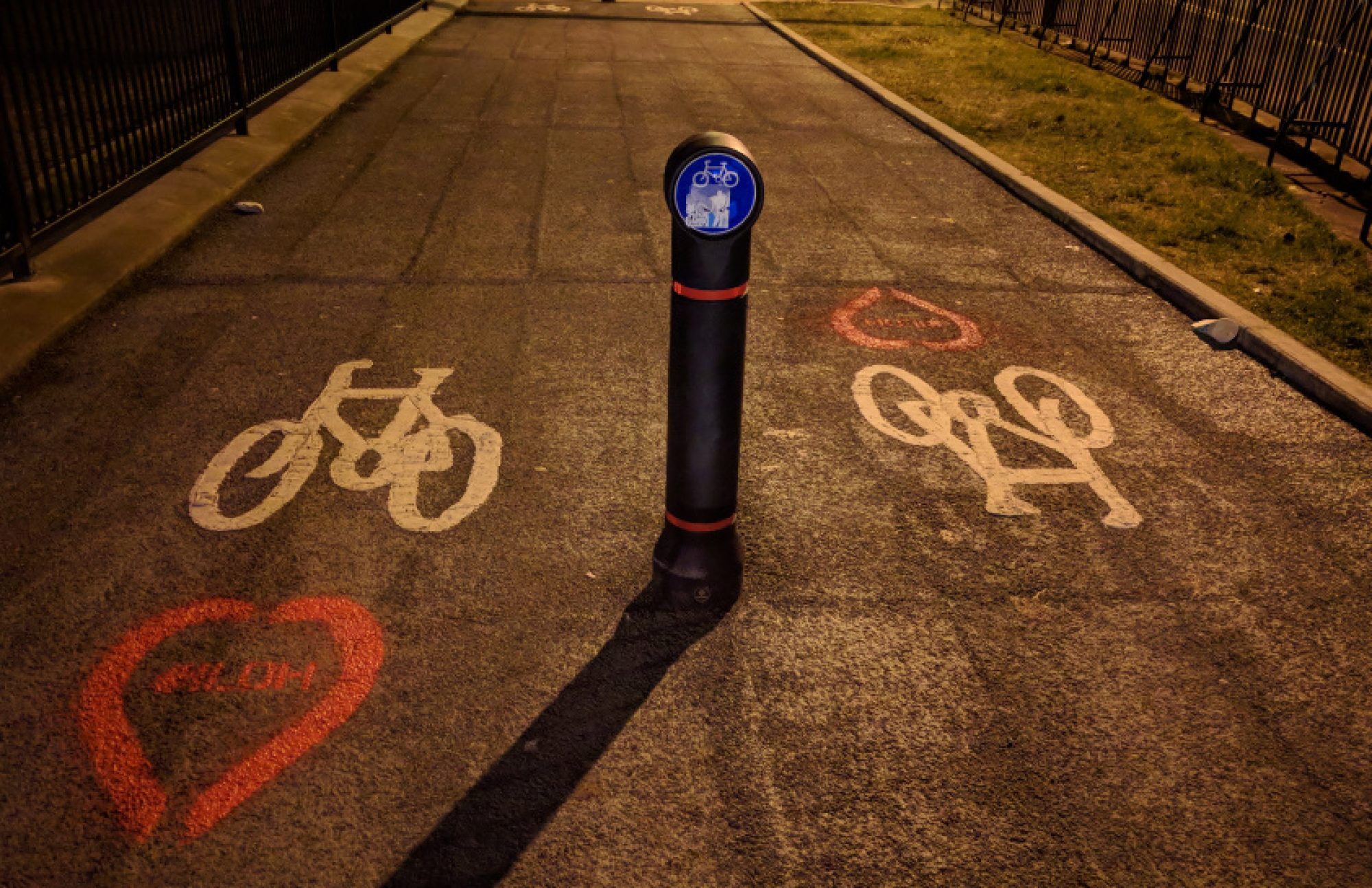
1.2: School Streets, Glasgow TRO
Council: Glasgow City.
Subject: Traffic Order covering streets near 19 primary schools across the city. Makes temporary road restrictions for School Streets permanent. These come into effect at the beginning and end of the school day (as shown in signs at St Anne’s Primary School at the top of this issue).
Website links: School Streets TRO documents (combined PDF file).
Deadline: 18 February 2022.
1.3: Glespin to Douglas pathway survey
Organisation: Community Action Lanarkshire (Rural Development Trust).
Area: Ayr Rd (A70) in rural South Lanarkshire, south of Lanark.
Subject: A consultation about potential routes west from the village of Douglas to the hamlet of Glespin. This came out of work for the Make Your Way project and would connect to the local primary school as well as other services. Also, it fits into strategic plans to link the River Ayr Walk in East Ayrshire with the Clyde Walkway in South Lanarkshire. However, a route on the eastern side of Douglas, on Ayr Rd towards NCN74, failed to win Sustrans funding in late 2021.
First featured: Digest 104, Item 1.3.
Website links: Glespin to Douglas survey and background about Make Your Way.
Deadline: 21 February 2022.
1.4: Haggs Road TRO

Council: Glasgow City.
Area: Haggs Rd by Pollok Park.
Subject: Changing a former one-way exit road from Pollok Park into a two-way entrance to the Burrell Collection (which reopens in Spring). Proposals would ban going straight on into the park from Shawmoss Rd and right turns from Haggs Rd. The council say anyone driving south on Haggs Rd, who wants to go into the park, will have to go past the entrance for about 3/4 of a mile to do a u-turn at a roundabout then drive back up to turn in to the left. It seems none of GoBike’s suggestions to an earlier consultation have been acted on. Issues included exemptions for cycling, allowing entry from Shawmoss Rd and a raised road table for the Haggs Rd shared path. See the following link for further details.
Website links: Haggs Rd TRO documents (PDF) and GoBike consultation response (PDF).
Deadline: 25 February 2022.
1.5: Drumchapel Local Development Framework
Council: Glasgow City.
Subject: The latest framework consultation, following previous strategic ones for Glasgow North, ‘Inner East’, etc. Drumchapel is known as one of the ‘big four’ post-war council housing estates (along with Castlemilk, Easterhouse and Pollok). The Drumchapel Cycle Hub is based near the sports centre but there’s very little cycling infrastructure around the area. The map has now made it past 20 comments (thanks to any of you who commented after the last Digest).
First featured: Digest 102, Item 1.12.
Website links: Drumchapel Commonplace map, Drumchapel survey link and background.
Deadline: No obvious deadline.
1.6: Dennistoun to Cranhill Liveable Neighbourhoods
Council: Glasgow City.
Area: From Dennistoun (including the Necropolis but not GRI), Milnbank, Haghill, Riddrie, Carntyne to Cranhill.
Subject: Transport links include roads like Duke St, Alexandra Parade, Cumbernauld Rd and Edinburgh Rd plus a few train stations. Apart from a few parks most big destinations are towards the city centre end – Necropolis, Tennents brewery and City Park offices. While Glasgow Royal Infirmary is just outside western edge of area. Dennistoun has held on to a few Spaces for People measures (from its failed LTN) but there’s very little infrastructure elsewhere. Consultation events were postponed – further events are due in February. Over 400 comments on the map so far.
First featured: Digest 100, Item 1.9.
Website links: Dennistoun to Cranhill LN Commonplace map, Dennistoun to Cranhill Place Standard survey.
Deadline: No obvious deadline.
1.7: Govan to Kingston Liveable Neighbourhoods
Council: Glasgow City.
Area: From ‘Greater Govan’ (including Cessnock, Kinning Park, Plantation) and Ibrox to Kingston.
Subject: ‘Everyday journeys’ around major transport links including Govan bus station, subway stations, Paisley Road West, Clyde Tunnel, Squinty Bridge/Clyde Arc and the forthcoming footbridge. Major destinations include Ibrox Stadium and the Southern General/Queen Elizabeth Uni Hospital. There’s some cycling infrastructure around Festival Park/Pacific Quay but no proper links to major routes like the nearby South West City Way. There have been over 200 comments on the map so far.
First featured: Digest 100, Item 1.10.
Website links: Govan to Kingston LN Commonplace map, Govan to Kingston Place Standard survey.
Deadline: No obvious deadline.
1.8: Malls Mire survey
Organisation: Urban Roots.
Area: Woodland park between Toryglen Asda, Polmadie Recycling Centre in Glasgow and Rutherglen Glencairn Football Club in South Lanarkshire.
Subject: An evaluation about the newly created park and paths. The site wraps around a regenerated housing estate, linking former wasteground with the woodland and ponds. Trails, outdoor play equipment and a bike pump track have been installed. Also, there are 3m wide shared paths to create a lit, mostly traffic-free route. It links Prospecthill Circus west to Polmadie Rd and east to the corner of Toryglen Rd/Pinkerton Ave in Rutherglen (about half a mile from Bike Town‘s workshop).
First featured: Digest 74, Item 3.4.
Website links: Malls Mire survey.
Deadline: No obvious deadline.
1.9: Ardrossan Connections Proposals
Council: North Ayrshire Council.
Subject: The next stage of the Ardrossan Connections project following consultation last year. The draft proposals cover the town centre and link between NCN753, in the west, and NCN73 to the east. They include both 1-way and 2-way cycletracks plus some shared paths. Comments on the proposals page so far seem to be split between people welcoming the measures and others who think they’re unnecessary and affect car parking.
First featured: Digest 78, Item 1.2.
Website links: Ardrossan Connections proposals and online design workshops during late Jan/early Feb 2022.
Deadline: No obvious deadline (but plans are due to be finalised by Spring 2022).
1.10: Raeberry St Quietway (Connecting Woodside)
Council: Glasgow City.
Area: Raeberry St, North Woodside (west of Maryhill Rd).
Subject: Further project from Connecting Woodside with junction redesigns at either end of the street and new secure cycle parking. The Maryhill Rd end would be narrower and the crossing moved to make a direct link to Trossachs St (towards Garscube Rd and the canal). The new North Kelvinside/Woodside RPZ sets the car parking bays.
First featured: Digest 99, Item 1.12.
Website links: Raeberry St Quietway ‘storymap’, Raeberry St plans PDF, Raeberry St survey.
Deadline: No obvious deadline.
Section 2: Consultation Feedback
2.1: Active Travel Strategy approved

Council: Glasgow City.
Subject: The draft strategy from autumn last year has been amended and then approved by a council committee. While strategy documents come and go, not many adopt as many GoBike policies as this one. As well as a finalised document, there are reports about the City Network’s financing and delivery. The eye catching figure of £1.8bn of benefits comes from the former. The latter lays out some of the choices that will have to be made about road space and other issues. It remains to be seen what decisions are made and how the ATS gets on with its big brother, Glasgow’s Transport Strategy.
First featured: Digest 97, Item 1.5.
Website links: GCC Active Travel Strategy article, Glasgow Active Travel Strategy – final version (PDF), ATS Interim Delivery Plan (PDF), ATS Strategic Business Case (PDF) and ATS Consultation report.
2.2: Ruchill to Cowlairs Liveable Neighbourhoods – Stage 1 report

Council: Glasgow City.
Subject: Consultation for Ruchill to Cowlairs (and Langside to Toryglen) Liveable Neighbourhoods started in late Sept/early Oct 2021. There was no closing date (and the Commonplace maps are still open). However, the council have announced the next stage of the process – a ‘Stage 1’ report split into two documents. The first document shows local history and background about Liveable Neighbourhoods. The second document shows the potential projects planned for the area. Ruchill to Cowlairs had fewer comments (86) than Langside to Toryglen (367). Despite that, both have a similar number of projects (13 projects versus 15). However, Ruchill–Cowlairs has further sub-projects within those on a wide range of things. Examples include the new Possilpoint Community Centre building, Routes to School maintenance and the ‘Milky Way’ between Borron St and Keppochhill Rd (near Graham’s Dairy).
First featured: Digest 96, Item 1.5.
Website links: Ruchill to Cowlairs LN – Stage 1 Report, Part 1 (background), Ruchill to Cowlairs LN – Stage 1 Report, Part 2 (projects) [24MB].
2.3: Langside to Toryglen Liveable Neighbourhoods – Stage 1 report

Council: Glasgow City.
Subject: Langside to Toryglen LN also has a Stage 1 report of two halves, along the same lines as Ruchill to Cowlairs. There are some eye-catching projects in the second document, including pedestrianising part of the road around the Battle of Langside memorial. Also, there are a few things to make Cathcart Rd more bearable for cycling and walking, like the Letherby Triangle project.
First featured: Digest 96, Item 1.4.
Website links: Langside to Toryglen LN – Stage 1 Report, Part 1 (background), Langside to Toryglen LN – Stage 1 Report, Part 2 (projects) [32MB].
2.4: Glasgow Uni campus redevelopment newsletter

Organisation: Multiplex/University of Glasgow.
Subject: It seems Multiplex have got a bit behind with their U of G newsletters and we’ve had a few months without any (they may need to ask for an extension!). Their January newsletter has the latest about the campus buildings and demolitions. It doesn’t mention that the experience cycling uphill on University Avenue is even more stressful than usual just now due to roadworks.
Website links: Glasgow Uni campus newsletter January 2022 (PDF) (or see the Powerpoint version on Multiplex’s website).