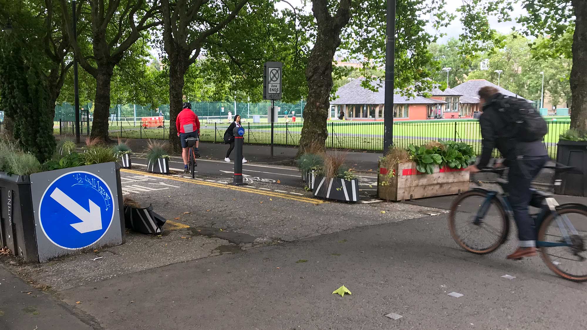

March-ing Orders & musical statues?
The Public Sector is getting close to its ‘end of year’ in March. That may explain why half a dozen new Traffic Regulation Orders (TROs) have just been published. Also, an older Order was passed for 20mph on Byres Rd in the West End. A few TROs are for Spaces for People measures in Glasgow. Obviously, none of East Dunbartonshire’s TROs are for SfP (as the only mainland Scottish council not to put in a bid).
‘What do we want for our city’s front room?’ – asks the latest George Square consultation. Elsewhere, North Lanarkshire is sounding people out about two active travel hubs and East Renfrewshire is sticking to its guns.
Contents
(new/updated items in bold – link jumps to article)
Section 1: Current Consultations
- School Streets, Glasgow TRO
- Glespin to Douglas pathway survey
- Haggs Road TRO
- Motherwell and Ravenscraig Active Travel Hubs
- George Square and ‘Block C’ Avenues
- Bilsland Drive & Hawthorn Street TROs
- St Helen’s Primary School, Bishopbriggs TRO
- A81 Milngavie Road/Maryhill Road TRO
- Electric Vehicle Charging Places – East Dunbartonshire TROs
- Drumchapel Local Development Framework
- Dennistoun to Cranhill Liveable Neighbourhoods
- Govan to Kingston Liveable Neighbourhoods
- Malls Mire survey
Section 2: Consultation Feedback
- Byres Road 20mph TRO
- Automated Vehicles: conclusions and next steps event
- Response to petition about Ayr Road, A77 (North)
Section 1: Current Consultations
(in date order for responses)
1.1: School Streets, Glasgow TRO
Council: Glasgow City.
Subject: Traffic Order covering streets near 19 primary schools across the city. Makes temporary road restrictions for School Streets permanent. These come into effect at the beginning and end of the school day (as shown in signs at St Anne’s Primary School at the top of previous issue).
First featured: Digest 105, Item 1.2.
Website links: School Streets TRO documents (combined PDF file).
Deadline: 18 February 2022.
1.2: Glespin to Douglas pathway survey
Organisation: Community Action Lanarkshire (Rural Development Trust).
Area: Ayr Rd (A70) in rural South Lanarkshire, south of Lanark.
Subject: Potential routes west from the village of Douglas to the hamlet of Glespin. This came out of the Make Your Way project and would connect to the local primary school as well as other services. Also, it fits into strategic plans to link the River Ayr Walk in East Ayrshire with the Clyde Walkway in South Lanarkshire. However, a route on the eastern side of Douglas, on Ayr Rd towards NCN74, failed to win Sustrans funding in late 2021.
First featured: Digest 104, Item 1.3.
Website links: Glespin to Douglas survey and background about Make Your Way.
Deadline: 21 February 2022.
1.3: Haggs Road TRO
Council: Glasgow City.
Area: Haggs Rd by Pollok Park.
Subject: Changing a former one-way exit road from Pollok Park into a two-way entrance to the Burrell Collection (which reopens in Spring). Proposals would ban going straight on into the park from Shawmoss Rd and right turns from Haggs Rd. Southbound traffic on Haggs Rd is meant to go past the entrance for about ¾ of a mile, u-turn at a roundabout then come back up to turn left into park. It seems none of GoBike’s suggestions to an earlier consultation have been acted on (see link, below). Update: The Friends of Pollok Park (FoPP) are due to meet GCC this week to discuss.
First featured: Digest 105, Item 1.4.
Website links: Haggs Rd TRO documents (PDF) and GoBike consultation response (PDF).
Deadline: 25 February 2022.
1.4: Motherwell and Ravenscraig Active Travel Hubs

Council: North Lanarkshire.
Areas: Motherwell town centre and Ravenscraig.
Subject: NLC want to test the water for an active travel hub in Motherwell, similar to those in Ayr, Falkirk and Stirling. The hubs in Ayr and Stirling are next to train stations but Motherwell’s £14.5m station redevelopment hasn’t included one in the plans. A building which had come up was the former Masonic Hall on Hope St. However, it’s separated by a busy roundabout and may not work for the whole community. A unit in the town centre, like Falkirk’s hub or Socialtrack‘s unit in Wishaw, might make more sense. Ravenscraig is the mostly empty former steelworks site. It’s recently got a new playpark near the Regional Sports Facility so that would be an obvious place for a bike project.
Website links: NLC Active Travel Hubs survey.
Deadline: 4 March 2022.
1.5: George Square and ‘Block C’ Avenues


(click for slightly larger version)
Council: Glasgow City.
Area: George Square and surrounding streets from Block C of the Avenues project:
Phase 1 – Dundas St, Dundas Lane and John St (2021‑26);
Phase 2 – St Vincent St, St Vincent Place, Hanover St, Miller St and George St (2023‑28).
Subject: Yet another look at what to do with George Square. However, the starting point for this one has the Spaces for People measures (with two filtered streets). Also, a previous survey in favour of a traffic-free square was part of the ‘Conversation’ in 2019. According to the new ‘Our Place’ website, a design phase has already started. The ‘Story so Far’ page shows how many different layouts the square has had since the 1800s. The surveys are under ‘How to Get Involved’ – the Avenues survey only has four questions. In contrast, the George Square survey has 36 questions! However, you don’t have to answer them all. The last few questions are about active travel.
First featured: most recently for the TRO in Digest 99, 1.6.
Website links: ‘Our Place – How to Get Involved’ surveys page and GCC article.
Deadline: 11 March 2022.
1.6: Bilsland Drive & Hawthorn Street (B808) TROs

Council: Glasgow City.
Area: Bilsland Drive & Hawthorn Street through Ruchill, Possilpark and Springburn.
Subject: Traffic Order to help make Spaces for People bike lanes permanent. The two roads form the B808 west–east across most of north Glasgow. However, the protected lanes aren’t continuous – they have similar issues to other SfP lanes (stopping short at junctions/side roads, drainage at bus stops, etc.). Equally, there’s potential for a continuous route to be a huge boost to cycling across a large area.
Website links: Bilsland Dr TRO (combined PDF) and Hawthorn St TRO (combined PDF).
Deadline: 14 March 2022.
1.7: St Helen’s Primary School, Bishopbriggs TRO
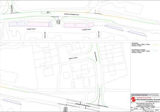
Council: East Dunbartonshire.
Area: Wester Cleddens Rd and Pentland Dr, Bishopbriggs.
Subject: Parking restrictions around St Helen’s Primary School.
Website links: St Helen’s PS TRO (combined PDF).
Deadline: 18 March 2022.
1.8: A81 Milngavie Road/Maryhill Road TRO

Council: East Dunbartonshire.
Area: Southern part of Bearsden between Kessington Public Hall and Garscube Estate.
Subject: Short sections of footway at the corner of MacFarlane St and Killermont St and along Maryhill Rd near Cluny Park. The current layout dates from 2016 during the fallout from the decision to halt the Bearsway. These bits of shared path are useful links to get to Garscube Campus and follow paths along the River Kelvin into Glasgow. It’s not clear why the TRO has come out now but, given the recent history, local members may want to contact EDC to support it.
Website links: A81 footway redetermination TRO (combined PDF).
Deadline: 18 March 2022.
1.9: Electric Vehicle Charging Places – East Dunbartonshire TROs
Council: East Dunbartonshire.
Subject: EDC are installing EV charging points all over the place. East – Bishopbriggs, Kirkintilloch, Lennoxtown, Lenzie, Milton Of Campsie, Torrance and Twechar. West – Milngavie. The drawings don’t show if the chargers will be on the carriageway or footway.
Website links: West EV chargers (combined PDF) and East EV chargers (combined PDF).
Deadline: 21 March 2022.
1.10: Drumchapel Local Development Framework
Council: Glasgow City.
Subject: The latest framework consultation, following previous strategic ones for Glasgow North, ‘Inner East’, etc. Drumchapel is known as one of the ‘big four’ post-war council housing estates (along with Castlemilk, Easterhouse and Pollok). The Drumchapel Cycle Hub is based near the sports centre but there’s very little cycling infrastructure around the area. The map has made it past 25 comments.
First featured: Digest 102, Item 1.12.
Website links: Drumchapel Commonplace map, Drumchapel survey link and background.
Deadline: No obvious deadline.
1.11: Dennistoun to Cranhill Liveable Neighbourhoods
Council: Glasgow City.
Area: From Dennistoun (including the Necropolis but not GRI), Milnbank, Haghill, Riddrie, Carntyne to Cranhill.
Subject: Transport links including roads like Duke St, Alexandra Parade, Cumbernauld Rd and Edinburgh Rd plus a few train stations. Most big destinations are towards the city centre end, while Glasgow Royal Infirmary is just outside western edge of area. Dennistoun has held on to a few Spaces for People measures (from its failed LTN) but there’s very little infrastructure elsewhere. Consultation events have been rescheduled for 22–25 February. After those, the process may move on to producing reports, like the ones for Langside–Toryglen and Ruchill–Cowlairs LNs. Over 420 comments on the map so far.
First featured: Digest 100, Item 1.9.
Website links: Dennistoun to Cranhill LN Commonplace map, Dennistoun to Cranhill Place Standard survey.
Deadline: No obvious deadline.
1.12: Govan to Kingston Liveable Neighbourhoods
Council: Glasgow City.
Area: From ‘Greater Govan’ (including Cessnock, Kinning Park, Plantation) and Ibrox to Kingston.
Subject: ‘Everyday journeys’ around major transport links including Govan bus station, subway stations, Paisley Road West, Clyde Tunnel, Squinty Bridge/Clyde Arc and the forthcoming footbridge. Major destinations include Ibrox Stadium and the Southern General/Queen Elizabeth Uni Hospital. There’s some cycling infrastructure around Festival Park/Pacific Quay but no proper links to major routes like the nearby South West City Way. There have been over 220 comments on the map so far.
First featured: Digest 100, Item 1.10.
Website links: Govan to Kingston LN Commonplace map, Govan to Kingston Place Standard survey.
Deadline: No obvious deadline.
1.13: Malls Mire survey
Organisation: Urban Roots.
Area: Woodland park between Toryglen Asda, Polmadie Recycling Centre in Glasgow and Rutherglen Glencairn Football Club in South Lanarkshire.
Subject: An evaluation about the newly created park and paths. The site wraps around a regenerated housing estate, linking former wasteground with the woodland and ponds. Trails, outdoor play equipment and a bike pump track have been installed. Also, there are 3m wide shared paths to create a lit, mostly traffic-free route. It links Prospecthill Circus west to Polmadie Rd and east to the corner of Toryglen Rd/Pinkerton Ave in Rutherglen (about half a mile from Bike Town‘s workshop).
First featured: Digest 74, Item 3.4.
Website links: Malls Mire survey.
Deadline: No obvious deadline.
Section 2: Consultation Feedback
2.1: Byres Road 20mph TRO

Council: Glasgow City.
Area: Byres Road, Church Street, Torness Street and Highburgh Road.
Subject: As Glasgow Uni get to the latter stages of their campus redevelopment, the council seems to have started the next steps for Byres Rd itself. This TRO was out for consultation in early 2020. Apparently, the “Traffic Regulation Order was made on 04/02/2022 to introduce a 20mph speed limit… to improve road safety and bring speed limits into line with surrounding residential areas.” The map also shows “Proposed & Existing Pedestrian Crossings” in beige. The existing crossings are on Highburgh Rd and the north-eastern part of Byres Rd. The proposed ones will be on the new one-way section of Byres Rd near Dalcross St (on way to Kelvinhall underground station) and across Church St (between the old school and the former Western Infirmary site). Later in the year, construction is due to start for Byres Rd’s redevelopment.
First featured: Byres Rd TROs.
Website links: Byres Rd 20mph TRO area map.
2.2: Automated Vehicles: conclusions and next steps event
Organisations: Scottish Law Commission and the Law Commission of England and Wales.
Area: UK-wide.
Subject: Event to report the Law Commissions’ findings from their Automated Vehicles Review. “The Law Commissions will be co-hosting the event with our Centre for Connected and Autonomous Vehicles (CCAV) colleagues. We plan to cover the following topics: key recommendations in the Law Commissions’ joint report; CCAV update; open Q&A; and closing remarks.” Takes place online on Tuesday 15 March between 2 and 4pm.
Website links: ‘Automated Vehicles: conclusions and next steps’ – event sign-up.
2.3: Response to petition about Ayr Road, A77 (North)
Council: East Renfrewshire.
Subject: Spaces for People measures on Ayr Rd (A77), Newton Mearns and the petition against the bollards/wands. The council have acknowledged the petition but come back with a robust response: “ERC will not be removing the bollards at this time. We will instead continue monitoring and progress… an outline ‘masterplan’ for Ayr Road.” Also: “Reduction of parking on Ayr Road is a desirable outcome of the project.”
It’s refreshing to hear a council making the case for active travel as firmly as this. Also, it’s quite brave, a few months ahead of local elections, so ERC deserve credit for it. Hopefully this is a template for council responses elsewhere, such as nearby Renfrewshire, South Lanarkshire and beyond.
First featured: Digest 104, Item 2.1.
Website links: ERC letter and table of responses.