
Consultation resurrection?
Happy Easter! Things are a bit dead, before numbers rise again after the election, so it’s a chance to bring back consultations that slipped through the net in the last few months. The 12 local authorities in the Strathclyde area don’t always let us know what they’re up to!
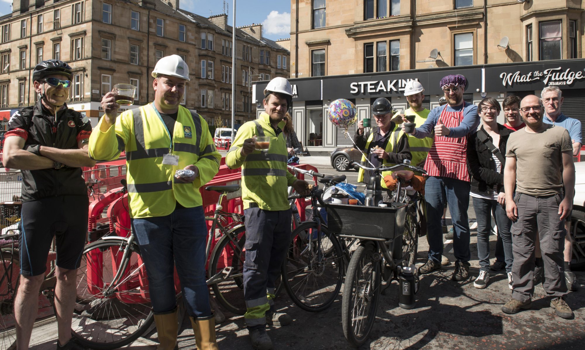
This issue features East Ayrshire and West Dunbartonshire for the first time in a while. North Ayrshire and Inverclyde still have consultations open. Also, regulars like Glasgow, East Renfrewshire and South Lanarkshire. The latter had a consultation that fell between Digest issues (see featured image, above) and sent a new update on NCN74.
Also, ahead of the local elections, check out Walk, Wheel, Cycle, Vote and consider a trip to Edinburgh for Pedal on Parliament‘s new route on 23 April (just after Earth Day).
Forthcoming consultation
Grassyards Road: Temporary cycle route extension (to MacKenzie Drive, Kilmarnock). Expected early May 2022 (presumably after the local elections).
Contents
(new/updated items in bold – link jumps to article)
Section 1: Current Consultations
- City Centre Campus/‘Learning Quarter’ (People-First infrastructure)
- Yorkhill to Anderston Liveable Neighbourhoods
- Ardrossan Harbour Consultation
- Drumchapel Local Development Framework
- Greenock to Battery Park SfP lane
Section 2: Consultation Feedback
- Foregate Square/James Shaw Lane, Kilmarnock (Temp. Pedestrian and Cycle Zone) TRO
- Active & Sustainable Travel Strategy and Action Plan (ASTSAP), West Dunbartonshire
- Churchill Ave route (& Cornwall St), East Kilbride
- NCN74 Bothwell/Uddingston
- East Renfrewshire Local Development Plan 2 formally adopted
Section 1: Current Consultations
(in date order for responses)
1.1: City Centre Campus/‘Learning Quarter’ (People-First infrastructure)
Organisation: Stantec on behalf of a partnership between University of Strathclyde, City of Glasgow College and Glasgow City Council.
Area: Townhead/Cathedral St area, north-east of city centre.
Subject: Consultation on the so-called ‘Learning Quarter’ where many streets are due to be in the city’s Avenues Project, including Cathedral St and North Hanover St. The campus project would link between those to the universities and college. Firstly, the Western Route includes steep Montrose St, as it goes past Strathclyde Uni’s ‘Heart of the Campus’ (Rottenrow Gardens). There’s another hill past City of Glasgow College towards Buchanan Bus Station. Secondly, the Eastern Route would connect to Rottenrow East and link to Avenues Plus routes on George St and John Knox St. Thirdly, the Northern Route goes from Cathedral St east of the college towards the new Sighthill Bridge. The survey asks about different options for streets on the routes. Stakeholder workshops will take place after Easter.
First featured: Digest 74, Item 2.1.
Website links: Public Engagement Web Hub.
Deadline: 8 May 2022.
1.2: Yorkhill to Anderston Liveable Neighbourhoods

Council: Glasgow City.
Area: From Yorkhill, Kelvinhaugh, Stobcross, Sandyford, Finnieston to Anderston.
Subject: The latest Liveable Neighbourhoods consultation covers the area between the River Clyde, River Kelvin, Kelvingrove Park and M8. Popular active travel infrastructure in the area includes NCN7/75 and the West City Way. Also, the (almost finished?) lanes funded by City Deal on Bunhouse Rd and Old Dumbarton Rd. Further segregated cyclepaths are due for Yorkhill and Kelvingrove Cycling Village. These include Minerva St and Haugh Rd (where Bike for Good have their West hub). However, there are still plenty of gaps, as shown when the riverbank was shut during COP26. A new bridge across the Clyde at the Riverside Museum is due to start construction. Meanwhile, the SEC’s redevelopment may close off the red ‘smartie tube’ bridge at Exhibition Centre station. The M8 motorway remains a barrier to destinations like the Mitchell Library and Anderston station.
First featured: Digest 107, Item 1.11.
Website links: Yorkhill to Anderston LN (Commonplace).
Deadline: June 2022.
1.3: Ardrossan Harbour Consultation
Council: North Ayrshire.
Subject: Ardrossan Harbour and ferry terminal redevelopment “…will improve the facilities and operations at Ardrossan to meet the additional capacity provided by the MV Glen Sannox.” The much-delayed ferry is due to enter service later in 2022. Part of the proposals are about active travel routes into the site. The consultation interface is 3D but the plans are squashed into slides from a presentation. There seem to be walking and cycling lanes into both the west side (Harbour Rd) and east side (behind the Housing Association building). The presentation also mentions cycle parking, which may be at the south-west corner of the terminal. However, the plans are very hard to read. The cycle lanes should link into the Ardrossan Connections project in the town. Despite some reaction against the project in the local paper and a petition, it has held consultation events in March/April.
First featured: Digest 109, Item 1.5.
Website links: Ardrossan Harbour Consultation page and Ardrossan Harbour survey.
Deadline: No obvious deadline.
1.4: Drumchapel Local Development Framework
Council: Glasgow City.
Subject: The latest framework consultation, following previous strategic ones for Glasgow North, ‘Inner East’, etc. Drumchapel is known as one of the ‘big four’ post-war council housing estates (along with Castlemilk, Easterhouse and Pollok). The Drumchapel Cycle Hub is based near the sports centre but there’s very little cycling infrastructure around the area. The map has made it past 25 comments.
First featured: Digest 102, Item 1.12.
Website links: Drumchapel Commonplace map, Drumchapel survey link and background.
Deadline: No obvious deadline.
1.5: Greenock to Battery Park SfP lane
Council: Inverclyde.
Subject: A Spaces for People temporary route between Greenock town centre and a coastal park. A recent council vote was 9:2 in favour of keeping the lanes for another six months, with a further review in September. Photos in the consultation survey show a mixture of on-road ‘soft’ segregation and painted lanes on footways and across side roads. While some of the junction and bus stop treatments may not be ideal, there seem to be decent protected sections too.
Website links: Greenock Town Centre to Battery Park – Community Engagement and Inverclyde Now article on council vote.
Deadline: No obvious deadline.
Section 2: Consultation Feedback
2.1: Foregate Square/James Shaw Lane, Kilmarnock (Temporary Pedestrian and Cycle Zone) TRO
Council: East Ayrshire (via Ayrshire Roads Alliance).
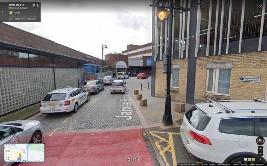
Subject: A TRO from a few months ago, which extends the previous Spaces for People scheme (which your author missed – apologies). James Shaw Lane has a taxi rank and car parking beside a multi-storey car park. It leads to Foregate Square at the Burns Mall Shopping Centre and the bus station (with links to pedestrianised King St). The Order bans general car traffic but allows Blue Badge holders, taxis and some loading. The council SfP page shows the painted treatment and signage at the tarmac end of James Shaw Ln. However, Google StreetView images (see above) suggest there’s an issue with enforcement. The multi-storey car park is due to be closed and demolished later this year. The new Order came into force on 24 February 2022.
Website links: Foregate Sq/James Shaw Ln TRO and Foregate Sq/James Shaw Ln plan.
2.2: Active & Sustainable Travel Strategy and Action Plan (ASTSAP), West Dunbartonshire

Council: West Dunbartonshire.
Subject: A new Active & Sustainable Travel Strategy consultation sadly finished in March. Unfortunately, GoBike don’t hear much from West Dunbartonshire Council (unlike East Dunbartonshire, where we’re Stage 1 consultees). The strategy’s website does mention networks of active travel routes but doesn’t mention standards like the revised Cycling by Design. As the graphic shows, there’s an emphasis on electric vehicles over active travel. However, it does at least mention an e-bike charging network. There is some good active travel infrastructure in West Dumbartonshire, like the Bowline. But, as in most council areas, they lack protected everyday routes outside the National Cycle Network. This includes tourist destinations like the car-centric Loch Lomond Shores. WDC share some transport and environmental functions with East Dunbartonshire and Inverclyde councils. Inverclyde recently posted a Shared Services update on behalf of the local authorities.
Website link: Active & Sustainable Travel Strategy and Action Plan site, Results of Strategy Consultation (Phase 1 PDF), ASTSAP Appendix A (Emissions PDF), ASTSAP Appendix B (Sustainable Travel. PDF).
2.3: Churchill Ave route (& Cornwall St), East Kilbride

Council: South Lanarkshire.
Subject: This consultation came up between Digests (with a deadline the day before the next one!). The route starts on Cornwall St and should solve some of the issues going east at the taxi rank. The segregated 2-way cycletracks go north on Churchill Avenue towards West Mains Rd and Aldi. The rest of the route goes south-east, where it links with an existing path towards South Lanarkshire College. An alternative route under the roundabout avoids the double road crossing but the new route doesn’t connect directly to it. Perhaps due to concerns about underpasses, from college students/staff at the consultation workshop. While the above route uses verges, it would change some kerblines and require roadworks. W Mains Rd’s Places for Everyone project drew criticism for that so there may be more flak to come. W Mains Rd is due further work to build a protected junction at Torrance Rd.
First featured: Digest 102, Item 1.4.
Website link: Churchill Ave proposal 1 (PDF), Churchill Ave proposal 2 (PDF), Churchill Ave proposal 3 (PDF) and EK town centre network phasing.
2.4: NCN74 Bothwell/Uddingston

Council: South Lanarkshire.
Subject: Also in South Lanarkshire, GoBike member Denny passed on a response from the council about re-routing NCN74 between the Raith Interchange and Uddingston. SLC said: “the proposed rerouting and improvement designs will shortly be going out to Public Consultation.” Also: “construction has started on an off-road section between North British Road and Bellshill Road. This path will now incorporate a 3m wide cycle lane accompanied by a 2m wide pedestrian pavement. It is anticipated that this work will be completed by 15 April 2022, weather depending.” This section was already a popular off-road path so the extra width should help avoid conflicts between people.
2.5: East Renfrewshire Local Development Plan 2 formally adopted
Council: East Renfrewshire.
Subject: East Ren’s new Local Development Plan finally made it over the finishing line. Following consultation, going to the Scottish Government Reporter, then Scottish Ministers (as we last heard in Digest 102, 2.5). ERC emailed: “As of 31st March 2022, the East Renfrewshire Local Development Plan 2 is now formally adopted.”
First featured: Digest 47, Item 1.5 (response: Digest 49, 1.3).
Website link: East Renfrewshire LDP2 page.
The Digest will take a break and return in May.