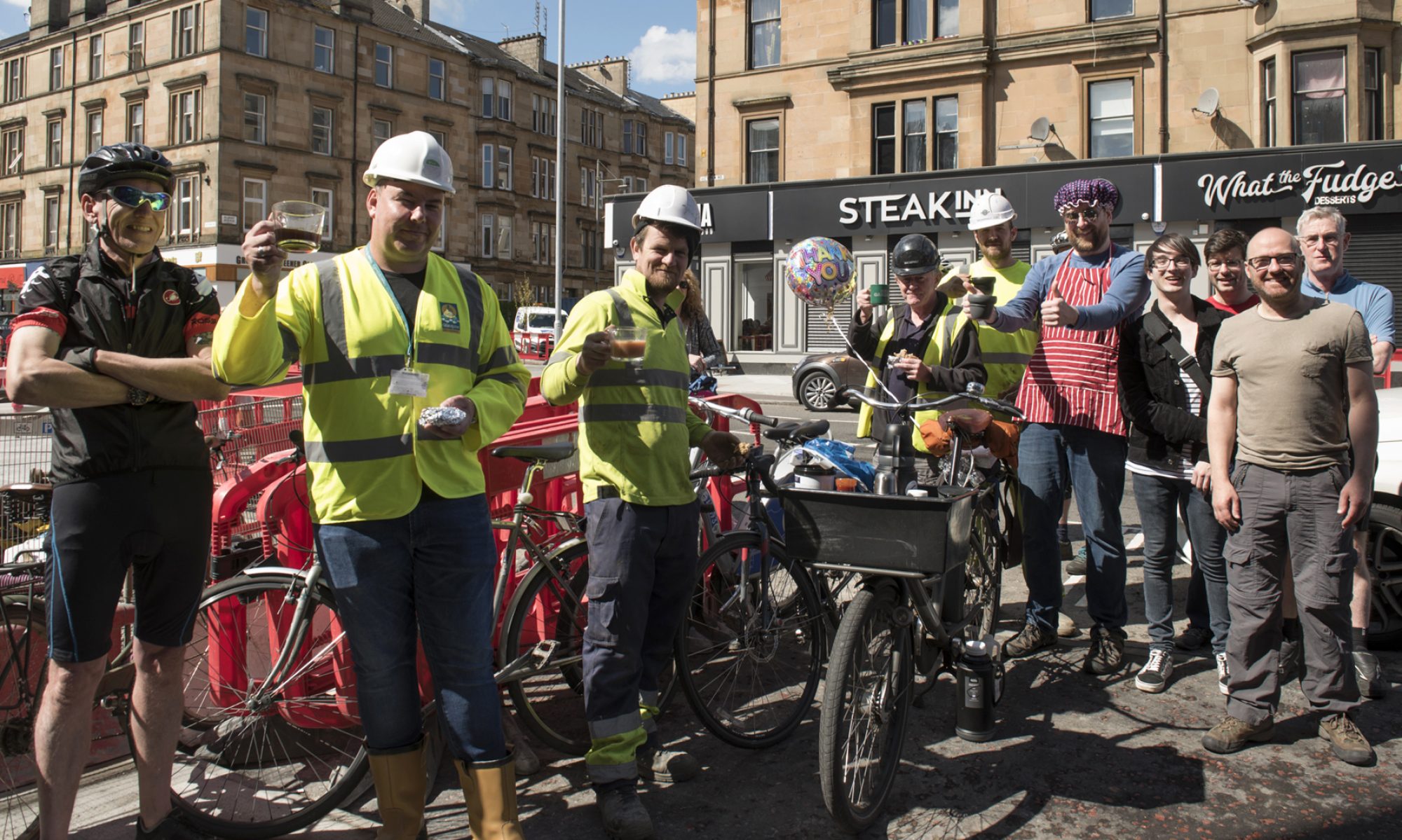

Events and updates from the city and future plans for North Lanarkshire.
In this Digest there are consultation events for areas either side of the M8. There’s a return to pre-pandemic plans for a few City Ways. Also, adding paths and removing the precinct in Motherwell.
If you’re in the city, see Andy’s three infrastructure routes around Glasgow to take in Spaces for People infrastructure. He’s also started to inform GoBike about closures and diversions; if you hear of any please do let us know.
Looking further ahead towards spring, and an election, Pedal on Parliament have news about their events in April.
This Digest includes links in the Contents page so you can jump straight to a topic if you want to.
Contents
(new consultations in bold)
Section 1: Current Consultations
- Glasgow City Council – (Y)our Districts Online Ideas Workshops – ‘Learning Quarter’, rescheduled online sessions Thursday 18th February
- North Lanarkshire Council – Ravenscraig Active Travel Links – Friday 19 February
- Queens Cross Housing Association – Woodside Making Places: updated masterplan and online public meeting – Thursday 25 February
- Glasgow City Council – St Andrews Drive (Sustainable Transport Route) Order – Sunday 7 March
- Glasgow City Council – East City Way Phase 1 (London Drive to Daldowie Road) Order – Friday 12 March
- Glasgow City Council – London Road/Hamilton Road (30mph Speed Limit) Order – Friday 12 March
Section 2: Forthcoming Consultations
Section 3: Consultation Feedback
- Glasgow City Council – North Kelvin and North Woodside (Traffic Management & Parking Controls) Order
- North Ayrshire Council – Ardrossan Connections
Section 1: Current Consultations
(in date order for responses)
1.1: Glasgow City Council – (Y)our Districts Online Ideas Workshops – ‘Learning Quarter’

GCC’s ongoing Districts consultations featured in Digest 78, including this one for the ‘Learning Quarter’. The rescheduled workshops are on Thursday 18th February. There’s an afternoon session (2–4pm) and an evening session (6–8pm) both online.
You can still comment on the Districts Commonplace map. Other relevant consultations about the wider area appeared in Digest 74, including Strathclyde Uni’s proposed active travel project. There’s also the Avenues Plus project for Duke St/John Knox St in a few years time.
1.2: North Lanarkshire Council – Ravenscraig Active Travel Links

An email from North Lanarkshire Council on 15 February is about a very short consultation period for active travel routes into part of the Ravenscraig site in Motherwell. It says:
“Proposals for new cycling and walking routes through Ravenscraig are being published for the public to give their views.
We are working with Sustrans and Ravenscraig Limited to improve connections between Ravenscraig and neighbouring communities and to expand the active travel network.
An online consultation, including a short survey, will run from Monday 8 February for two weeks. It is available at www.northlanarkshire.gov.uk/regeneration-and-investment/ravenscraig-active-travel-links
The two key elements of the project are:
- a south-north link to connect Craigneuk, via “The Castings” housing development, off Meadowhead Road, with the Regional Sports Facility (RSF) and new public park, and
- an east-west link to connect Craigneuk, via “The Castings” housing development, to New College Lanarkshire Motherwell Campus.
It’s proposed the paths will have lighting, seating, landscaping with wildflower areas and woodland planting, play features along the route, fencing and CCTV where possible.
“As the Ravenscraig site develops with new housing, business, retail, schools and leisure, we want the area to be accessible for everyone for walking, cycling and wheeling,” said Jonathan Speed, Senior Project Manager at North Lanarkshire Council.
“These active travel routes will provide direct, off-road links from the south to the facilities within Ravenscraig, as well as connecting to a wider network of paths to Motherwell, Wishaw and Carfin.
“The project is an important part of the Ravenscraig masterplan, and we would like to hear from as many people as possible during our consultation to ensure the proposals meet the need of residents.”
The project is being funded by Transport Scotland and Sustrans, through their ‘Places for Everyone’ programme.
Feedback from the consultation will inform the final plans for the project, then the council will apply for planning permission. Subject to the necessary approvals and securing funding, it is anticipated work to construct the first of the two active travel routes would start later this year.”
This seems to have been taken over by the council from Central Scotland Green Network (CSGN) who started the project. While an active travel route is welcome, this only covers the south-east corner of a vast area. This route is in contrast to the Ravenscraig Access Infrastructure (RAI) Project from Digest 75, Item 1.2 – a dual carriageway with shared pavement. While there are road links in all directions there are no active travel links to the west of the site (behind Dalzell Works) towards the town centre. We can only hope something comes out of item 2.1, below, to improve the situation.
Deadline is this week, Friday 19 February. If you know the area at all, please fill in the survey.
1.3: Queens Cross Housing Association – Woodside Making Places: updated masterplan and online public meeting – 25 February

This featured in Digest 79 about the Woodside area, between Maryhill Rd and Garscube Rd. It could become an important link along N Woodside Rd and St George’s Rd to the segregated cycleway being completed on Garscube Rd (A81). The consultation map is on the updated Woodside Making Places website. There is an online public meeting on Thursday 25th February.
1.4: Glasgow City Council – St Andrews Drive (Sustainable Transport Route) Order – Sunday 7 March
GoBike first reported on plans for St Andrews Drive in a Consultation Extra in late November 2019. The route would extend the South West City Way (SWCW), the segregated cycleway along Shields Rd. It currently ends at a crossing on St Andrews Drive. The extension would roughly double the length of the SWCW and create a segregated route from the ‘Squiggly’ Bridge, all the way past Maxwell Park to Pollok Country Park.

Glasgow City Council have now announced a Traffic Regulation Order for the length of the St Andrews Dr route. There’s also a SAD notice, SAD report and SAD wee Statement of Reasons. These seem to deal with parking to clear the way for the route.
Further details are still available on the consultation website from late 2019/early 2020. It includes a long ‘Storymap’ and links to PDFs of technical plans for the route (starting at Shields Rd): sections 1–3, sections 4–6, sections 7–9, sections 10–12 and section 13 (Dumbreck/Haggs/Titwood Rd junction).
The existing South West City Way is 2-way (bi-directional) with both lanes on one side of the road. The extension would be the same but, instead of using kerbs as segregation, it would use black and white ‘cycle lane separators’ (also known as zebras/orcas/armadillos). These had already been used on Archerhill Rd, Knightswood. Since then we’ve become more used to seeing them on many of Glasgow’s Spaces for People routes during 2020.
A GoBike response to the SWCW extension plans was sent to Glasgow City Council in late January 2020. It covered points about the choice of route, side road junctions, design elements, 2-way provision, speed limits and implementation. It also gave detailed feedback about parts of the route, especially junctions, like at Dumbreck/Haggs/Titwood Road at Pollok Park.
It’s not clear whether GoBike’s points have been taken on board or if designs have been amended. Nor is there any detail about when construction might start. However, it could mean GCC are trying to do some of it during March, before the end of Financial Year. There’s a consultation period for the TRO with a deadline of 7 March. See the GCC website at www.glasgow.gov.uk/proposedtro.
1.5: Glasgow City Council – East City Way Phase 1 (London Drive to Daldowie Road) Order – Friday 12 March

East City Way, Phase 1 had a consultation event over two years ago, as mentioned in a Consultation Extra from October 2018. Preparations for work to begin on the ECW weren’t announced until March 2020 and were then halted by the COVID-19 pandemic. However, GoBike put in a response to the draft plans shortly afterwards. Work eventually started near Mount Vernon station in late summer 2020 (after a further delay which angered a local Tory councillor).

A new order from Glasgow City Council suggests Phase 1 might finally be completed soon. The TRO covers the section that’s been under construction between London Drive and Daldowie Road (next to the Dog’s Trust). An email to GoBike says:
“I now enclose a copy of the press notice of the proposed Order, relevant map, statement of reasons and detailed report.
Details of the proposals will also be available on the Glasgow City Council website at www.glasgow.gov.uk/proposedtro .
As stated in the attached documentation, any person wishing to object to the proposed Order should send details of the grounds for objection in writing to Group Manager, Technical Services, Neighbourhoods and Sustainability, Exchange House, 231 George Street, Glasgow, G1 1RX or email SustainableTransport@glasgow.gov.uk and it must be received by Friday 12th March 2021.”
Although it’s taken a long time, Phase 1 of the East City Way is welcome. It turns the former filter lane into 2-way bike lanes and should make the junction under the railway bridge safer for pedestrians as well as people cycling. While it’s a neat solution for the junction, it’s unfortunate that it doesn’t match up with the existing 1-way segregated lanes on Hamilton Rd. Some cyclists will have to cross over at the lights to continue their journey eastbound while others might choose to stay on the road all the way.
It remains to be seen if smooth new tarmac might tempt them into the cycle lane, away from London Road’s usual roughcast road surface. At the western end there are nearly 2 miles until you reach the Spaces for People lanes at the Shell petrol station. This stretch was traditionally a main route into Glasgow and had a higher speed limit to match. However, that is about to change…
1.6: Glasgow City Council – London Road/Hamilton Road (30mph Speed Limit) Order – Friday 12 March

Closely related to the previous item is this order to change the speed limit on a long stretch of London Rd and Hamilton Rd. Since the M74 extension was built, London Rd has become less well used as a trunk road (apart from on Celtic matchdays). The new limit starts near the Premier Inn on Hamilton Rd (A74/A721), goes past the Dog’s Trust and Mt Vernon then all the way along London Rd to join the current 30mph limit at Dewar’s distillery. It’s a distance of about 3.5 miles on a very rough road surface that isn’t very cycling friendly. While it’s unlikely to become heaven for cycling any time soon, it is a step in the right direction.
GoBike received an almost identical message to the London Rd/Hamilton Rd one, above, so it’s not worth repeating. Here’s the 30mph notice, 30mph map, 30mph report and 30mph Statement of Reasons.
Section 2: Forthcoming Consultations
2.1: North Lanarkshire Council – Town Visions
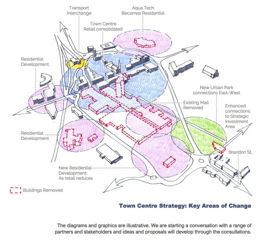
North Lanarkshire Council have been consulting about their town centres for a few years using various methods, including the Place Standard tool. During 2020, NLC rebranded these processes as ‘Town Visions’. This covers eight towns: Airdrie, Bellshill, Coatbridge, Cumbernauld, Kilsyth, Motherwell, Shotts and Wishaw.
The plans shown so far range from relatively minor changes in Shotts to demolishing large parts of Motherwell town centre and building a few new railway bridges (see image above). By the way, these are different ones to the demolitions and new railway ‘underbridge’ covered in Digest 75. The main issue driving these is economic development, since there will be less retail in town centres in future, but active travel is part of the mix too.
NLC have been consulting with local stakeholders ahead of further public consultation due later in the year. See the Town Visions webpage for links to PDFs of each current town plan.
Section 3: Consultation Feedback
3.1: Glasgow City Council – North Kelvin and North Woodside (Traffic Management & Parking Controls) Order
This order featured back in Digest 55 (Item 1.5). It covers a large area on the northern edge of the Woodside project featured above (Item 1.2) and west of Maryhill Rd. Along similar lines to previous schemes in Partick and other areas, it establishes a Restricted Parking Zone (RPZ). An RPZ marks car parking bays on roads throughout the area and charges for them both hourly through parking meters or annually through residents permits. However, all spaces are available on a ‘first come first served’ basis.
GoBike had commented on the draft plans and a few amendments were made by the council. To refresh your memory of the plans, see: relevant map A, relevant map B, relevant map C, statement of reasons, detailed report and frequently asked questions (FAQs).
GoBike’s response to these RPZ proposals was sent on 24 March 2020. On 8 February 2021 we received a reply:
“I note your comments regarding end-on and angled bay parking. During the design phase of the project parallel parking bays were preferred over end-on and angled bays. Where possible we have aimed to avoid end-on and angled bays with only a minimal amount included within the plans. Unfortunately the Council cannot control driving behaviours and preferences when it comes to parking.
I can confirm that another team in the Council is working on sustainable transport and cycle projects within the area, and I will pass on your noted comments for their consideration.
Your comments will be considered and included within the final report which will inform the decision. Once a decision has been taken in regards to these proposals I shall write to you again and advise of the outcome.”
So, we can look forward to future correspondence on this one (on or before January 2022?).
3.2: North Ayrshire Council – Ardrossan Connections
GoBike have been sent a follow-up email after the initial Ardrossan Connections consultation finished earlier in the month. There’s an update on the project website, including a recording of parts of the launch event (with automatic subtitles if you want a laugh). Further online consultation events are due in March.