
Locked in discussion?
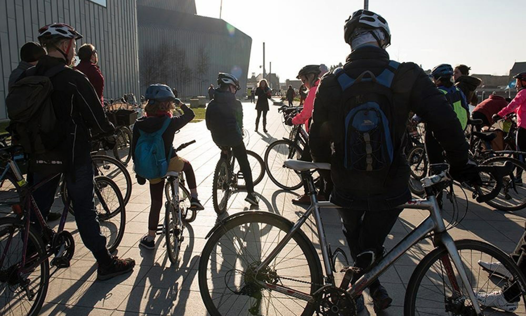
Cycle parking is one of the topics in this Digest – the bike park inside Cadogan Square multi-storey car park (pictured, above) says something about the state of current facilities. Also, it contrasts with some of the points in Glasgow’s latest consultations; including about where cycling really sits in the transport hierarchy.
As shared paths are blocked around that big climate conference, there are question marks about whether the message on sustainable transport will get through. Drafts of two major strategies could set the tone for Glasgow in the next decade – both the Active Travel Strategy and Transport Strategy just happen to be out for consultation during COP26.
There are seven consultations for neighbouring areas but Glasgow will be hogging the headlines for the next few weeks. GoBike is running a ‘feeder ride’ from Lanarkshire in to the main climate demo on Sat 6 November. See other rides from around the city and beyond on Pedal on Parliament’s COP26 feeder rides page.
Contents
(new consultations in bold – link jumps to article)
Section 1: Current Consultations
- Cardonald Area TRO
- Secure City Centre Cycle Parking Survey (deadline extended)
- Milngavie TRO – Waiting & Loading Restrictions
- Make Your Way: Key Links pathways
- Draft Active Travel Strategy (GCC)
- Nitshill Road (40mph Speed Limit) Amendment Order
- Draft Glasgow Transport Strategy: framework
- Draft Parking Management Plan (EDC)
- Ayr Road (South) Active Travel Improvements
- Langside to Toryglen Liveable Neighbourhoods
- Ruchill to Cowlairs Liveable Neighbourhoods
- Ayr Road (North): Spaces for People, Phase 2
- Tarbet to Inverarnan A82 road/active travel improvements
- Helensburgh to Garelochhead active travel route
- Rethink Glasgow
Section 2: Consultation Feedback
- COP26 Active Travel route closures
- St Andrews Drive (Sustainable Transport) Order 2021
- Glasgow Uni Campus newsletter
Section 1: Current Consultations
(in date order for responses)
1.1: Cardonald Area TRO

Council: Glasgow City.
Area: Cardonald, south-west Glasgow.
Subject: One-way streets, filters and parking restrictions near Cardonald train station, Lourdes Secondary School and elsewhere.
Website links: Cardonald press notice, Cardonald report, Forfar Ave/Kinross Ave map, Kingsland Drive map, Lintlaw Drive map and Tarfside Ave map.
Deadline: 29 October.
1.2: Secure City Centre Cycle Parking Survey

Council: Glasgow City.
Subject: Secure cycle parking at city centre employers and travel hubs. These would include the main rail stations at Central and Queen St, as well as Buchanan Bus Station.
First covered: Digest 94, Item 1.10.
Website link: GCC city centre cycle parking consultation page and cycle parking survey.
Deadline: EXTENDED – 1 November.
1.3: Stewart Street Car Parks, Milngavie TRO – Waiting & Loading Restrictions
Council: East Dunbartonshire.
Area: Milngavie.
Subject: Removing waiting restrictions at a town centre car park.
First covered: Digest 96, Item 1.3.
Website links: Stewart St Car Parks map, Notice for Revocation Of No Waiting – Stewart St Car Parks, Stewart St draft order and the 2013 Order.
Deadline: 1 November.
1.4: Make Your Way: Key Links pathways
Organisation: Community Action Lanarkshire.
Area: Douglas & Leadhills/Wanlockhead, rural South Lanarkshire (and Dumfries & Galloway).
Subject: Shared use pathways between Douglas to NCN74 and Leadhills–Wanlockhead. Outdoor events in the local areas from 20–28 Oct.
First covered: Digest 75, 1.3.
Website links: Make Your Way Douglas, Leadhills and Wanlockhead article (for link to online survey).
Deadline: 1 November.
1.5: Draft Active Travel Strategy

Council: Glasgow City.
Subject: Active Travel Strategy to replace the previous Cycling Strategy. “The draft Active Travel Strategy and the Liveable Neighbourhoods Plan are both part of a suite of transport related plans and documents which will create a modern, resilient and sustainable transport system for Glasgow.”
First covered: Digest 97, 1.5.
Website links: GCC Active Travel info and downloads and GCC Active Travel Survey. There’s also, an Active Travel ‘Storymap’ and now a CommonPlace map for the proposed city network.
Deadline: 22 November (not 24th as previously stated).
1.6: Nitshill Road (40mph Speed Limit) Amendment Order

Council: Glasgow City.
Area: South-west Glasgow.
Subject: A few 40mph signs to be moved on Nitshill Rd to allow for the entrance to a new development. Usual reason given: ‘For preserving or improving the amenities of the area through which the road runs’.
Website links: Nitshill Rd map, Nitshill Rd report, Nitshill Rd press notice.
Deadline: 22 November.
1.7: Draft Glasgow Transport Strategy: Framework

Council: Glasgow City.
Subject: “The new transport strategy will be city-wide, and provide a framework for investment and decision-making on transport issues up to 2030.” Note: specific transport projects won’t be covered until the ‘Glasgow Transport Strategy: Spatial Delivery Framework’ in 2022. Also, GCC say it links in with City Centre Transformation plan.
Website links: Glasgow Transport Strategy page, Draft framework document (39MB!), GTS ‘Story Map’ (some parts load slowly or are broken), GTS online survey.
Deadline: 26 November.
1.8: Draft Parking Management Plan
Council: East Dunbartonshire.
Subject: A “coordinated, operational plan for parking management.”
First covered: Digest 97, Item 1.6.
Website links: Draft parking management plan consultation page and survey.
Deadline: 30 November.
1.9: Ayr Road (South) Active Travel Improvements
Council: East Renfrewshire.
Area: Ayr Rd south from Newton Mearns.
Subject: Build a replacement shared-use path on the north/west side of Ayr Road, between North Hillhead Road and the M77 overbridge.
First covered: Digest 97, Item 1.7.
Website link: ERC Ayr Road South consultation page.
Deadline: 24 December.
1.10: Langside to Toryglen Liveable Neighbourhoods consultation
Council: Glasgow City.
Area: From Langside (at edge of Shawlands) across Battlefield, Mount Florida and part of King’s Park to Toryglen (and Polmadie).
Subject: “Liveable Neighbourhoods will be accessible and healthy places that allow people of all ages and abilities, to play and socialise outdoors in their local area, as well as making walking, cycling and public transport the first choice.”
First covered: Digest 96, 1.4.
Website link: Langside to Toryglen LN Commonplace map.
Deadline: No obvious deadline.
1.11: Ruchill to Cowlairs Liveable Neighbourhood consultation
Council: Glasgow City.
Area: From Ruchill (at edge of Maryhill) across Possilpark, Hamiltonhill, Rockvilla, Craighall, Keppochhill and Port Dundas to Cowlairs (plus Sighthill Park).
Subject: As above. See also GCC’s Liveable Neighbourhoods overview and Urban Big Data Centre’s article for further background.
First covered: Digest 96, 1.5.
Website link: Ruchill to Cowlairs LN Commonplace map.
Deadline: No obvious deadline.
1.12: Ayr Road (North): Spaces for People, Phase 2
Council: East Renfrewshire.
Area: Ayr Rd through Newton Mearns.
Subject: Phase 2 consultation about replacing the phase 1 cones with light segregation.
First covered: Digest 91, Item 1.5.
Website link: ERC Ayr Road Phase 2 Commonplace page.
Deadline: No obvious deadline.
1.13: Tarbet to Inverarnan A82 road/active travel improvements

Organisation: Transport Scotland.
Area: Loch Lomond north west shore (A82) in Loch Lomond & Trossachs National Park.
Subject: New shared path added to re-aligned/improved A82. Scenic route north from Tarbet to Inverarnan (at head of Loch Lomond).
First covered: Digest 97, Item 1.11.
Website link: Tarbet to Inverarnan ‘storymap’.
Deadline: No obvious deadline.
1.14: Helensburgh to Garelochhead active travel route
Council: Argyll and Bute.
Area: Gare Loch east shore (A814/B872).
Subject: Active travel route between Helensburgh and Garelochhead (by Faslane naval base).
First covered: Digest 95, 1.5.
Website link: Helensburgh to Garelochhead active travel consultation.
Deadline: No obvious deadline.
1.15: Rethink Glasgow
Organisations: Lateral North/OnePlanet/After The Pandemic
Area: Glasgow.
Subject: A “region-wide conversation to re-think a new vision for Glasgow’s future”.
First covered: Digest 95, 1.6.
Website link: Rethink Glasgow, Commonplace site.
Deadline: No obvious deadline.
Section 2: Consultation Feedback
2.1: COP26 Active Travel route closures

Council: Glasgow City.
Area: NCN7/Clyde Walkway (Riverside to Lancefield Quay), West City Way (bridge over M8), Finnieston, etc.
Subject: The ongoing saga of active travel diversion routes for COP26. GoBike (and a few GCC councillors) have sent several messages to Get Ready Glasgow without getting many in return. See our recent post for further information. The quality of much of the signage, paths, ramps and segregation on the diversion routes leaves a lot to be desired. While there have been a few minor improvements, routes have been further chopped and changed by the council. The best way to keep up-to-date is to check GoBike’s social media.
First covered: Digest 94, Item 1.2.
Website links: GoBike on Facebook/GoBike on Twitter.
2.2: St Andrews Drive (Sustainable Transport) Order 2021
Council: Glasgow City.
Area: St Andrews Drive from Shields Rd to Pollok Country Park.
Subject: Parking and other restrictions to pave the way for the extension to the South West City Way. This is due to be a ‘soft segregated’ route along similar lines to Wallacewell Rd in the north-east of the city (see photos in info page).
First covered: Digest Extra Nov 2019.
Website links: SWCW Extension info page, GoBike response (Digest 85, 3.2).
2.3: Glasgow Uni Campus newsletter
Organisation: Multiplex.
Area: Glasgow Uni Campus.
Subject: Ongoing redevelopment of uni buildings and public spaces between Byres Rd/Church St and Kelvingrove Park.
Website links: October newsletter.