
Glasgow City Council have advised that anyone with suggestions for small projects that might improving cycling, such as new dropped kerbs or signage, should email them in to them to this address, marking the subject ‘Cycling Improvements’. If you have any success be sure to let us know!
Faults should continue to be reported by telephone or via the MyGlasgow app.
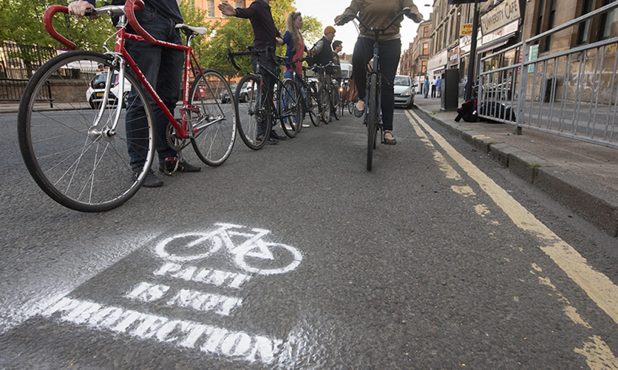
What types of Cycle Facility are there?
Off-road
Cycle track with separate footway – where cyclists and pedestrians co-exist side by side, but on separate surfaces.

Photo credit: andypreece at CycleStreets
Location: Erskine Bridge, Erskine.
View on Google StreetView
Line segregated cycle track and footway – where cyclists and pedestrians co-exist side by side, on the same surface, but with a white line in between.

Photo credit: andypreece at CycleStreets
Location: Nitshill Road, Glasgow.
View on Google StreetView
Unsegregated shared use cycle track and footway (roadside) – where cyclists and pedestrians intermingle on the same surface, without any segregation. (See On the origins of shared use)

Photo credit: andypreece at CycleStreets
Location: Bothwell Road, Hamilton.
View on Google StreetView
Unsegregated shared use cycle track and footway (away from road) – the classic “cycle path”.

Photo credit: andypreece at CycleStreets
Location: Larchfield Drive, Rutherglen.
View on Google StreetView
On-road
Mandatory cycle lane – on road, with solid white line dividing it from the rest of the road. Other vehicles may not enter.

Photo credit: andypreece at CycleStreets
Location: West Nile Street, Glasgow.
View on Google StreetView
Advisory cycle lane – on road, with broken white line dividing it from the rest of the road. Other vehicles may enter.

Photo credit: andypreece at CycleStreets
Location: Cumbernauld Road, Millerston.
View on Google StreetView
Recommended route for cyclists – on road, with no special facilities for cyclists other than signage. Usually motor traffic will be light.

Photo credit: andypreece at CycleStreets
Location: Gleniffer Avenue, Glasgow.
View on Google StreetView
Exemptions from bans
Contaflow cycle lane – on road cycle lane allowing cyclists to proceed in the opposite direction to other traffic on a one-way street.

Photo credit: andypreece at CycleStreets
Location: Netherlee Road, Glasgow.
View on Google StreetView
Contraflow cycle track – segregated cycle track allowing cyclists to proceed in the opposite direction to other traffic on a one-way street.

Photo credit: timbo at CycleStreets
Location: Hope Street, Glasgow.
View on Google StreetView
Road closure exempting cycles – where other vehicular traffic is prevented from using a road as a through route, but cyclists are permitted to continue through. Also known as ‘filtered permeability’.

Photo credit: rightee at CycleStreets
Location: Claremont Street, Glasgow.
View on Google StreetView
Banned turn exempting cycles – where other vehicular traffic is prevented from making a specified turn, but cyclists are permitted to do so.

Photo credit: andypreece at CycleStreets
Location: Alderman Road, Glasgow.
View on Google StreetView
Traffic Signals
Advance Stop Lines for Cycles – where cyclists get to stop at traffic signals in front of other vehicles, providing better visibility and a head-start.

Photo credit: andypreece at CycleStreets
Location: University Avenue, Glasgow.
View on Google StreetView
Cycles Only Traffic Signals – where cyclists get to proceed through a junction at a different time from other vehicular traffic.

Photo credit: andypreece at CycleStreets
Location: Crow Road, Glasgow.
View on Google StreetView
Toucan Crossing – a signalised pedestrian and cycle crossing, usually used where a cycle path crosses a main road.

Photo credit: andypreece at CycleStreets
Location: West Mains Road, East Kilbride.
View on Google StreetView
Grade-separated Crossings
Foot and Cycle Bridge – a route for pedestrians and cyclists to pass over a main road, railway line or river.

Photo credit: andypreece at CycleStreets
Location: David Livingstone Memorial Footbridge, Blantyre.
View on Google StreetView
Underpass – a route for pedestrians and cyclists to pass under a main road or railway line.

Photo credit: andypreece at CycleStreets
Location: College Street, Dumbarton.
View on Google StreetView
Steps
Wheeling ramp – allows cycles to be wheeled up the side of steps.

Photo credit: andypreece at CycleStreets
Location: Motherwell Road, Hamilton.
View on Google StreetView
Parking
Cycle parking stand – allows cyclists to lock bike to stand in street for free.

Photo credit: timbo at CycleStreets
Location: Blythswood Square, Glasgow.
View on Google StreetView
Cycle locker – enclosed box allowing cycle to be stored with greater security than afforded with a simple stand.

Photo credit: andypreece at CycleStreets
Location: Rutherglen Railway Station.
View on Google StreetView
There are many more photos of cycle infrastructure at the CycleStreets Photomap. There is also a more comprehensive listing of cycle infrastructure terms in the Cycling Embassy’s Dictionary.