
Routes in Glasgow City, North Lanarkshire and South Lanarkshire. Also, plans for Argyle & Bute and East Renfrewshire.
Argyle & Bute
Active Travel Strategy Consultation

Argyll and Bute Council says:
“The council is developing an active travel strategy, to help attract funding for improving transport connections in the area, a priority for communities, council and partners in Argyll and Bute. Our population is spread out across a large rural area, which makes large-scale transport solutions challenging. However, with some of the shortest commute distances in Scotland *—this presents a great opportunity to develop active travel (walking, cycling, wheeling).”
*2022 Census
The ATS covers vision, opportunities/challenges, etc. as well as infrastructure priorities and doing network plans. The latter would be for towns/islands over 3,000 people, including popular destinations like Helensburgh and Oban.
Links: Active Travel Strategy article, draft ATS document and ATS survey.
Deadline: Thurs, 9 April 2026.
East Renfrewshire
Barrhead Masterplan Consent Area

East Ren Council says:
“Over the past 18 months, ERC has undertaken an extensive public consultation process, reaching over 3000 Barrhead residents, to develop a 2050 Vision and Masterplan for Barrhead, known as Brighter Barrhead. The Brighter Barrhead Masterplan looks at the whole town, from the town centre to new development areas, including sites that could be better used. These cover streets, housing, parks, education, health, skills, and jobs. By bringing these together, the Masterplan seeks to guide and co-ordinate investment and development.”
The most interesting part for active travel is the Green Loop orbital route. Consultation events have passed so this one may close soon.
Links: Barrhead MCA article, Barrhead MCA Guidance, Barrhead MCA map, Barrhead MCA feedback form.
Deadline: No obvious deadline.
Glasgow City
Connecting Greater Govan – Route 1: Govan Road to Pollok Country Park

Glasgow City Council call this route Govan-Partick Bridge to Pollok Park but it starts to the east of Water Row on Govan Road. On Orkney St and Broomloan Rd it is fairly direct, via Ibrox and Bellahouston Park, down to Drumbreck Rd just before the M77 (2.7km total). The route skirts past residential areas and shopping streets but still serves some major destinations in a car-dominated area (which includes Ibrox Primary School’s Bike Bus). Proposed new junctions at busy Paisley Road West and removing the Edmiston Dr roundabout would be a boost to active travel and road safety. Online reaction was split and local businesses have been vocal critics of cycle lanes so it could do with a good response in the consultation. This route needs to stick if more are to follow (including Route 2 towards Queen Elizabeth University Hospital). Consultation events have passed.
Links: Route 1 article, Route 1 Storymap and Route 1 survey.
Deadline: 30 March 2026.
People First Zone (PFZ) – Phase 1

GCC have talked about a ‘People First Zone’ since the City Centre Transport Plan consultation in 2022. This Experimental Traffic Regulation Order (ETRO) focuses around the Queen St/Ingram St junction, which has some of the highest footfall in the city centre. There are extended pavements plus decking and planters on Queen St and Ingram St (similar to those at St Vincent Place). The t-junction would get a ‘raised crossing’ (level with pavement) to try to slow down motor traffic. Also, a bus gate from 7am–7pm (to let buses through but not cars). Works have already started. Previous ETROs (for Spaces for People bike lanes) lasted 18 months. The PFZ area between Queen St and Candleriggs (Merchant City) will be monitored from April onwards.
Links: PFZ article, PFZ StoryMap, PFZ circulation plan and PFZ survey.
Deadline: 19 April 2026.
North Lanarkshire
Stepps to Condorrat: Strategic Network Route 6

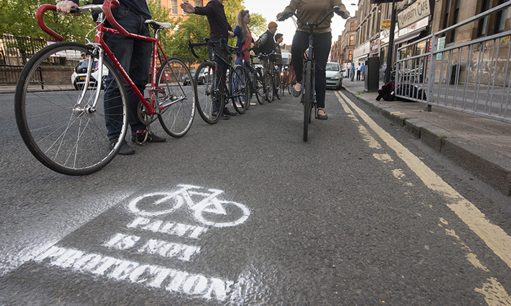
Early consultation about route options between Stepps (at the Glasgow boundary near Hogganfield Loch) and Condorrat (Cumbernauld). Phases 1–3 go along the A80, in NLC’s ‘Northern corridor’ area, via Chryston and Moodiesburn. There’s a two-pronged approach into Condorrat/Cumbernauld. Phase 4 along Main Rd sounds like it may be some kind of compromise to preserve car parking. Phase 5 would upgrade existing footpaths along Mollins Rd/Westfield Road. In line with NLC’s Active Travel Strategy these tend to be shared path/widened pavement routes (see: Live & Constructed Active Travel Routes page – MS Sway). However, the consultation’s main visual shows a path divided between walking and cycling (see image at top of this page). It also seems to be alongside a single carriageway road. If so, and there’s enough support for it, that would be a big change from the current A80 dual carriageway.
Links: Active Travel Live Projects page, SNR6 StoryMap and survey.
Deadline: No obvious deadline.
South Lanarkshire
Clydesdale Way

South Lanarkshire Council say:
“The £7 million Clydesdale Way project focuses on the rural path and cycling network to address the gaps in the regional paths network linking to John Buchan Way, Southern Upland Way and Clyde Walkway. It aims to establish active travel links between local communities and create investment in infrastructure to develop tourism in the area. It is part of a larger active tourism project worth £22 million, funded by Levelling Up Fund…”
The map of potential phases shows near complete routes apart from gaps around Lanark and south of Symmington. If the whole route corridors were completed it would be transformative for active travel between Douglas, Lanark, Biggar and smaller villages towards Dumfries and Galloway.
Links: Clydesdale Way article, Clydesdale Way StoryMap, Clydesdale Way survey.
Deadline: 3rd April 2026.
Note: We’re now in the pre-election period, where councils are restricted from making new announcements, so things may slow down a bit until May.