Some of you may have seen the article by Rab McNeil in the Herald on Sunday last week, 28th October, entitled “On Cults in Lycra”? Get it?? Continue reading “The Power of the Press and the Right of Reply”
Strathclyde Cycle Campaign
Some of you may have seen the article by Rab McNeil in the Herald on Sunday last week, 28th October, entitled “On Cults in Lycra”? Get it?? Continue reading “The Power of the Press and the Right of Reply”

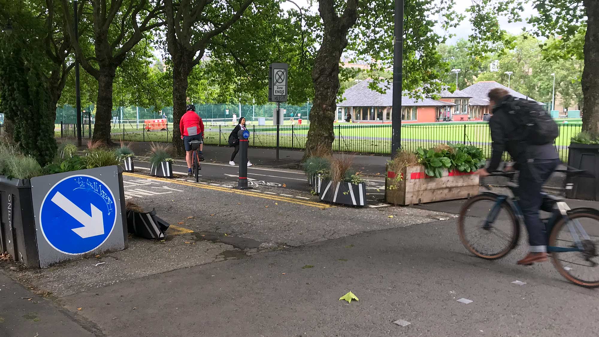
Ballie Kyle Thornton at the Auldhouse Roundabout (about to take his life in his hands to cross the Pollokshaws Rd dual carriageway)
** UPDATE **
Since we last reported on this councillor tour, we have been contacted by a wonderfully proactive staff member at Sustrans who has highlighted that funding is in fact available, specifically for junction and roundabout improvements, such as at the key accident hotspot of the Auldhouse Roundabout. We have passed this information back to Bailie Kyle Thornton and would encourage you to also highlight this information to your local councillors.
The details are as follows:
Through the Community Links programme, Sustrans Scotland can offer funding specifically for junction and roundabout improvements. We can offer 100% funding for design (pre-construction) stage, followed by 70% funding for the construction stage. This means applicants only need to find 30% of construction costs. There is no limit on the amount of funding applicants can apply for and we encourage applicants to be ambitious.
Let’s hope we can build on this pot and have our councillors take action with it!
** UPDATE END **
Continue reading “** UPDATE – FUNDING IS AVAILABLE! ** Councillor Tour – Newlands/Auldburn Ward”

Sunday 4th November – Baldernock Loop
This ride will take in the East Dunbartonshire countryside around Balmore and Baldernock, but on the way out of the city we will see a couple of contrasting housing developments, both of which include cycle paths. The return will be via the Bears Way and Kelvin Walkway, arriving back in Glasgow in time for lunch. 20 miles, with a short length of unsurfaced path between Cadder and Balmore and a couple of short lengths on busy main roads. Continue reading “GoBike Ride – Baldernock Loop – Sunday 4th November”
Did you catch us on Scotland Tonight a few weeks ago? We were asked to go live on STV to represent people cycling in a discussion about Sir Chris Hoy’s call to end the ‘Us and Them’ rhetoric sadly all too common on the roads (and in the media). Perhaps predictably, the discussion somewhat ignored this call and the questioning tried to lead the debate towards well… us and them talk about “bugbears” on the roads. We tried to steer that line towards more productive debate about the need for safe spaces for cycling… Continue reading “GoBike Live on Scotland Tonight”
You may have noticed recently that the GoBike website has had a swanky new make over – and very pleased we are with it too. Thank you loads to our hard working web group volunteers for helping out with it.
One new resource we’ve added on there is an Evidence section packed full of publications, statistics, fact and figures for the most discerning of debaters and anecdotal myth naysayers. Continue reading “Evidence Doth Maketh the Facts”

A reminder that the Barrhead South Travel Links Consultation event is tomorrow 24th October (see 1.1 below), and among other things we also have exciting news with the potential for good active travel links at the new station proposed for Robroyston. Continue reading “Consultation Digest Issue 20, 23 October 2018: Barrhead travel routes, traffic plans for the new Robroyston Railway Station, Open Space Strategy for Glasgow and a couple of reminders”
Ballie Kyle Thornton at the Auldhouse Roundabout (about to take his life in his hands to cross the Pollokshaws Rd dual carriageway)
Bob Downie took his local councillor on a tour of his ward this week, concentrating on the notorious Auldhouse Roundabout:
As everywhere in Glasgow, cycling in the Newlands/Auldburn Ward has its challenges, but none more so than the Auldhouse Roundabout. Bailie Kyle Thornton kindly agreed to join me in an examination of this location and this tour was therefore more a site-specific visit than a general excursion of the ward. Continue reading “Councillor Tour – Newlands/Auldburn Ward”
A consultation invitation from East Renfrewshire, sent to us via Twitter:
“We want to make travelling within East Ren easier, ensuring communities are connected to services, leisure and jobs. Help identify improvements to transport links in Barrhead on our interactive map http:/ or drop-in to our event at Barrhead Foundry, 24 Oct, 4-8pm
If you live or work, or just visit Barrhead, do please get to the event on Wednesday 24th October, or put your views on the interactive map.

Many thanks to Iona for keeping you up-to-date so well while I was off on a big tour of Kenya – four weeks without getting on a bike – and what news there was. A massive rethink on Byres Road! Didn’t we all do well! That’s the power of lots of us letting people know our views, so please keep writing and answering those surveys. Let’s hope Byres Road does become as peaceful as this earlier publicity picture suggests, but with those all important segregated cycle lanes.


We have seen a massive turn around by the council this week following our campaigning for a segregated cycle lane for Byres Road (woop woop and yay for everyone involved!) and so to celebrate we thought it would be timely to highlight the campaigning we have been involved in over the last year or so. A whistle stop tour for now, but look out for our new website coming soon, with more info. Continue reading “GoBike Campaign Success”