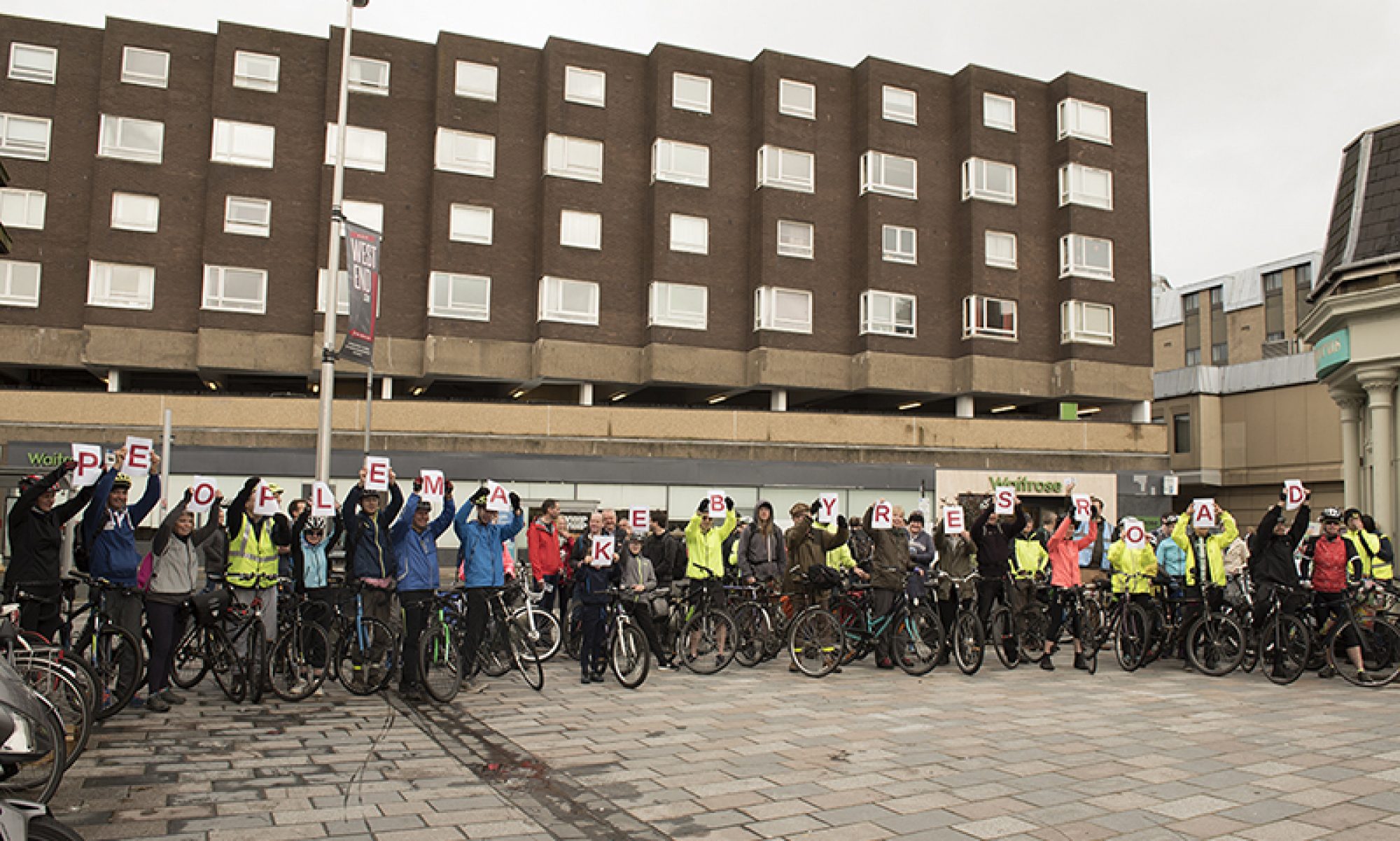
Councillor Tour 10, Govan, Ward 5 with Councillor Allan Young (Green Party), 11 November 2017

On Saturday 11th November 2017, GoBike members Bob Downie and Andy Winter, and Rumina Kakati (who leads rides enjoyed by new, nervous and lapsed cyclists) met with Allan Young, the Green councillor for Govan ward, to go on a tour of some of the cycle facilities in the ward. Committee member Brenda Lillicrap organised the ride but was prevented from doing all but the start of the tour by a puncture.  We were delighted that Allan was available to come out with us and hope that the other three ward councillors will be able to come for a similar tour in future. The invitation remains open . Our route took us out and back from Cessnock subway station, past Bell’s Bridge, the Science Centre, Queen Elizabeth University Hospital and Govan centre, all the while critiquing the cycle facilities we saw and used, good and bad.

Our start was in Walmer Crescent, a short one-way street with slow traffic, no junctions, and a sharp corner at both ends – ideal for the council’s declared default of permitting contraflow cycling on one-way streets. Not yet though.

Picture 1, shown above: Start – Govan Ward 5 Tour 11/11/17, Rumina Kakati, Allan Young, Andy Winter and Bob Downie at Cessnock Station

Picture 2Map Route taken on Govan Ward 5 tour 11/11/17. Numbered points refer to photograph locations below

Our route initially took us north on the signed Cycle Route 7 along Cessnock Street, Brand Street – now with perpendicular parking for the new flats along the south side, a potential hazard for cyclists on this well-used route – and Govan Road. We able to see the ‘improvements’ being made connected with Fastlink. We wondered about the value of spending money on a grade-separated cycleway alongside a road where the only permitted traffic is buses and taxis – and there aren’t any bus routes. There are much stronger candidate areas for cycle infrastructure spending even when the funding is ring-fenced for work connected with Fastlink.

Our first major hurdle was where Govan Road joins Pacific Drive. At these traffic lights, cyclists are invited to behave like pedestrians and cross Pacific Drive to cycle westward on the north-side pavement. To cross, cyclists must wait for 3 individual sets of pedestrian controlled lights, the first to cross the two lanes of the Fastlink bus corridor (not available for cycle use), followed by lights for each lane of ordinary traffic. The presence of extensive pedestrian barriers makes crossing by more than 2-3 bikes at a time very difficult. The experienced cyclists will almost certainly ignore the invitation to use this crossing and travel westward on the road. Those new to cycling (or with tandems, trailers or cargo bikes) are discouraged by tight turns made more difficult by poles, railings and control boxes, especially when there are pedestrians or other cyclists to consider.

While manoeuvring the crossing we agreed that plans to designate the footway on the south side for shared use (right through the bus shelter, and next to the sparsely used Fastlink carriageway) were a frustratingly marginal improvement, and we wondered why no effort had been made to route cyclists behind the Village Hotel to get toward’s Bells Bridge. There is already a crossing across Pacific Drive opposite the Bell’s Bridge path, albeit one offset from the desire line and with yet more barrier/pole/box obstacles.

Picture 3CrossToPavement We were invited to behave as pedestrians and use the pavement on the north side of Pacific Drive (point 1 on map)

It was generally agreed that the new path from Pacific Drive to Bell’s Bridge then continuing along the river in front of the BBC and the Science Centre was excellent. We wished it were possible for the riverside path to extend eastwards under the Clyde Arc Bridge. Back at Govan Road we continued westward and on to Golspie Street, which was re-engineered to accommodate the Fastlink carriageway. This gives it the appearance of a fast dual-carriageway, by-pass type of road, with its absence of active frontages and sweeping turns at the junctions. With the two directions of normal traffic using the single non-Fastlink carriageway it feels like a hostile piece of road for cyclists. This section is difficult to avoid for east-west travel because of the barrier of the lines into the subway depot. The layout of the both junctions on this stretch encourages drivers to make fast left turns, with the potential for left-hooking cyclists. The extensive pedestrian barriers at the junction with Harmony Row hem cyclists in in a manner that is worrying. There is nowhere for cyclists to escape if cars come too near.

Picture 4Barriers Extensive barriers at the junction of Golspie Street and Harmony Row (point 2 on map)

A newish, good quality pedestrian-cycle route took us the 200m from Golspie Street to Langlands Road. This was free of motor traffic and wide enough for cyclists and pedestrian to easily pass in both directions. A useful improvement would be a dropped kerb at the eastern end to allow easy access for west-bound cyclists without having to mingle with pedestrians at the pelican crossing.

Picture 5SharedPath Using the Golspie Street to Langlands Road cycle/pedestrian route (point 3 on map)

On Langlands Road significant sections of the advisory cycle lanes, only denoted by painted lines, were blocked by parked cars on both sides of the road. We understand these painted lanes form part of the ‘active travel access’ for the newly enlarged hospital. Allowing parking in cycle lanes shows that cyclists lack any real status on Glasgow’s roads. Cycle users deserve better.

Picture 6CarsInBikeLane Cars parked in the Langlands Road cycle lane (point 4 on map)

We carried on along Langlands Road to the underpass beneath the A739, the busy dual carriageway leading to the Clyde Tunnel. This underpass gives cycle access to the Queen Elizabeth University Hospital, but the large amount of graffiti and general feel of dilapidation gives it an edgy feel. This is not a facility most people would like to use at night.

Picture 7Graffiti Pedestrian/cycle underpass beneath the A739 to the Queen Elizabeth University Hospital. A highly graffitied and unwelcoming place (point 5 on map)

The feeling of dilapidation continued on the west side of the A739 where the first entrance to the hospital had no dropped kerb as well as being very rough, and needing another tight turn to negotiate the bollards in the underpass entrance.

Picture 8HospEntrance Off-putting entrance to the QEUH. Note the lack of dropped kerb (point 6 on map)

We continued north beside the A739 on an excellent shared pedestrian/cycle path which continued along Moss Road. At the junction with Peninver Drive a new pedestrian/cycle crossing has been installed but the timing of the lights was so slow (about 3 minutes) that no one was inclined to wait and we all took the chance to cross when the traffic appeared clear. The timing of these lights needs to be reviewed.

Picture 9LongWait Very slow timing of the lights allowing cycle crossing from Moss Road to Peninver Drive (point 7 on map)

Onward to Govan Road where we noted that parking was allowed by the shops near the junction with Holmfauldhead Place. We were told that this parking can at times cause significant congestion leading to cyclists being squeezed on the road, with drivers overtaking without allowing sufficient space.

Picture 95ParkingSqueeze Govan Road near the junction with Holmfauldhead Place. A busy road restricted by allowing on-street parking. Cyclists get squeezed here (point 8 on map)

A major problem in this area is the difficulty that south-going cyclists have turning west along Govan Road when they exit the Clyde Cycle Tunnel. To cross Govan Road “by the book” is so slow and complex that few cyclists comply and simply cross Govan Road when and where they can. The lack of a simple and safe crossing is simply unacceptable.

Our tour concluded with a ride through the centre of Govan and discussion as to how a dedicated cycle route through the main street of Govan Road could be a significant feature as part of the area regeneration.

Overall we were underwhelmed by the cycle facilities that we saw and used in Govan. Short sections were excellent but on the whole we felt that most were let down by poor design and poor implementation. The biggest issues are the lack of interconnectivity between adequate facilities and the method the planners use to take cyclists across main roads by requiring cyclists to behave like pedestrians and use complex, slow, barriered crossings. These are tricky for inexperienced cyclists to manoeuvre through, and experienced cyclists are likely to ignore the lights and cross as and when they see a gap in the traffic. The perennial problem of cars parking in non-segregated cycle lanes remains an issue in Govan as almost everywhere else in the UK.

We hope that Councillor Allan Young will be able to use the information gained in this tour to inform him in his work as a councillor and as ever, GoBike are here to help should he (or any of the other three Govan councillors) have any further questions.

We have one more tour planned for Friday 01 December with Councillors Cullen and Cunningham around Ward 13, Garscadden/Scotstounhill.  Then, unless we can choose daylight during the winter, we’ll be hoping to resume in the spring – if councillors are minded to join us!

Knightswood Park BMX track – Cycle Route access, part 1, Segregated


Glasgow City Council are planning a part segregated and part shared footway cycle route access to Knightswood Park, to be built in time for the 2018 European BMX Championships, for which the park will be a venue.

There was public consultation in August but we were not formally told of this although some of our members went along.  The Traffic Regulation Order that has been issued is sparse on information but after asking questions of the Council Officer who is dealing with the scheme we were sent drawings earlier this week.  These have helped to formulate our response: GoBike Yoker to Knightwood Sustainable Transport Corridor 1 171117  This is only to the segregated cycleway part of the scheme.  The more contentious part is the shared footway element and we’ll get our response to that out well before the closing date next month.

Consultation on this segregated element closes on 19 November and the TRO documents are here: YokerToKnightswood-NoticeOfProposals-230x114mm-RTO TRO no waiting no loading cycle track 1 of 3 TRO corner protection 3 of 3 TRO corner protection 2 of 3 TRO information Report

In summary, we support the segregated cycleway but have concerns about junction treatment, management of parking, the cycleway width behind floating bus stops, the robustness of the orcas without bollard reinforcement and the connectivity of the scheme.

Glasgow’s Fastlink – why are there “cycle upgrades” off the route?

Fastlink in Glasgow is absolutely not what we were initially led to expect.  It wavers from side to side of the road, cycling is allowed in this bit but not that, there is no accommodation for people exiting the southbound Clyde Cycle Tunnel to get across to the new hospital and one could go on.  Now we are aware that “cycle upgrades” are being carried out – in the form of shared footways off the main, direct route!  There has been no consultation that we are aware of.  The drawings we have are here: P_5100-S_100_Govan Road_Festival Park GA P_5100-S_101_Summertown_Rd and the letter we have sent, to quite a few people since we were not sure of the person in charge of this work is here: GoBikeFastlinkImprovementConcernsLetter251017 For simplicity we repeat the content of the letter below:

Continue reading “Glasgow’s Fastlink – why are there “cycle upgrades” off the route?”

Glasgow Councillor Tour 9, Thursday 19 October, Ward 23, Partick East / Kelvindale, Walking Tour with Green Councillor, Martin Bartos

On the evening of Thursday 19 October, GoBike Convenor, Tricia Fort, and member, Johnston Orr, met with Councillor Martin Bartos, for a short walking tour of Ward 23, Partick East/Kelvindale.  We took more or less the same route that we had covered with the other 3 councillors for the ward, from near Byres Road along Highburgh/Hyndland Road to Great Western Road and we walked because Martin is not yet back on his bike following a collision with a taxi some time ago.  This is the only ward where all 4 councillors have met with us, setting a great example to all the other wards!  Johnston and Martin are pictured below:

From east to west, our discussion covered, first of all, Byres Road, which is currently being considered for redevelopment.  Martin is concerned at the lack of ambition being shown in the current Glasgow City Council proposals.  We have thus put him in touch with the GoBike grouping that is developing alternative proposals, see: https://space4peoplebyresroad.wordpress.com/2017/10/20/our-vision/ and the photo at the top of this blog is option 2 showing local access and a bus route with cycle lanes both sides.  Remember that there’s a ride-out tomorrow along the route – details in the link.

Our next point of discussion was the lack of access into Dowanhill for bikes from Highburgh Road.  Caledon Street, Dowanhill Street, Beaumont Gate and Hyndland Street are all one-way southwards with no exception for cycles and the only legal option is to turn right into Crown Road South – which is on a bend, and it’s a busy road.  Contraflow cycling on one-way streets is the default position in Cycling by Design (clause 5.i.5), the City Council’s chosen design guide, so why doesn’t it apply here, where there is a toucan crossing to aid the passage of people with bikes up Dowanhill Street?  It should also be noted that contraflow cycling would reduce traffic speeds on these streets.

Third, we noted the good intention of providing disabled parking bays, also noted on our walking tour with Councillors Kenny McLean and Martin Rhodes, which extend right out to the cycle lane – potentially increasing the number of disabled people in the area!

Fourth, we looked at the buildout at the end of the row of shops on Hyndland Road.  The eastbound painted cycle lane, missing since the junction with Clarence Drive, reappears here, right on the bend and just at the pinch point where the road is at its narrowest.  The buildout has been put in place apparently to provide 2 loading bays, which are being misused as parking bays – just where the cycle lane could have been.

Fifth, we noted the blockage in the access provided to Prince Albert Road; why is no action taken against parking at all these cycle accesses?

Sixth, we discussed the potential of access via Hughenden Lane to the sports facilities and Gartnavel Hospital and points further west.

Seventh, we looked at the junction of Hyndland Road with Great Western Road, a scene of constant red-light jumping by cars and constant misuse of the left-turning lane to go straight on to Clevedon Road.  Why is no action taken to remedy this?

A further point of discussion was the type of cycle facility needed to encourage cycling.  While a segregated cycle lane is needed on either side of Great Western Road, which is a major route into the city, a two-way segregated cycle lane would be far better than the current position on Hyndland/Highburgh Road if the Council persists in allowing the storage of private property (colloquially known as car parking) on the road but reduces it to one side only.

Martin asked about traffic evaporation when roads are closed to motor vehicles, or when access is reduced, and Johnston has provided this information:

“The economic case for building cycle lanes – https://www.citylab.com/life/2013/12/safer-streets-pay-businesses/7880/ from 2013 and a pretty comprehensive roundup from 2015 https://www.citylab.com/solutions/2015/03/the-complete-business-case-for-converting-street-parking-into-bike-lanes/387595/

Closing roads to cars and traffic evaporation – the Wikipedia page on Induced Demand is a good place to start as it leads into a section on traffic evaporation https://en.m.wikipedia.org/wiki/Induced_demand and the academic study referencing UK cases (I was wrong, there are some!) – https://web.wpi.edu/Pubs/E-project/Available/E-project-051109-062746/unrestricted/D09_Traffic_Final_Report.pdf and the same studies referenced by the EU paper at http://ec.europa.eu/environment/pubs/pdf/streets_people.pdf

Plenty to digest there, and some of it is heavyweight stuff, so maybe try this news article on what Paris is doing right now for some real-world evidence from a European city’s current policy decisions – https://www.fastcompany.com/3064157/when-paris-closed-a-major-road-to-cars-half-its-traffic-just-disappeared

Glasgow Councillor Tour 8, Ward 6, Pollokshields, with Green Party Councillor, Jon Molyneux, Thursday 19 October 2017

On the afternoon of Thursday 19 October, Councillor Jon Molyneux, Green Party, met GoBike convenor, Tricia Fort and GoBike members, Bill Fraser, who is also on Pollokshields Community Council, Bob Downie and Nick Kempe for a cycle tour of Ward 6.  We were waved off from Pollokshaws Road at Shawlands Cross by Baillie Hanif Raja, Labour Party, who doesn’t cycle but wished us well.

Details of the route planned for us by GoBike ride leader, Andy Preece are given here: Councillor Ward Tour – Pollokshields map and his notes are here: Councillor Ward Tour – Pollokshields  We deviated slightly from the route and the actual route is shown here: 

So, what did we notice apart from the information given in Andy’s notes?  We left our meeting point on Pollokshaws Road, the most heavily cycled route in Glasgow, that has next to no cycle facilities and went along Moss-Side Road, past Shawlands Academy.  There were cars parked right along, with no sign of any assistance for parents or pupils who might want to cycle to school.  We made our way over the railway at Crossmyloof Station, with only an Advance Stop Line for anyone who wants to cycle to Hutchesons’ Grammar School, and down into Titwood Road.

Springkell Avenue is a wide, quiet road, where all the houses have gardens and driveways – so why do they park on the road?  We then came to this, where apparently a nearby housing development is having an adverse effect on the railway bridge:

Yes, there was room to get through on our bikes, so why isn’t it signed for bikes as well as pedestrians?  Where’s the permeability?

At the end of Springkell Avenue, a pleasure to cycle on, we came to the path down to Dumbreck Road.  Apart from the spreading vegetation over the path, there is no lighting on this path, nor on the section that goes all the way to Nithsdale Road – not a winter commuter route then!  At Dumbreck Road we joined the carriageway; a tricky manoeuvre since the toucan crossing and lights seem to assume that someone on a bike will be going into Pollok Park not over the motorway towards Bellahouston Park.  We checked out the exit from Bellahouston Park, thinking that quite a few families from the area might want to cycle to and from it.  The only crossing over Dumbreck Road is a pedestrian one; there is no traffic signal for cars or bikes exiting the park.

As the picture shows, there are no cycle facilities on NIthsdale Road, a useful route across to the east of the ward, and with 2 lanes of traffic coming towards Dumbreck Road, it’s quite a narrow access for bikes as well as cars.  Later, we turned into Maxwell Drive, where cars park right over the painted cycle lanes, or are parked so close to the cycle lane that an opening door could seriously damage a bike and its rider.

We made our way to Albert Drive where the Community Council has put much effort into trying to prevent cars being parked at street corners.  Double yellow lines have been painted on them all, but they are not mandatory until the necessary signs are in place.  The signs are not in place – what an omission by the City Council!

On the eastern end of Albert Drive, we came upon a car parked on the cycle lane and then the cycle lane disappeared under a road narrowing scheme designed to protect the weak railway bridge:

So, one wonders, why wasn’t the bike lane continued, but with segregation, to narrow the road?  Where are people on bikes supposed to go?  Into the narrow roadway or on the footway?  After this point the cycle lanes disappear again under parked cars.

We took a left on Barrland Street to avoid the busy Pollokshaws Road but we did go to the eastern end of Maxwell Road, where there are no formal dropped kerbs to Pollokshaws Road but tarmac ramps were made for a running race a couple of years ago.  Fortunately, they have not been removed.

The Community Council, we heard, are working towards improving Maxwell Road by liaising with house-builders and improving the parking situation.

We took a look at Forth Street, the home of Soul Riders, where recent parking changes included making the street one-way, and not exempting bikes.  So, it’s either a long detour or a technically illegal ride on the footway to get to their premises.  Where is the encouragement to cycle?  Where is the permeability?

At the new school on St Andrew’s Road, we cycled along McCulloch Street, that has been nicely traffic-calmed, and which gives much better access to Shields Road and the crossing to the South-West City Way.  From this cycle way, just about the best in the city, we made the awkward right turn at West Street Subway Station to travel along all the painted cycle lanes back to Pollokshaws Road and we finished our tour alongside the cars parked on the contraflow lane linking Pollokshaws Road with Eglinton Street.

The potential is there in this ward to encourage cycling, but a bit of enlightened thinking is needed to protect the existing cycle lanes and to improve access and permeability.


Ride for a better Byres Road, 22 October


We have been sent the following message, which we are pleased to repeat, to encourage you all to ride, and then act, to ensure the revamped Byres Road is cycle and active travel friendly:

If you are keeping an eye on the future design of Byres Road, you may be interested in this event this October.

Byres Road is currently undergoing redesign and it presents a great opportunity to make big improvements to this important street. Currently the road is dominated by motor traffic that makes for an unpleasant walking environment and a hostile cycling experience.

The current proposals lack the commitment and ambition that will make Byres Road a people friendly place. We want Byres Road to have a pleasant walking environment, safe cycling provision, and low volumes of motor traffic.

That’s why we’re Riding for a Better Byres Road on Sunday 22nd October. Show your support by coming on our family friendly ride. We’re gathering at the Transport Museum for 10:45am to leave at 11:00am to ride the length of Byres Road. We’ll then gather at Vinicombe St for 11:15am after which we’ll go for lunch and spend the walking and cycling pound!

Please feel free to pass this on to anyone you think might be interested.

Regards,
Euan Muir

https://space4peoplebyresroad.wordpress.com/2017/10/04/ride-for-a-better-byres-road/

Councillor Tour 7, Drumchapel / Anniesland, Ward 7, Thursday 12 October

Congratulations and a gold star to Councillor Elspeth Kerr, SNP, pictured above wearing purple, who doesn’t own a bike but yet cycled 6.5 miles round her ward on Thursday with Anne Glass, from Drumchapel Cycle Hub, also pictured and GoBike Convenor Tricia Fort.  We are indebted to Anne and the Drumchapel Cycle Hub for the loan of Elspeth’s purple bike, shown above.  The route we took, a shortened version of one devised by Andy Preece,  is shown below:

Here’s a guide to the route: Councillor Ward Tour – Anniesland & Drumchapel final

There are some busy main roads in this ward and we cycled on the footway along Drumry Road East, through the roundabouts to Great Western Road, then from the point where we left the canal path up Great Western Road to Knightswood Cross and again at the end of our ride along Drumchapel Road and back up Drumry Road East to the Hub.  There are no cycle facilities on these busy roads and although it is not correct to cycle on the footway, it is far safer for someone like Elspeth, who is not confident on the road.

So, in this relatively poor area with fairly low car ownership, what did we see apart from the lack of cycle facilities?  As Andy points out in his notes, when we crossed from the Great Western Retail Park to the south side of Great Western Road, the footway is shared.  At the Glasgow boundary, with no change of width in the footway, this stops, and people on bikes are directed to the canal towpath.  What if they want to go straight up Great Western Road towards Knightswood?  Tough, and they encounter a lack of dropped kerbs if they do venture here on a bike or they are pushing a pram or a wheelchair.

We went on the canal towpath for quite a bit of this ride, and one has to be aware of pedestrians and dogs.  There are ground lights for part of the way, but to ensure these are effective, vegetation must be kept back.  At Lock 35, we crossed to the north side to look at the garden that has been developed by volunteers, including members of GoBike:

Back on Great Western Road, we noticed that, although laybys have been provided for parked cars, some drivers prefer to leave their car in the inside lane of this 3-lane road!

This picture shows 1 car in the layby, 3 parked in the inside lane, and 1 car actually moving in the middle lane.  This doesn’t leave much room for bikes, or buses.  This dual carriageway, a major artery to the city centre, has plenty of room for a cycle way on each side.

At Knightscliffe Avenue we cut in round the Netherton Community Centre and onto the path, Temple Walkway, which runs from Glencoe Street right past the Community Centre and the disused Temple Swimming Pool to Shafton Road.  The path has a good surface and could be used much more for cycling and walking if it were lit.

Shafton Road took us round, via Avenel Road to the canal, with a steep access path and we cycled west as far as Blairdardie Road Footbridge.  From here, with no dropped kerb to help us down to the roadway, we made our way along Moraine Avenue, and to the path that took us under the railway to Essenside Avenue and more locations needing dropped kerbs:

Here, at the access to the path leading to Drumchapel Road, the fence is blocking the very bit of the kerb that is dropped, albeit only slightly.  So, all in all, this is not an area that is active-travel-friendly, but with much potential for improvement.

Glasgow Councillor Tour, Ward 7, Langside, 11 October

On Wednesday evening, 11 October 2017, a group of GoBike members met Tanya Wisely, Green Party Councillor for Ward 7 to tour her ward and to see how the ward can potentially link into the proposed South City Way.  The photo above shows, from left to right, Graham Muirhead, Meredith Muirhead, Tanya Wisely, Tricia Fort, Bill Wurthmann and Bob Downie at our meeting point, Langside Hall.  This photo and the ones below taken by Ajit Panickar, a GoBike member who also joined us for the tour.

Here’s the route we followed: https://www.strava.com/activities/1225746006   and the map:

So, what did we experience?

  • Streets between tenements with cars parked both sides, leaving little room for moving vehicles.
  • Dropped kerbs blocked by parked cars – on Carmichael Place (at the end of the White Cart Cycle Route path) and at the end of our ride hampering cycle access to Balvicar Street from Pollokshaws Road.
  • A very tricky road crossing from Sinclair Drive over Battlefield Road to Grange Road.
  • No cycle facilities leading to the New Victoria Hospital, but there is a narrow cycle lane marked on the footway on Queen’s Park Street, circling part of the hospital, which doesn’t connect into any cycle lane at the Grange Road or the Prospecthill Road end.
  • A nice, wide road past Hampden connecting Cathcart Road to Aikenhead Road, where there is then a very narrow shared footway with a long wait at the toucan crossing to cross to an equally narrow shared footway, part of the “Cathkin Braes Route”.
  • Cars parked on the roadway outside houses, leaving little room for bikes, cars, vans to move along and certainly not an environment where children could play outside their gardens.
  • New flats and houses in Toryglen with no cycle lane access.
  • A narrow, dark path from Prospecthill Circus to Polmadie Road; if this were widened and lit for its full length and the glass cleared regularly, and the junction area of Polmadie Road to Aikenhead Road to Dixon Road made less daunting for people on bikes it would provide an excellent link from Toryglen to Govanhill and to the forthcoming South City Way.  Access to the South City Way from other parts of the ward is feasible – if the route could be continued around Queen’s Park – on both sides (Langside Road/Queen’s Drive and Pollokshaws Road), while a route through the park is fine for a leisurely cycle ride in daylight.
  • The curious nature of some streets,eg Dixon Road, being adorned with blue signs indicating that this is a  “Route recommended for pedal cycles on the main carriageway of a road”.  One wonders what the criteria are to merit the signage.

Some details of the route from Andy Preece, who devised the tour – although we deviated a little at the end to check out the access at Balvicar Street are here: Councillor Ward Tour – Langside v2

Car blocking the dropped kerb at the end of Carmichael Place where there is access to and from the riverside path through to Tantallon Road – and yes, the car is parked on the double yellow lines.

Aikenhead Road at Hampden

Car blocking the cut-through from Balvicar Road to Pollokshaws Road, the end of the route we took.

Glasgow Councillor Tour 5, Victoria Park, Ward 12, 06 October 2017

On Friday 06 October Councillor Maggie McTernan, Labour Councillor for Ward 12, Victoria Park, toured part of her ward with GoBike committee members John Donnelly and Alasdair Macdonald and GoBike member Neil Lovelock.  Councillor McTernan doesn’t cycle so John took her, and Neil, round in the rickshaw he currently owns.  After the ride she posted her photos and a commentary on her Councillor Facebook page; she has very kindly sent us the photos and allowed us to use her words to describe the ride.  They are reproduced in bold below:

“The question you need to ask is, would you let your child cycle ahead of you?”

Thanks to Neil, Alasdair and John from Gobike for taking me on a cycle tour of my ward, Victoria Park, today – with an honourable mention for John, who powered the cycle rickshaw for non-cycling me!

If we want to cut emissions and improve health, we need to take seriously the cycle routes across the city – as John said, they should be safe enough for a child to use.

Most of us don’t just use one form of transport – we walk, cycle, drive or take public transport depending on the situation. So our infrastructure should reflect this, supporting us to share our public spaces safely.

Cycle paths don’t always have dropped kerbs – here, the entrance to the cycle path had bollards that were too close to allow the rickshaw through!

Double parking to block a cycle path, opposite a bus stop…

Some of the signage is faded, making it hard to follow cycle routes

There’s good news too – this pavement at St Paul’s Primary was widened in 2014, to improve safety for children cycling to school

The route that the group followed was devised by GoBike ride leader, Andy Preece and is given here: Councillor Ward Tour – Victoria Park map and his comments on features along the route are here: Councillor Ward Tour – Victoria Park

Glasgow – Woodside Mini-Holland project wins Community Links PLUS funding!

We have just been sent this good news from Glasgow City Councll, which makes a refreshing change from our earlier post about Dowanhill!

“Woodside Mini-Holland Update

Glasgow City Council is delighted to announce that the ‘Woodside Mini-Holland project’ has been successful in winning the Community Links PLUS competition facilitated by Transport Scotland and Sustrans.

The Woodside Mini Holland bid proposes to improve walking and cycling including the creation of a Dutch style cycle-friendly area using a combination of hard infrastructure and softer measures to increase the attractiveness of everyday active travel and creating better streets and places for people. The project will see some £8m spent on transforming the Woodside Area.

The project is considered as having four main elements:

  • Place. Enhancing the road environment is vital to making this area a lucrative place to visit and attractive to pass through.
  •   Segregated cycle tracks. Safe, dedicated cycle tracks, more attractive pedestrian space and excellent public transport connections.
  • Permeability and Connectivity for the Woodside area
  •   Outreach work. At least 5% of the project budget will be allocated for outreach activities aimed at encouraging active and sustainable travel, working closely with partners and community organisations.

We will be in touch in due course to keep you informed and advise how you can contribute to the design.

Please share with family and friends or have them email the project team if they would like to be added to the Woodside Mini-Holland mailing list.  The email address, if you wish to get updates direct is:  SustainableTransport@glasgow.gov.uk

Kind Regards

WMH Team

Glasgow – UK Council of the Year 2015″