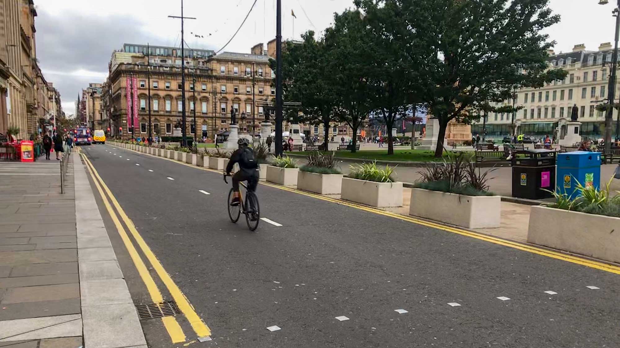


The last Commonwealth Games in 2014 was a watershed moment for cycling in Glasgow. It marked the introduction of the city’s first hire bike scheme – Nextbike. A combination of road closures, big crowds of pedestrians and some decent weather, helped make cycling the best way to get to many of the venues. It introduced a lot of people to cycling in the city. Including The Herald sports writer Graham Speirs, who wrote: “cycling will live in the memory as a spin-off of Glasgow 2014”.
Fast forward 12 years and Glasgow has a new fleet of e-bikes from Voi, which are easier to use (once you get going!). The city has more high quality cycling infrastructure, including some brand new sections in the West End and city centre. There are also fewer events and venues to get to. So, it should be easy to cycle to all of them?
As in 2014, the East End has swimming events at Tollcross International Swimming Centre and track cycling at Glasgow International Arena, Parkhead (formerly Emirates). Again, the SEC is at the centre of things with multiple events but this time the athletics are at Scotstoun, to the north-west. There are also cultural events at Kelvingrove Park and SWG3 in the West End and the Merchant City in the city centre.

The official website does encourage travel “by foot or wheel”. It says: “Cycling is another great way to travel, with Glasgow’s extensive cycle network providing safe, direct routes across the city.” But it doesn’t give you much else to go on. There are cycling maps of Glasgow available – see GoBike’s Routes page.
So, how does Glasgow’s cycling infrastructure actually perform?
Scotstoun

Scotstoun stadium is on Danes Drive – the nearby bridge on that road has a shared path under it at the edge of Victoria Park. It weaves through an underpass then a few short streets to the shared path alongside South Street. It’s not that obvious but once on this raised former railway path it’s a fairly straight line for a few hundred metres. It drops down to a crossing at South St then a shared (not very wide) pavement. It continues on Castlebank St, eventually crossing the bridge over the River Kelvin near the Riverside (Transport) Museum.
Fingers crossed visitors turn down the hill at the Riverside to join the Clyde Walkway/NCN7 to the SEC and city centre. Missing the turn and going straight on would take them towards the Clydeside Expressway. Hopefully no-one ends up on Victoria Park Drive South, near the stadium, which goes to the notorious Thornwood Roundabout. The roundabout and Castlebank St are due to get segregated cycle lanes but not for a few years.
Scottish Events Campus (SEC)

The SEC is right next to the Clyde Walkway/NCN7 shared path, which has been kept open, so is easy to cycle to. This area was partly closed off in 2014 (when the BBC commandeered the silver Millennium Bridge to their studios). This time round the path was in use even during the opening ceremony, despite the royals and politicians attending. However, there are more police around and a few new obstacles to look out for, like Hostile Vehicle Mitigation (HVM) barriers. Also, temporary sign boards take up some space on the path at a few places. Elsewhere, smaller signs on the railings and temporary stickers on the path itself direct visitors to nearby venues. There will be more pedestrians around so it may need a wee bit more time (and patience) to get along the path.

SWG3

SWG3 is a former industrial site that’s developed into a cultural venue over the past 20 years. However, it’s tucked away on Eastvale Place, behind a railway viaduct, so it’s not on everyone’s radar. The most obvious signs of it are the large graffiti murals on the railway arches and surrounding streets. The most direct route to it from the Clyde Walkway is over the footbridge by the Clydeside Distillery stone tower. However, this has steps on both sides (which really should have been ramped by now).
An easier way is further along by the Riverside Museum – there’s a path over a slope and under the Clydeside Expressway to get to the path on the other side (at Ferry Rd). However, recent works have improved cycle routes to SWG3 from the north with 2-way lanes on Sandyford St. It turns onto to Gilbert St/Haugh Rd and also links to Yorkhill Park/Centurion Way (and lanes to Old Dumbarton Rd and Byres Rd). The venue itself has a lot more cycle parking than it used to but it can still get busy during events.

West End

The SEC and SWG3 are very close together but it makes sense to mention the routes between them and Kelvingrove Park. Some guides may include the covered bridge from the SEC (nicknamed the ‘Smarties tube’). However, that takes you to Minerva St and a very busy bit of the Argyle St ‘strip’ in Finnieston. Also, the bridge has some restrictions on access and hazardous right angle turns you can’t see around.
The new lanes, as above, are phase 1 of Connecting Yorkhill and Kelvingrove. They will eventually offer an alternative up Sandyford St, right along Gilbert St and Haugh Rd. Sadly, Radnor St (to Kelvin Way) is still closed off at Argyle St. For now, the most direct route is still along Kelvinhaugh St, crossing Argyle St, then Derby St to the park gates. Phases 2 and 3 of Connecting Yorkhill and Kelvingrove are due to cover this route.

Kelvingrove Park

There are some more HVM barriers at the gates to the park but all usual access routes seem to be open. Inside the main gates a sign on wooden fence says ‘Bikes and Buggies left at own risk’, which seems to be intended as bike parking? It’s possible to walk a bicycle around the food stalls and you can try locking it somewhere more secure. However, you may be asked to move your bike if there are staff supervisors around (stewards don’t seem that bothered). There’s a stage, big screens, seating and merchandise as well as food/drink. Free to access but nothing is cheap inside!

Going from Kelvingrove Park to the city centre uses the West City Way from N Claremont St/Berkeley St. It was Glasgow’s first longer segregated cycle route, opened in 2013. After kerb-protected 2-way lanes on Elderslie St, it goes along a quieter road section of Argyle St.
City Centre

The West City Way reaches the city centre over the Anderston/Connect2 Bridge (formerly ‘Bridge to Nowhere’). It’s a shared path that climbs up to cross the M8 to Waterloo St. A slight issue just now on Waterloo St is a gap in the 2-way protected bike lanes at the former site of The Admiral pub. Building work has closed the cycleway and pavement. It’s good to have temporary cycle lanes as a stop-gap but these are being used by pedestrians.

A new alternative to the bridge is crossing the road at Anderston train station to the Argyle St West lanes (at the other side of the Marriott hotel). The lanes are still being finished at either end but are nearly complete in the middle. Unfortunately, the bike traffic lights haven’t been programmed – if you wait at the red light near JP Morgan you’ll be waiting a long time! It’s a real shame the contractors and Glasgow City Council haven’t been able to open these for the Games.
Thankfully, Gordon St has reopened outside Central station so there’s an east-west route here again (with contraflow bike lane to WCW on Hope St). There were plans for Gordon St before the Union St fire but those will need to be revised now the Union Corner building is gone. The busy pedestrianised areas of Gordon St and Buchanan St lead through archways into Royal Exchange Square. At the Queen St side, in front of the Gallery of Modern Art/Wellington statue, is the start of the Merchant City.
Also, the northern road on George Square has finally been repaved so it connects to George St again. At the other end of George St, there’s a contraflow on Duke St for the works on its Avenues Plus project. Sadly, George Square’s redevelopment isn’t due to fully complete until after the Games – not a good first impression from Queen St station.

The route along the Clyde Walkway to the city centre has a few minor twists and turns but is mostly straightforward. Many people cycle the Broomielaw/Clyde St protected lanes eastbound. That route was only designed to go westbound so it’s a bit sketchy at junctions. It is planned to convert the route to 2-way but that’s a few years away.
The East End venues are straight on along Clyde St via Glasgow Green. A slight left turn takes you onto the Bridgegate protected lanes at the Clutha pub (with Ukraine and Rennie Mackintosh murals). Those go onto King St into the Merchant City. At Trongate there isn’t a specific traffic light phase to cross into Candleriggs but you can get across.
Merchant City

Queen St and Ingram St have new decking and seating areas (similar to those on Saint Vincent Street). Candleriggs has held onto its ‘Spaces for People’/Covid-19 seating and barriers next to the covered Merchant Square. Diagonally opposite is Candleriggs Square Live zone with a screen, stage and food/drink. The Merchant City Festival takes place in the surrounding streets during the Games. From King St, the one-way loop of Parnie St leads to a crossing through to Saint Andrew’s St. Protected 2-way cycle lanes go past the church (St Andrews in the Square) onto James Morrison St.
Glasgow Green

This time around there are no Games events in Glasgow Green but it’s still a hub for walking and cycling. The protected lanes from James Morrison St/London Rd come in to the road past the People’s Palace and Templeton building. Shared pavement, by the playpark, goes straight on to traffic lights to cross to James St.
Along the river from Clyde St there’s a wide section of the Clyde Walkway/NCN 7 past the Boathouse. If you turn off just before the dark blue St Andrews suspension bridge you can follow a path up a slope to the corner and the crossing to James St.
East End

The pavement route along James St, and round the corner to Bridgeton Cross, is passable but could do with a serious upgrade. Past the bandstand, you cross at the corner of Bridgeton train station back onto London Rd. That’s the end of the western gap in the East City Way – you’re now back into protected 2-way lanes. This bit of segregated cycleway was the first in Glasgow (and recently had some overdue repairs to drains). After the traffic lights you cross to newer 1-way protected lanes.
Alternatively, if you’re on the shared path by the river, it narrows before the white Smartbridge at Dalmarnock. Going north there goes past Dalmarnock train station on the Clyde Gateway lanes to the velodrome.
If you continue on the Clyde Walkway, round past the sewage works, there are other turns you can take towards the velodrome around the 2014 Games Village.
Glasgow International Arena

The renamed Glasgow International Arena (formerly Emirates) has the velodrome alongside a large sports hall and gym. On it’s north (rear) side there’s the East City Way 1-way protected lanes. The corner crossroads has a Cyclops-style junction with traffic lights, which you cross clockwise. Older pavement lanes go past the arena’s entrance road on the Clyde Gateway (north-south). There are loads of bike parking stands on either side of the arena, as you’d expect for a velodrome.

Tollcross International Swimming Centre

Further along London Road the 1-way lanes’ kerbs turn to temporary barriers. This section through Braidfauld is due to be upgraded in future (as part of East City Way Phase 5). Turn onto Braidfauld Rd to go to Tollcross. There’s no cycling infrastructure on the roads next to the swimming pool itself. Main roads like Tollcross Rd/Gallowgate are best avoided – cycle on London Rd instead.
Conclusion
The Commonwealth Games 2026 use a mixture of cycling infrastructure from shared paths and pavements to fully segregated 2-way or 1-way lanes. These range from over a decade old to still under construction. This doesn’t show the whole story, especially missing out the South City Way and many others. However, they probably show a realistic picture of how it is to cycle around Glasgow. Better quality infrastructure is more common in some areas but there are still plenty of gaps and more work to do.
Postscript
An accidental discovery, while passing Glasgow International Arena, was this temporary bike parking station for Voi hire bikes (off Nuneaton St).

Apparently there are others, including on Minerva St. Which begs the question: why isn’t there one next to the SEC, where there are bikes locked all over the path railings?