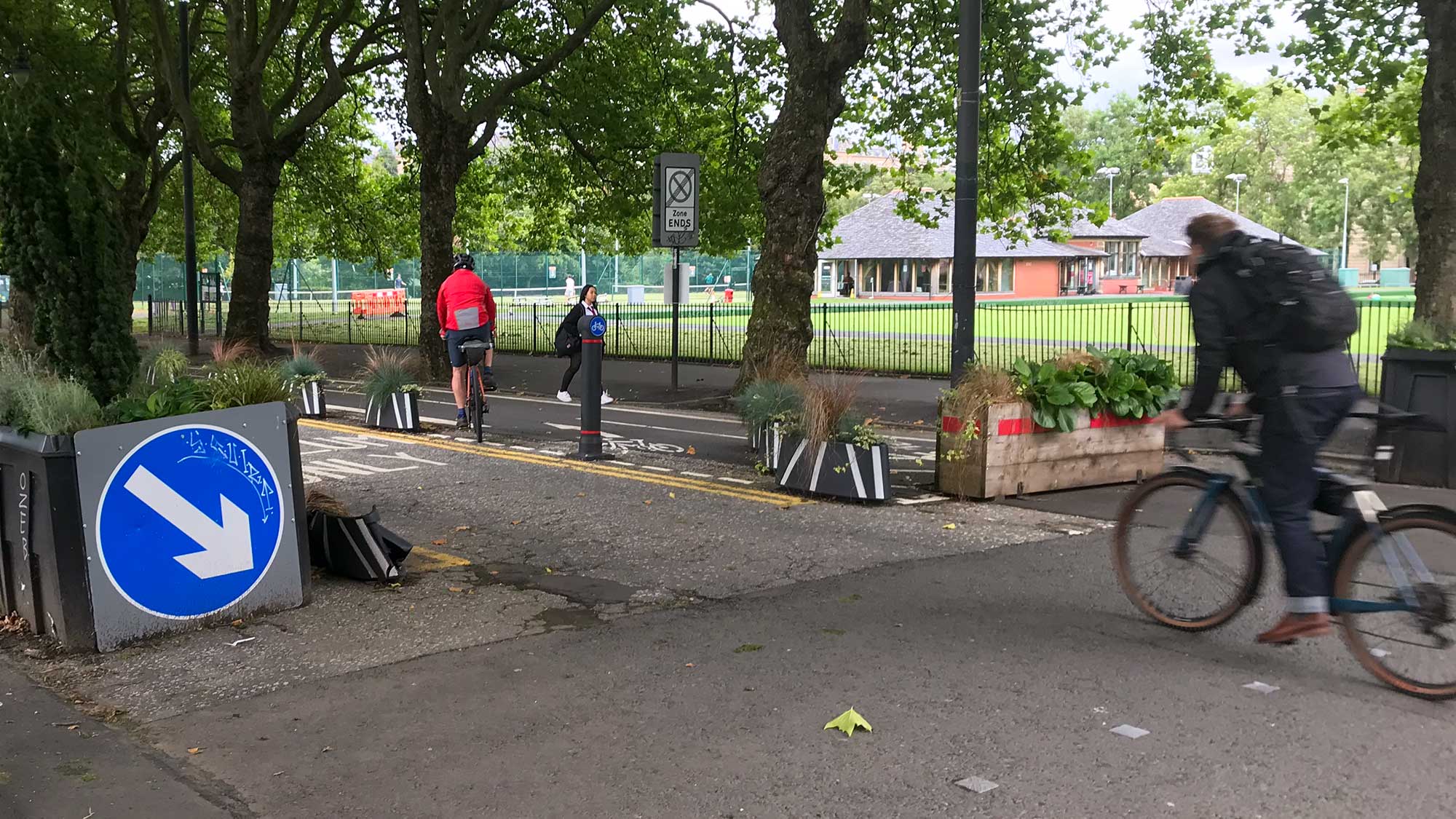


After GoBike’s Annual General Meeting on Saturday 7 November, we had a group bike ride around some of the brand new cycling infrastructure in the city centre. This included several ‘Avenues’: Cowcaddens Road, North Hanover Street, South Portland Street and Argyle Street (West).
We also looked at Anderston, which has a consultation on right now (along with Connecting Yorkhill & Kelvingrove – both consultations close on Sunday 22 November). Photos were taken along the way (and a few later on).
Our ride started across the road from our AGM venue, the Renfield Centre, at the corner of Holland St and Bath St. Ride leader Andy pointed out how most of Holland St had been transformed but, despite its name, there was little to no cycling infrastructure. There are bi-directional lanes on the next block on Pitt St, which are pretty decent (if steep in places). Instead, we set off along the one-way road section of Holland St onto Sauchiehall St.
Sauchiehall Street

Sauchiehall St was the original pilot for the Avenues project; (eventually) completed in 2019. It has some issues with pedestrian conflict, junctions, etc. However, it has bedded in as a useful 2-way route on a busy one-way street. We headed east onto Sauchiehall Precinct, the pedestrianised section that was redeveloped more recently. Glasgow City Council just announced future upgrades to some buildings on the street (and elsewhere in the city centre as part of the City Centre Strategy).
Cambridge Street

Cambridge St links between Sauchiehall St and Cowcaddens Rd. Bike lanes developed here over several stages since the “worst bike facility in the world”, a central painted lane done in 2001. Temporary barriers during the Covid-19 lockdown were replaced with permanent infrastructure. The greenery makes a difference here – a few cafes and pubs have outdoor seating and you don’t really notice the car parking/loading spaces. Heading northbound, the bike lanes end before a ramp down to the underpass to Cowcaddens Subway station. Almost everyone would use that part of the route in the past but there’s now a new option of protected lanes going right onto Cowcaddens Road.
Cowcaddens Road

One of the biggest transformations in the Avenues project is the former 4-lane Cowcaddens Rd. A lot of that is down to slimming the carriageway to two/three lanes. Another major factor is stopping up Port Dundas St at what was a very wide, busy junction (which still has access for emergency vehicles and cycling). It was part of the late 1990s Colleges Cycle Route – narrow painted on-road lanes (green with dashed line, so it was legal to park in them). Long-time GoBike member Peter was cycling on the new Avenue for the first time and was amazed at how much it had improved.

Cowcaddens Rd goes past Glasgow Caledonian University and Buchanan bus station to join North Hanover St. The t-junction is still under construction so we had to pick our way across.
North Hanover Street

The new sections of cycle lane are almost complete between the junctions. It seems only the ‘rain gardens’ (to help prevent flooding) have still to be planted alongside. However, the next section from Cathedral St to George Square hasn’t started yet so we had to go on the road there.
George Square/George Street/Merchant City

Being on the road through George Sq meant there wasn’t any time for photos. The western side of the square re-opened in September. Most of the rest is still closed off so we couldn’t reach the new bike lanes (they’re due to be at north-east corner and along southern edge – see image of plans from summer 2024). The next section of George St is due to become an Avenue in future. The part next to the square (pictured, above) may be done first. Later on, the gap should be filled between High St and Duke St (the latter has an Avenues Plus route currently under construction). We went down Montrose St to cross Ingram St onto Candleriggs.

South City Way (King Street/Bridgegate/Gorbals St)

On the other side of Trongate, King St used to have painted lanes alongside car parking. In 2024 they were made into permanent kerb-protected cycle lanes (as Phase 5 of the South City Way). We had to wait for a wee while at the crossing next to King’s Court and then only just fitted in at the next lights between carriageways at Clyde St. A few people commented how it’s quite a complicated junction. Work is underway on Stockwell St – partial cycle lanes there won’t change the junction, unfortunately. There was plenty of room once we were on the bridge on the South City Way. This stretch is even better now the Citizen’s Theatre redevelopment is complete.

Norfolk Street/South Portland Street

We turned onto Bedford St to zigzag towards Norfolk St. The reason was to try out the new cycle crossing into S Portland St. It’s unusual as you go round three sides of the junction, doubling back on the other side, before turning left onto S Portland St. There was another wait here but the lane had plenty of space. It’s next to a former council building which has been demolished to make way for continuing paths and more housing (see North Laurieston Movement Strategy plans). South Portland St was looking good on the way to the suspension bridge.

Clyde St/Dixon St/St Enoch Square

Back on the north bank of the river, we had a short wait for the lights at Dixon St (along with a delivery rider and a few Voi riders at the other side). The drop kerb on Dixon St has been upgraded since it’s become a popular link. The square has its festive fairground so we had to take it easy going around it onto Argyle St. It helped being more visible in a group than you would be on your own.
Argyle St (West)

On the way to the Four Corners junction, there is currently just a painted contraflow lane (usually with a vehicle parked in it). The next phase of Argyle St East is due to convert this into 2-way kerb-protected lanes. We had to watch for pedestrians here and in the contraflow lane under Central Station/“Heilanman’s Umbrella”.

Argyle St West Avenue was in an unfinished state during the Commonwealth Games but seems to be just about there now. As expected, it weaves a lot and isn’t that wide but the lanes are smooth and uni-directional (with angled kerbs so you shouldn’t catch a pedal on them). We waited a few times at lights on the way along. However, the green at the last crossing was deceptive as it was on while the road had a green light. It seems the bike light is for going straight on, despite the fact the lane stops a few metres after the crossing! We reported this to GCC but please watch out for it if you go this way.

Anderston
On the other side of Argyle St there are more crossings over motorway slip roads to the area outside the station under the M8. The council has started calling this ‘Anderston Plaza’ (Connecting Anderston consultation ongoing at time of writing). Plans include demolishing the white footbridge with steps (in background of first photo).

Crossing onto the next section of Argyle St there’s the spiral up to the Anderston Bridge (former ‘Bridge to Nowhere’). It was completed in 2013 as part of the West City Way active travel link. The new protected lanes in the Connecting Anderston plans would fill a gap in the WCW to Elderslie St. It’s a fairly quiet stretch but linking it up may help less confident riders and widen the appeal of the route. Smoother crossings under the M8 and onto Argyle St West will offer an improved route to the Low Level of Central Station.

West City Way (Waterloo St)

We continued over the bridge and the Waterloo St parallel crossing. This gap used to have bollards, which may have prevented recent use by a wayward motorist! Pitt St is to the left but we went right along Waterloo St. The 2-way kerbed lanes are closed further along with a coned area instead. It’s at the former site of a previous AGM venue, the Admiral Bar (sadly demolished but the owners have the Admiral Woods a few blocks away).

Gordon Street (Central Station)

After passing the contraflow cycle lane on Hope St (the oldest in Glasgow?) we finished on Gordon St. Following the Union Corner fire, the City Centre Strategy includes a group looking at new plans for the street (last Gordon St plans were in 2025). It still has a chaotic mix of pedestrians, bikes, cars, taxis and buses. As we discovered when the 398 got very close while we took a group photo!
Andy leads monthly group rides on the first Sunday of the month. The December ride goes to Paisley/Renfrew and the annual GoBike infrastructure ride will return in January. See the Cycle Rides page for details.