
Happy New Year!
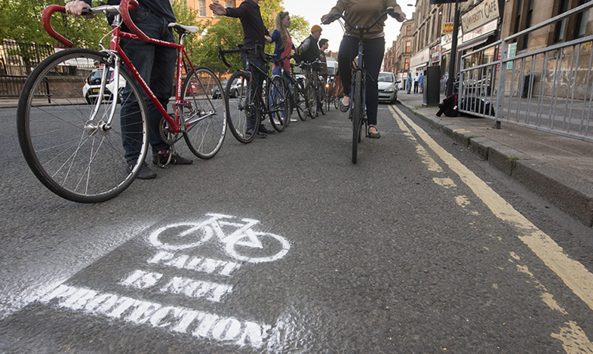
The first Digest of 2022 has a few loose ends to clear up from last year. Firstly, there’s the proposed regeneration of Shawlands Arcade on Kilmarnock Rd (as shown in split image, above). Secondly, there’s North Lanarkshire Council’s Active Travel strategy, which is a long way off the pace set by Glasgow’s.
The last edition featured negative reaction to Spaces for People lanes in East Kilbride, South Lanarkshire. Another issue has come up elsewhere – a petition against SfP lanes between Paisley and Howwood in Renfrewshire.
While cycling is usually on the agenda in Glasgow it’s often missed out in surrounding areas, which feed the city’s traffic issues. Cars are king in suburban towns so any projects that try to redress the balance will need support. On a more positive note, Sustrans are funding minor upgrades to existing NCN routes in Renfrewshire and elsewhere.
Contents
(new/updated items in bold – link jumps to article)
Section 1: Current Consultations
- A803, Kirkintilloch Road (and Side Roads) Bishopbriggs TRO
- East Kilbride, Spaces for People
- Shawlands Arcade Regeneration
- Low Emission Zone – Full proposal
- Dennistoun to Cranhill Liveable Neighbourhoods
- Govan to Kingston Liveable Neighbourhoods
- Ruchill to Cowlairs Liveable Neighbourhoods
- Langside to Toryglen Liveable Neighbourhoods
- Malls Mire survey
- Drumchapel Local Development Framework
- Raeberry St Quietway (Connecting Woodside)
Section 2: Consultation Feedback
- Howwood to Paisley, Spaces for People route
- Active Travel Strategy 2021–2031 (North Lanarkshire Council)
Section 1: Current Consultations
(in date order for responses)
1.1: A803, Kirkintilloch Road (and Side Roads) Bishopbriggs TRO
Council: East Dunbartonshire.
Area: South Bishopbriggs towards the town centre.
Subject: Parking restrictions on the eastern side of the A803 from the end of Springburn Rd (at Colston Rd) to Bishopbriggs Cross, near the train station. Also, parking restrictions at junctions on side streets along the western side of Kirkintilloch Rd, from Coltpark Ave to Brackenbrae Rd.
First featured: Digest 101, Item 1.5.
Website link: A803 & Side Roads documents (combined PDF of plans and report).
Deadline: 7 January 2022.
1.2: East Kilbride, Spaces for People
Council: South Lanarkshire.
Area: East Kilbride town centre.
Subject: Protected two-way cycle lanes on Cornwall St (replacing a road lane and a bus stop) and zebra/cycle crossings. One-way lanes towards the train station on part of Brouster Hill and a short contraflow cycle lane on Torrance Road. The route is due to be extended east to Churchill Ave and west to the Queensway for EK’s Active Travel network. The lanes have been criticised on social media. Also, a related project on West Mains Rd (adding a protected junction) had roadworks delays which angered locals, including a councillor. Please support the SfP project so the next phases can proceed as planned (unlike the Bearsway).
First featured: Digest 89, Infrastructure Update.
Website links: EK SfP online survey, South Lanarkshire View article and EK SfP plans (foot of page).
Deadline: 16 January 2022 (extended from original deadline of 24 December 2021).
1.3: Shawlands Arcade Regeneration

Organisation: Shawlands & Strathbungo Community Council (in conjunction with developers, Clydebuilt).
Area: Shawlands Arcade between Kilmarnock Rd and Pollokshaws Rd.
Subject: Regeneration of the shopping arcade. Flats above retail units with gaps for access between Kilmarnock Rd and Pollokshaws Rd. The original consultation seems to have slipped through the net in summer 2021 (apologies). However, the local Community Council are now collating ideas for the public spaces. They want links or photos of places that people like; to use as inspiration. There are no cycle lanes in the current plans (middle alley between buildings has steps). Other new developments, such as the Meatmarket at Duke St (Item 1.5), have a segregated cycle path through the site. Further consultation on the Arcade is expected soon.
Website links: S&SCC Facebook post – email: enquiries@shawlandsarcade.com or shawlandsstrathbungocc@gmail.com. Original Shawlands Arcade proposals (scroll down and click magnifying glass button to view).
Deadline: 16 January 2022.
1.4: Low Emission Zone – Full proposal
Council: Glasgow City.
Area: City centre.
Subject: Phase 2 of the Low Emission Zone in the city centre (Phase 1 was buses only). Older, more polluting motor vehicles will be charged for driving into the zone. Its boundary has changed slightly. Parts of some streets around the edges of the zone have been added to it and the Stow College/GSA building has been left out. The LEZ is due to begin on 31 May 2022 but enforcement won’t kick in until a year later. When fines do come in they escalate for repeat offences. Some ‘grace periods’ and exemptions apply, including for city centre residents, so the full zone wouldn’t be implemented until June 2024.
First featured: Digest 90, Item 1.3.
Website links: Full proposal document, detailed map PDF and further background on the LEZ website.
Deadline: 20 January 2022.
1.5: Dennistoun to Cranhill Liveable Neighbourhoods
Council: Glasgow City.
Area: From Dennistoun (including the Necropolis but not GRI), Milnbank, Haghill, Riddrie, Carntyne to Cranhill.
Subject: One of four LN consultations using Commonplace maps and the Place Standard tool. Transport links include roads like Duke St, Alexandra Parade, Cumbernauld Rd and Edinburgh Rd plus a few train stations. Apart from a few parks most big destinations are towards the city centre end – Necropolis, Tennents brewery and City Park offices. While Glasgow Royal Infirmary is just outside western edge of area. Dennistoun has held on to a few Spaces for People measures (from its failed LTN) but there’s very little infrastructure elsewhere. Consultation had started in the community but further events have been postponed. Over 380 comments on the map so far.
First featured: Digest 100, Item 1.9.
Website links: Dennistoun to Cranhill LN Commonplace map, Dennistoun to Cranhill Place Standard survey.
Deadline: No obvious deadline.
1.6: Govan to Kingston Liveable Neighbourhoods
Council: Glasgow City.
Area: From ‘Greater Govan’ (including Cessnock, Kinning Park, Plantation) and Ibrox to Kingston.
Subject: ‘Everyday journeys’ around major transport links including Govan bus station, subway stations, Paisley Road West, Clyde Tunnel, Squinty Bridge/Clyde Arc and the forthcoming footbridge. Major destinations include Ibrox Stadium and the Southern General/Queen Elizabeth Uni Hospital (see next item). There’s some cycling infrastructure around Festival Park/Pacific Quay but no proper links to major routes like the nearby South West City Way. There have been over 190 comments on the map so far.
First featured: Digest 100, Item 1.10.
Website links: Govan to Kingston LN Commonplace map, Govan to Kingston Place Standard survey.
Deadline: No obvious deadline.
1.7: Ruchill to Cowlairs Liveable Neighbourhoods
Council: Glasgow City.
Area: North of the canal from Ruchill (at edge of Maryhill) across Possilpark, Hamiltonhill, Rockvilla, Craighall, Keppochhill and Port Dundas to Cowlairs (plus Sighthill Park).
Subject: The edges of this area have been redeveloped with active travel routes along the canal. Nearby Sighthill is being completely rebuilt including a segregated cycle route on St Rollox Dr. However, Cowlairs, Ruchill and Possilpark have a lot of derelict sites. The Spaces for People lanes on Hawthorn St have added a west-east cycle route (with some gaps). Over 80 comments so far.
First featured: Digest 96, Item 1.5.
Website links: Ruchill to Cowlairs LN Commonplace map, Ruchill to Cowlairs Place Standard survey.
Deadline: No obvious deadline.
1.8: Langside to Toryglen Liveable Neighbourhoods
Council: Glasgow City.
Area: From Langside (at edge of Shawlands) across Battlefield, Mount Florida and part of King’s Park to Toryglen (and Polmadie).
Subject: A really random Liveable Neighbourhood area, including busy Langside and empty Polmadie. There’s not much active travel infrastructure between the proposed SCW extension to Battlefield Rest and Malls Mire at Toryglen, except the protected bit of Aitkenhead Rd and the unprotected Spean St path. Over 360 comments so far.
First featured: Digest 96, Item 1.4.
Website links: Langside to Toryglen LN Commonplace map, Langside to Toryglen Place Standard survey.
Deadline: No obvious deadline.
1.9: Malls Mire survey

Organisation: Urban Roots.
Area: Woodland park between Toryglen Asda, Polmadie Recycling Centre in Glasgow and Rutherglen Glencairn Football Club in South Lanarkshire.
Subject: An evaluation about the newly created park and paths. The site wraps around a regenerated housing estate, linking former wasteground with the woodland and ponds. Trails, outdoor play equipment and a bike pump track have been installed. Also, there are 3m wide shared paths to create a lit, mostly traffic-free route. It links Prospecthill Circus west to Polmadie Rd and east to the corner of Toryglen Rd/Pinkerton Ave in Rutherglen (about half a mile from Bike Town‘s workshop).
First featured: Digest 74, Item 3.4.
Website links: Malls Mire survey.
Deadline: No obvious deadline.
1.10: Drumchapel Local Development Framework
Council: Glasgow City.
Subject: The latest framework consultation, following previous strategic ones for Glasgow North, ‘Inner East’, etc. According to GCC: “The purpose of the Drumchapel Local Development Framework will be to provide a structure for future development in the area. It will act as an overarching framework to identify urban planning priorities for Drumchapel and to help take them forward.” There are less than 20 comments on the map so far.
First featured: Digest 102, Item 1.12.
Website links: Drumchapel Commonplace map, Drumchapel survey link and background.
Deadline: No obvious deadline.
1.11: Raeberry St Quietway (Connecting Woodside)
Council: Glasgow City.
Area: Raeberry St, North Woodside (west of Maryhill Rd).
Subject: Further project from Connecting Woodside with junction redesigns at either end of the street and new secure cycle parking. The Maryhill Rd end would be narrower and the crossing moved to make a direct link to Trossachs St (towards Garscube Rd and the canal). The new North Kelvinside/Woodside RPZ sets the car parking bays.
First featured: Digest 99, Item 1.12.
Website links: Raeberry St Quietway ‘storymap’, Raeberry St plans PDF, Raeberry St survey.
Deadline: No obvious deadline.
Section 2: Consultation Feedback
2.1: Howwood to Paisley, Spaces for People route

Council: Renfrewshire.
Area: Route along Beith Rd, from Howwood through Johnstone to Paisley.
Subject: This temporary route using ‘wands’ was installed in summer 2021. A petition started in December 2021 calling for it to be removed (which currently has over 700 signatures). It was back in the news after a cyclist was injured on Beith Road (near Rannoch Road). However, the local press report quotes a councillor talking about deaths and near misses then a council statement saying “Police Scotland attended and have confirmed to us the road layout was not a factor in this accident and the driver was not at fault.” If you use the route and want to voice support, you can email feedback to ei@renfrewshire.gov.uk.
First featured: Digest 65, Item 1.2.
Website link: Spaces for People Storymap and route plans PDF.
2.2: Active Travel Strategy 2021–2031 (North Lanarkshire Council)

Council: North Lanarkshire.
Subject: This strategy has been in the pipeline since 2020 but only reached GoBike in late 2021. We’re not aware of any public consultation. It arrives along with plans for redevelopment of town centres and country parks plus NLC’s Town/Community Hubs (schools as community centres). While neighbouring South Lanarkshire is building segregated lanes on roads, North Lanarkshire are focusing on shared paths. The strategy has a single paragraph in the PDF version about road space reallocation. However, it has pages of detail about shared path construction. The focus on routes away from main roads may come from NLC’s work with Glasgow & Clyde Valley (GCV) Green Network. However, it’s disappointing it doesn’t address needs like cycle commuting or personal safety (many greenspace routes can’t be lit as it would disrupt biodiversity).
Website link: NLC Active Travel Strategy Storymap (see Transport Context) and NLC Active Travel Strategy PDF.