
Last chance to make the city’s pop-ups become permanent.
Glasgow City Council’s consultation on its Spaces for People projects is in its last few weeks. There are also consultations and feedback about a few projects in the city. Elsewhere, there’s SfP in East Ren, ‘Discussion’ in East Dunbartonshire and a new road and potential new paths for Lanarkshire.
Infrastructure works continue in Glasgow and beyond for temporary lanes, permanent routes and secure cycle storage. So, there’s another round-up…
Infrastructure Update
- Bunhouse Rd and Old Dumbarton Rd seem nearly complete while work continues on Benalder St and Ferry Rd (for Yorkhill & Kelvingrove Cycle Village).
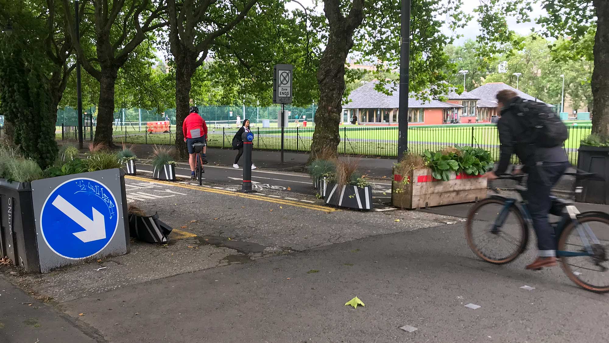
- Finnieston saw its first on-street secure ‘bikehangars’ (by Cyclehoop) with more due in the Southside and elsewhere. However, some people questioned why the city centre, North and East End were less well covered.
- Royston Rd pop-up lane works continue – might be finished by the end of SfP consultation!
- Some of South Lanarkshire’s towns and villages get 20mph zones, like in Bothwell. The council have also introduced mandatory 20mph zones around schools.
- Strathclyde Park’s widened path is complete near the playpark. Also, the east gate on spine road has moved to allow car access to the Beach car park (while stopping through traffic).
Contents
(new consultations in bold – link jumps to article)
Section 1: Current Consultations
- Community Action Lanarkshire – Make Your Way surveys for Crawford + Elvanfoot, Glespin, Rigside + Douglas Water (ends 13 June)
- Glasgow City Council – Maryhill Road/North Woodside Road/Hopehill Road (Traffic Regulation) Order (ends 18 June)
- Glasgow City Council – Spaces for People survey (ends 20 June)
- Waverley Park Collective – Liveable Streets Waverley Park (amended deadline: 21 June)
- East Renfrewshire Council – Davieland Rd, Giffnock Spaces for People project
- North Lanarkshire Council – East Airdrie Link Road, Stage 2 survey
- East Dunbartonshire Council – Active Travel Discussion (ends 28 Sept)
Section 2: Forthcoming Consultations
None this time.
Section 3: Consultation Feedback
- Glasgow City Council – Planning decision about site to the south of Crawford St/Rosevale St/Beith St
- Dennistoun Community Council – Update on Spaces for People scheme
- Urban Roots – Malls Mire newsletter May 2021
- Multiplex – Glasgow Uni campus newsletter June 2021
Section 1: Current Consultations
(in date order for responses)
1.1: Community Action Lanarkshire – Make Your Way surveys for Crawford + Elvanfoot, Glespin, Rigside + Douglas Water

The Make Your Way project looks at sustainable travel in rural South Lanarkshire. It started in 2016 creating active travel maps (see: www.makeyourwayclydesdale.com). Since then it has evolved to offer Bikeability training, wayfinding and infrastructure. Previous MYW consultations appeared in Digest 75, Item 1.3. These led to plans for active travel routes to connect villages to the nearby NCN74.
A new lot of villages is due to follow similar steps. Crawford and Elvanfoot are both next to NCN74, south of Biggar. Glespin is off to the west (past Douglas) and Rigside/Douglas Water are to the east (south of Lanark). Some of these places may be familiar from Cycling UK or other group rides. Find the surveys at the following links:
- Crawford and Elvanfoot survey (C+E under 16s survey).
- Glespin survey (Glespin under 16s survey).
- Rigside and Douglas Water survey (R+G under 16s survey).
Surveys are also available from the box outside Crawford Village Hall, Elvanfoot phonebox, Glespin Community Group (glespincommunitygroup@hotmail.com) and Atwal’s Rigside.
The above surveys close on Sunday 13 June.
1.2: Glasgow City Council – Maryhill Road/North Woodside Road/Hopehill Road (Traffic Regulation) Order

It’s third time lucky to explain this novel junction proposal for Maryhill Rd, which was first covered in May. However, there had been an earlier Stage 1 process to which GoBike responded. Sadly, none of our suggestions were taken on board.
The key features appear to be: the middle crossing is for bikes only, it’s diagonal and it’s completely separate from the surrounding toucan crossings. The issue may be that anyone cycling across who turns onto Maryhill Rd could cut across the line of people walking on the crossings at each arm of the junction (on their own green man) potentially with cyclists coming from behind their shoulder. That seems to be why the council wants to ban left and right turns onto Maryhill Rd from the diagonal cycle-only crossing.
There are other diagonal bike crossings being installed as part of the protected junction layouts on Garscube Rd (for the same project, Connecting Woodside). However, the segregated cycle lanes there will make a big difference and reduce numbers cycling on the carriageway. There’s also the issue about how practical this prohibition might be – will people ignore the ban (or maybe use a toucan crossing to turn onto Maryhill Rd instead)?
Regardless, we have the above proposal and prohibition, which the latest GoBike response about Maryhill Rd TRO objects to. We await to see if there will be any constructive dialogue. The TRO files were in Digest 86, Item 1.1 and closing date is Friday 18 June.
1.3: Glasgow City Council – Spaces for People survey

This consultation covers every temporary Spaces for People project in the city. These have been grouped into headings like ‘City Centre‘, ‘Neighbourhoods‘, ‘School Car Free Zones‘ and ‘Pop-up Cycle Lanes‘. There’s a wide range from across the city, a few of which have been in place in some form for about a year now. In contrast, others are still being finished (like Royston Rd in the Update, above). The quality varies, particularly around junctions, but most make cycling or walking across the city a bit less stressful and more accessible.
Do we want to go back to life without them? If not, there are plenty of ‘Retain it’ checkboxes to tick in the GCC SfP survey (and boxes to comment in too).
A closing date has been announced – you have until Sunday 20 June.
1.4: Waverley Park Collective – Liveable Streets Waverley Park

We first covered this Southside neighbourhood project in Digest 81, Item 1.8. The Liveable Streets project is run by the Waverley Park Collective and had 650 contributors to that first stage. Great to see this from a grassroots group – the depth of consultation and engagement is something the city council could learn from.
The next stage is consulting about three design options to improve road safety. These would use different combinations of filters, traffic calming and ‘pinch points’ to slow down/re-route motor vehicles.
See the Waverley Park options page for summaries of the designs with sliders and comment boxes under each one to give feedback. One of which asks which street you live in so it’s obviously aimed at locals. There are also videos about the options and overall process. It looks like a lot of time and thought has gone into the options and the website.
There’s no obvious closing date but the last stage didn’t last too long.
1.5: East Renfrewshire Council – Davieland Rd, Giffnock Spaces for People project

This Spaces for People project aims to deal with road safety and accessibility issues from bad parking to speeding. As in Digest 87, 1.4, it’s about Davieland Rd next to Rouken Glen Park in Giffnock, East Renfrewshire.
It proposes temporary measures to protect pedestrian and cycling space while retaining car parking. It also has an eye on the future as well. The survey asks about future priorities as well as a reaction to the current proposal.
The background and survey are both on the Davieland Rd consultation page.
1.6: North Lanarkshire Council – East Airdrie Link Road, Stage 2 survey

This project first came up in Digest 56, Item 2.1 (when the planned workshops were cancelled due to COVID-19). It was formerly known as the Airdrie Bypass plan, which is pretty much what it does (to take through traffic away from Chapellhall and Airdrie). However, it will now also connect to the new Monklands Hospital when it’s built at Wester Moffat.
Stage 1 of the project considered various routes. Now, Stage 2 has a preferred route, which is the longest option (going furthest north towards Cumbernauld). There was a workshop about active travel on the route but very few details in this consultation.
See the East Airdrie Link Road, Stage 2 survey for maps and videos of the route to give feedback. No obvious closing date but detailed design is due to start in autumn 2021.
1.7: East Dunbartonshire Council – Active Travel Discussion

This wide-ranging project first appeared in Digest 86, 1.2. The ‘Ideas Map‘ for the East Dunbartonshire area has over 300 contributions so far.
There are a few more online consultation events this week (including tonight for Bearsden/Milngavie) then the rest in August/September. See a full list of events and background info on the Active Travel Discussion webpage. The closing date for the whole thing is 28 September.
Section 2: Forthcoming Consultations
None this time.
Section 3: Consultation Feedback
3.1: Glasgow City Council – Site to the south of Crawford Street/Rosevale Street /Beith Street planning decision
This development first got a mention in Digest 50, 3.7. The site is next to NCN 7 on the way into Partick. It’s since come back with the city council emailing GoBike about the latest planning decision (Planning Application Reference: 19/02063/PPP). It gives the go ahead for the flats despite local objections – no real surprises there.

However, it comes with a long list of recommendations, including making it a car free development. Also, point ‘p’ is about active travel routes:
“p. A survey of pedestrian and cycle movements on the part of National Cycle Route 7 that falls within the site and that immediately adjacent shall be submitted to and approved in writing by the planning authority. The survey shall identify any enhancements to the path required as part of the proposed development to accommodate increased cycle and pedestrian movements associated with the development. Where enhancements are required to maintain pedestrian and cyclist safety, these shall be specified in the survey report. The approved measures shall be completed before any of the dwellings are occupied.”
It’s rare for a UK planning decision to ask for active travel paths to be dealt with before people move in. Paths usually come well after the fact (if at all).
3.2: Dennistoun Community Council – Update on Spaces for People scheme
This detailed update by Dennistoun Community Council was posted in May. Apologies to GoBike member Wesley for its belated appearance in the Digest. Nonetheless, it gives an insight into what went wrong with the Spaces for People scheme in Dennistoun. It never was the ‘Low Traffic Neighbourhood’ the city council claimed as the design didn’t stop ‘through traffic’ (it only had one filter). Severe delays in installation, removing cycle contraflows and chopping/changing the layout (even before it was finished) managed to alienate almost everyone in the area.

What is left are a few one-ways and extended pavements near schools. These have settled down and seem to work reasonably well. However, it is a long way short of what it could have been. After this experience there are question marks about how locals might react to changes in future. It looks like we won’t have long to wait as Dennistoun has been named as part of a ‘Liveable Neighbourhood’ pilot area.
3.3: Urban Roots – Malls Mire newsletter May 2021
Malls Mire, between Toryglen and Rutherglen has been making steady progress since first appearing in Digest 74, 3.4. This latest Malls Mire newsletter has news about new paths and other greenspace work across the site.
3.4: Multiplex – Glasgow Uni campus newsletter June 2021
Also progressing, but with a lot more steel and concrete, is Glasgow Uni’s new campus development. They’re already on their June 2021 campus newsletter with news about what’s going in ‘University Square’ and their latest piles.