
“It’s in the trees, it’s coming!”*
The latest drop-in event is about Dams to Darnley Country Park and East Renfrewshire’s Balgray Connections project. Today’s event is in Avenue Shopping Centre, Newton Mearns, 11am–3pm (near Costa). Another follows on 2 November, 3pm to 7pm at Barrhead Foundry centre.
Also, it’s decision day at Inverclyde Council for the Spaces for People route in Greenock. Will they follow Renfrewshire and remove it? Or will it get a stay of execution?
A few consultations come to an end over the Hallowe’en weekend – including for North Ayrshire, North Lanarkshire, East Dunbartonshire and Glasgow.
1: Current Consultations
- Greenock to Battery Park SfP lane
- Irvine housing developments
- Ravenscraig Levelling Up Fund bid
- Meadowhead Road (Craigneuk) Active Travel and Road Safety Improvement
- South Central Local Development Framework (SCLDF)
- Lennoxtown Main Street Improvement Project Consultation
- Loans to Troon active travel path – Phase 3
- St George’s Road – Phase 2
- Giffnock Local Action Plan map
- Clarkston Local Action Plan map
- Eaglesham Local Action Plan map
- Balgray Connections
2: Consultation Feedback
3: Proposed Traffic Calming/Traffic Regulation Orders
1: Current Consultations
(in date order for responses)
1.1: Greenock to Battery Park SfP lane

Council: Inverclyde.
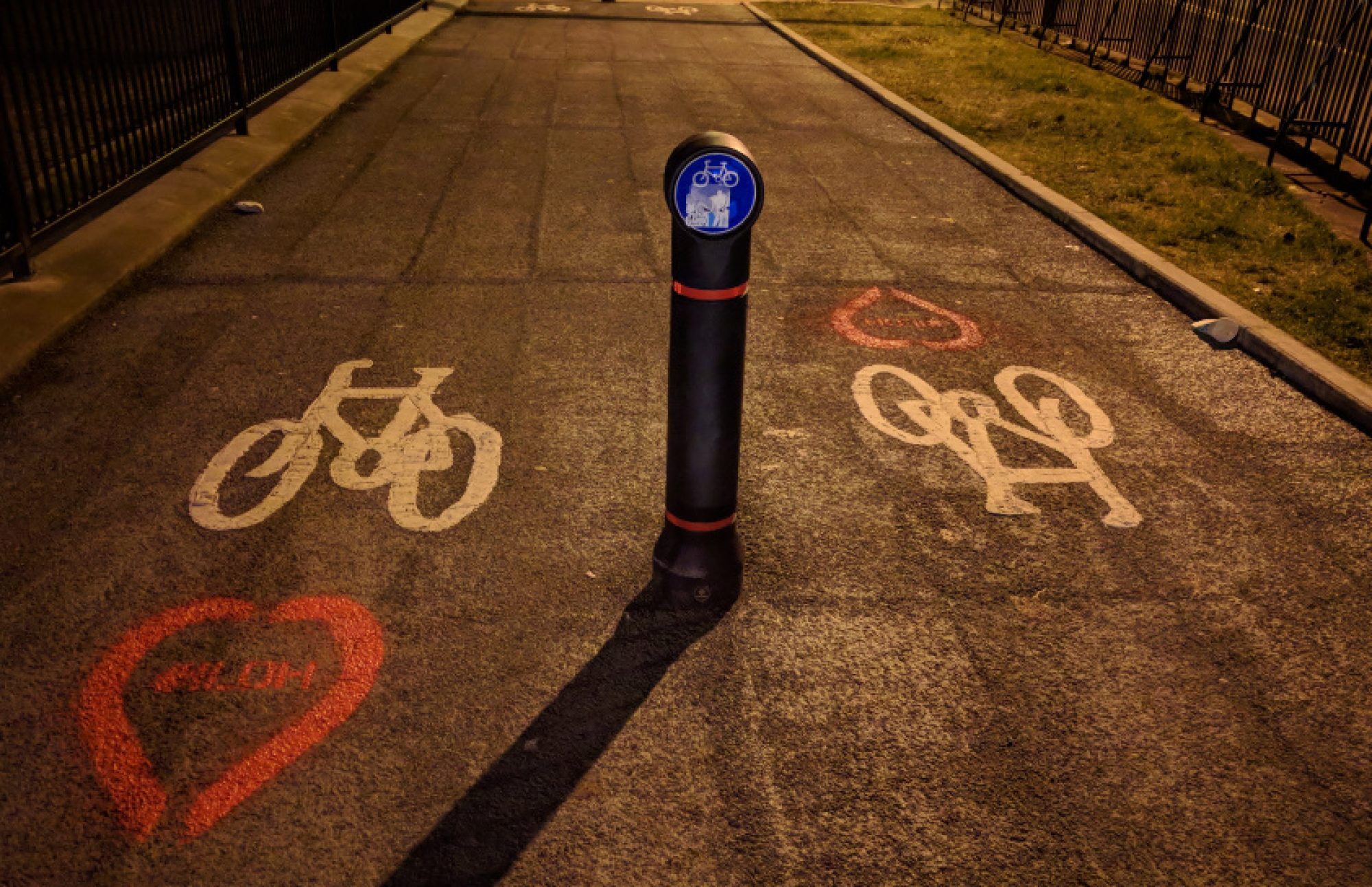
Subject: Spaces for People temporary route between Greenock town centre and a coastal park. A mix of painted lanes on pavement and protected cycletracks on road. A vote by the council in March was 9:2 in favour of keeping the lanes for another six months. A review was due in September with the next environment and regeneration committee meeting on 27 October. The council’s SfP update report has some interesting statistics about cycle usage and traffic flow. People cycling the existing Coastal Path (east of the new lanes) seem to stay on the eastern shared pavement on Container Way; then use Patrick St/Brougham St instead of crossing to Laird St/Dalrymple St. The western side of Container Way has strange chicane barriers and Tesco’s car park entrance, which may have something to do with it (above). The report recommends improvements and making the temporary lanes permanent.
Featured: Digest 108, Item 1.12.
Website links: Greenock Town Centre to Battery Park – Community Engagement and Inverclyde Now article on council vote (March 2022).
Deadline: No obvious deadline.
1.2: Irvine housing developments
Council: North Ayrshire
Subject: Two sites are being redeveloped – part of Ayrshire Central Hospital’s grounds and Montgomerie Park in Irvine, either side of the A78. Both housing plans include accessible homes and walking/cycling links. Montgomerie Park seems to include a cycle path alongside the site, which links to an existing off-road path, but there isn’t much detail.
Featured: Digest 120, Item 1.6.
Website links: Ayrshire Central Hospital consultation and Montgomerie Park consultation.
Deadline: 28 October 2022.
1.3: Ravenscraig Levelling Up Fund bid
Council: North Lanarkshire.
Area: Part of the former Ravenscraig Steelworks site between Motherwell and Wishaw.
Subject: ‘Proposals to develop a large site in Ravenscraig.’ However, it’s a relatively small part of the huge Ravenscraig site. Also, most of the money appears to go on groundworks for utilities. New active travel links would be mainly linking the new estate to existing paths. That would still leave the ‘missing link’ to the west of Robberhall Rd towards Coursington Rd. The bid for the former industrial site would go to the UK Government’s Levelling Up Fund (without any hint of irony!). Comments have to go to the council by email: ravenscraigluf@northlan.gov.uk.
Website links: Ravenscraig Levelling Up Fund bid webpage.
Deadline: 28 October 2022.
1.4: Meadowhead Road (Craigneuk) Active Travel and Road Safety Improvement
Council: North Lanarkshire.
Area: Craigneuk area between Ravenscraig and Wishaw (near Shieldmuir train station).
Subject: ‘Take 2’ for this street after a previous attempt at active travel improvements hit the skids. The Meadowhead Rd plans from 2020 included rain gardens, speed chicanes and changes to car parking. Some residents took issue with the latter – the project was delayed and then lost funding. The new plans widen the north footway to a 3m shared path. The road is a bus route, which had ruled out speed bumps, but the new plans add half a dozen speed tables. A path already goes east from the Wishawhill Wood Pump Track to Wishaw’s Main St. Meadowhead Rd could connect between it and the recent Ravenscraig Active Travel Link path, going north to the new playpark by the Regional Sports Centre.
Featured: Digest 80, Item 1.2.
Website links: Meadowhead Rd consultation webpage and Meadowhead Rd ‘storymap’.
Deadline: 30 October 2022.
1.5: South Central Local Development Framework (SCLDF)
Council: Glasgow City.
Area: South of the river from Kinning Park round to Oatlands and down to Shawlands (excluding Pollokshields).
Subject: Toryglen is also included in the ‘South Central’ area for this Local Development Framework. Apparently, it’s less urgent than a Strategic Development Framework (SDF). The neighbourhoods involved vary from less well off Govanhill to affluent Strathbungo. Also, the map of the area shows how it overlaps with the Riverside SDF between the Barclays site and the Squinty Bridge.
Featured: Digest 118, Item 1.12.
Website links: Transforming Communities Glasgow webpage.
Deadline: 31 October 2022.
1.6: Lennoxtown Main Street Improvement Project Consultation
Council: East Dunbartonshire.
Subject: Lennoxtown is known as the site of Celtic FC’s training complex. Despite being at the foot of the Campsie Hills, its Main St is not as picturesque as its setting. It has had some regeneration, including Lennoxtown Hub, housing the library and health services. Now a previous improvement project from 2019 is restarting – an initial survey is due to lead to refreshed concept designs for the Main St.
Featured: Digest 121, Item 1.7.
Website links: Lennoxtown project page and survey.
Deadline: 31 October 2022.
1.7: Loans to Troon active travel path – Phase 3
Organisation: Ayrshire Roads Alliance (ARA).
Subject: Another second attempt at a consultation. This path and 2-way cycletrack built in Troon as a Places for Everyone project is to be extended to the village of Loans, South Ayrshire. ARA say: “Phase 3 will complement the completed Phase 1, from Troon Train Station to Dundonald Road via Harling Drive, and Phase 2, through Marr College playing fields to Muirhead Primary School.” This consultation has two options about which way to take the Buchan Rd path. Both are residential streets with on-street car parking – Lochlea Ave or North Dr (which leads to an existing path to Loans). A previous consultation had detailed plans for one-way streets but that isn’t mentioned this time. There’s a map to comment on and a detailed survey.
Featured: Digest 120, Item 1.9.
Website links: Loans to Troon consultation/survey and ARA consultation page.
Deadline: 4 November 2022.
1.8: St George’s Road – Phase 2
Council: Glasgow City.
Area: Part of the wider Connecting Woodside project.
Subject: St George’s Rd, including remodelling the dangerous Charing Cross junction. A 2-way protected cycletrack would run from there alongside the M8 (with two options for the crossing at Phoenix Rd). It then crosses from the south to north side of the road at Clarendon Place, which would be stopped up at its south end (and re-opened at north). The route would continue on the north side of St George’s Rd to meet the protected lane already built at Garscube Rd. Also, it would have new pedestrian crossings at Woodside Library, N Woodside Rd and St George’s in the Fields.
Featured: Digest 121, Item 1.13.
Website links: St George’s Rd consultation (foot of page), storymap and survey.
Deadline: 14 November 2022.
1.9: Giffnock Local Action Plan map
Council: East Renfrewshire.
Subject: Three further consultations on East Ren towns (following the five in Digest 112, June 2022). While each varies in size, all are relatively affluent and suburban areas south of Glasgow. All three have drop-in events but Giffnock’s took place earlier in the month. Giffnock includes Fenwick Rd, which had ‘soft segregation’ on its cycle lanes for a while before the temporary bollards were removed in spring (Digest 107). As well as the A77, a rail line goes through the town with only a handful of crossing points. The map has over 150 comments.
Featured: Digest 121, Item 1.14.
Website links: Giffnock Commonplace map.
Deadline: 14 November 2022.
1.10: Clarkston Local Action Plan map
Council: East Renfrewshire.
Subject: Clarkston’s consultation comes after its neighbour across the White Cart Water, Busby, had its turn in the summer. The southern edge of Clarkston includes Williamwood High School, off Eaglesham Rd (B767), the subject of a current cycle lane petition. The map has over 260 comments.
Featured: Digest 121, Item 1.15 and previous Clarkston consultation.
Website links: Clarkston Commonplace map.
Deadline: 14 November 2022.
1.11: Eaglesham Local Action Plan map
Council: East Renfrewshire.
Subject: While many of East Ren’s towns bleed into each other, Eaglesham is more rural, between Whitelee Wind Farm and East Kilbride, South Lanarkshire. Also, it’s less connected, without a rail line or cycle paths to nearby towns. The map has over 60 comments.
Drop in event – Eglinton Arms Hotel: Tuesday 1 November, 9.30am – 11am & 3.30pm – 7pm.
Featured: Digest 121, Item 1.16.
Website links: Eaglesham Commonplace map.
Deadline: 14 November 2022.
1.12: Balgray Connections

Council: East Renfrewshire.
Area: Balgray reservoir in Dams to Darnley Country Park, between Barrhead and Newton Mearns in East Renfrewshire.
Subject: Active travel paths added to Aurs Rd in Barrhead and Barrhead Rd in Newton Mearns. In Barrhead, it seems to be a ‘Quietway’-style route on Springfield Dr, parallel to Aurs Rd. It would have raised road tables at junctions and toucan crossings at Aurs Rd and Springfield Rd. At the Newton Mearns end, there would be a shared pavement around the M77 bridge and Westacre Roundabout. However, east of a toucan crossing, there would be proper segregated cycle lanes. These should go the rest of the way to Mearns Cross but there’s doubt about the design around bus stops (possibly due to accessibility concerns?). The Aurs Rd re-alignment project is the bit in the middle, due for construction in 2023–24.
Drop-in events – The Avenue Shopping Centre, Newton Mearns: Thurs 27 October, 11am–3pm. Barrhead Foundry centre: Wed 2 November, 3–7pm.
Website links: Balgray Connections Commonplace map.
Deadline: 21 November 2022.
2: Consultation Feedback
2.1: Dennistoun to Cranhill event

Council: Glasgow City.
Subject: An in-person consultation event took place at Reidvale Centre about initial projects for the Dennistoun to Cranhill Liveable Neighbourhoods project. Like other LN areas, the in-depth Stage 1 report had a long list of potential projects. Those projects went to local ward councillors and Spatial Planning officers to help choose a shortlist. See links to display boards of the five initial projects: Dennistoun/Reidvale railway bridges (between Bellgrove station and Millerston St), Riddrie Town Centre (Smithycroft Rd), Carntyne Square, Hogarth Park/Todd St improvements and Cranhill M8 bridge lighting. These will go in a Stage 2 report to the council in late November.
Featured: Digest 118, Item 2.1.
Website links: LN drop-in event background (Dennistoun Community Council) and City Council LN webpage.
2.2: Eurocentral/A8 roundabout

Council: North Lanarkshire.
Area: A8, next to the M8, between Coatbridge, Bellshill and EuroCentral Business Park.
Subject: Apparently, NLC’s surveys for a ‘park and ride’ train station at a motorway business park didn’t show enough demand. Instead, they’ve changed their City Deal project to a roundabout on a dual carriageway (with a few active travel routes)! The new junction on the A8 would link to to an expanded railhead for freight (currently accessed from Reema Rd, Mossend) and to the former Shanks & McEwan site at Carnbroe/Orchard Farm. The active travel routes would apparently link EuroCentral west to Mossend and east to Newhouse but there are no designs. The email says NLC will appoint designers during the winter so there may be a consultation during 2023.
Website links: City Deal projects along the A8/M8. Also, railhead planning application and Carnbroe Waste/Renewable Energy Facility planning application (which locals have campaigned against).
2.3: Bellshill ‘Wheeled Sports Area’ opening

Council: North Lanarkshire.
Area: Strathclyde Country Park – north of Bellshill Golf Club, near Bankhead Ave and Bellshill Rd (A721).
Subject: More positive news the other side of Bellshill where the VeloPark consulted on in summer 2021 has just opened (now the ‘Wheeled Sports Area’). It has a pump track and mountain bike trails as well as upgraded paths. Should be a great addition to the park and Bellshill, especially for younger generations. Images and video from the opening weekend show it was very popular.
Featured: Digest 92, Item 1.9.
Website links: NLC Wheeled Sports Area webpage and post by Socialtrack.
Section 3: Proposed Traffic Regulation Orders
3.1: East Dunbartonshire TROs

Areas: Bearsden (Allander Junction and ‘MacFarlane etc Redetermination’); Bishopbriggs (Linnhe Ave and Schools Orders); Kirkintilloch (Market Road & Chryston Road).
Subject: Orders to redetermine footways and parking restrictions (including near the Bearsway).
Website links: East Dunbartonshire TROs (at foot of Roadworks page).
3.2: Glasgow City Traffic Calming/TROs

Areas: City-wide.
Subject: TROs – There are another two TROs for Spaces for People projects – Provanmill Rd, Blackhill and Cumbernauld Rd (next to Hogganfield Park) plus the five ‘made’ SfP orders. Also, proposed TROs for Leeside Dr and a few for Carmunnock Rd.
Traffic Calming – Linkwood Dr, Drumchapel; Wardie Rd, Easterhouse.
Website links: Glasgow City Proposed TROs, Glasgow City Proposed Traffic Calming Schemes.
3.3: North Lanarkshire TROs
Areas: Bellshill and Glenmavis.
Subject: Orders to reduce speed limits on the A721 Motherwell Rd/Bellshill Rd and B802 Glenmavis Rd.
Website links: North Lanarkshire Live Consultations.
*Quote from ‘Night of the Demon’ (1957) as sampled on ‘Hounds of Love’ by Kate Bush. Don’t have nightmares…