
All points East (Ren)
This Digest is dominated by consultations for East Renfrewshire. (The last issue should have included some of them too – apologies.) Five area consultations use Commonplace maps, similar to Glasgow’s Liveable Neighbourhoods (one of which is still open). Other East Ren projects are for a section of Ayr Rd (A77) and supporting documents for the council’s Local Development Plan 2 (LDP2). It’s almost as if ERC have some new active travel staff…
Elsewhere, Inverclyde still have a survey open on a Spaces for People route. Also, a consultation is due to open in June about a gap site by the Clyde…
Forthcoming consultations
Anderston Quay/City Wharf
16 June – ‘live chat’ consultation
Anderston Quay is a derelict site, west of the Kingston Bridge by the Clyde. According to Re:Glasgow, revised plans for flats and public realm are due soon. Apparently, the proposals will go public from Wednesday 15 June, with a live chat online on 16 June, at the website www.citywharfglasgow.info (consultation deadline: Friday 8 July 2022).
Contents
(new/updated items in bold – link jumps to article)
Section 1: Current Consultations
- Yorkhill to Anderston Liveable Neighbourhoods
- Barrhead Consultation Map
- Busby Consultation Map
- Neilston Consultation Map
- Newton Mearns Consultation Map
- Thornliebank Consultation Map
- A77 Active Corridor (Ayr Road)
- LDP2 – Supplementary Guidance Consultation (ERC)
- Greenock to Battery Park SfP lane
Section 2: Consultation Feedback
- GHA Parking Areas – City Centre Traffic Management Order
- Glasgow Low Emission Zone
- Clydesdale STAG – Part 2 Appraisal
- SWG3 venue – bike parking
1: Current Consultations
(in date order for responses)
1.1: Yorkhill to Anderston Liveable Neighbourhoods
Council: Glasgow City.
Area: From Yorkhill, Kelvinhaugh, Stobcross, Sandyford, Finnieston to Anderston.
Subject: This Liveable Neighbourhoods consultation covers the area between the River Clyde, River Kelvin, Kelvingrove Park and M8. It includes NCN7/75, West City Way and the City Deal lanes on Bunhouse Rd and Old Dumbarton Rd. Also, cycletracks are due for Yorkhill and Kelvingrove Cycling Village including Minerva St and Haugh Rd (at Bike for Good‘s West hub). A new bridge across the Clyde at the Riverside Museum has finally started construction. Meanwhile, the SEC’s redevelopment may close off the red ‘smartie tube’ bridge at Exhibition Centre station. The M8 motorway hems in destinations like the Mitchell Library and Anderston station.
First featured: Digest 107, Item 1.11.
Website links: Yorkhill to Anderston LN (Commonplace).
Deadline: June 2022.
1.2: Barrhead Consultation Map

Council: East Renfrewshire.
Subject: Part of the East Renfrewshire Programme of consultations “about the changes and improvements you would like to see made to spaces, buildings and facilities so we can start to plan future projects.” Each town already had its own colourful branding with a local landmark or two. Barrhead’s has Dams to Darnley Country Park at the edge of Glasgow City boundary. It’s a popular greenspace where Aurs Rd is due to be re-aligned to add a walking and cycling route. Also, there’s an image of Barrhead Museum (former Burgh Hall) on Main St. The street has shops down one side but may have space for protected cycle lanes on the other (but it doesn’t seem to have come up so far). Most comments on the Commonplace map focus on the town centre and southern neighbourhoods.
Website links: Barrhead Commonplace map.
Deadline: 20 June 2022.
1.3: Busby Consultation Map

Council: East Renfrewshire.
Subject: Part of the East Renfrewshire Programme. Busby’s landmark is its library in Duff Memorial Hall on Main St. It’s a smaller place, across the White Cart Water from Clarkston and just over a mile outside East Kilbride. Nearby rural areas have some popular cycle routes, including Carmunnock. Some of the comments on the map are about road safety issues around Main St/East Kilbride Rd.
Website links: Busby Commonplace map.
Deadline: 20 June 2022.
1.4: Neilston Consultation Map

Council: East Renfrewshire.
Subject: Part of the East Renfrewshire Programme. Neilston is represented by an image of Neilston Pad, a hill south of the village. While the consultation covers a larger rural area, most comments focus on the centre of the village.
Website links: Neilston Commonplace map.
Deadline: 20 June 2022.
1.5: Newton Mearns Consultation Map

Council: East Renfrewshire.
Subject: Part of the East Renfrewshire Programme. Newton Mearns has both Mearns Castle and Mearns Kirk as symbols. It’s one of the bigger suburban towns but lacks rail services so is even more car-focused. It has the A77 Ayr Rd running through it and attracting many comments on the map (see later item on A77, below). Other main roads have clusters of comments as well as its links to Dams to Darnley Country Park (from the other end of Aurs Rd – planning application for re-aligned road/active travel path).
Website links: Newton Mearns Commonplace map.
Deadline: 20 June 2022.
1.6: Thornliebank Consultation Map

Council: East Renfrewshire.
Subject: Part of the East Renfrewshire Programme. Thornliebank is next to Rouken Glen Park so borrows the Boathouse and waterfall for its identity. It’s also next to Giffnock and right at the edge of the Glasgow City boundary. Although it has a station going to Glasgow, its roads and paths are slightly cut off by the railway line and Auldhouse Burn. Most comments are around its Main St. A previous charette called Transforming Thornliebank is mentioned as a template that wasn’t followed up.
Website links: Thornliebank Commonplace map.
Deadline: 20 June 2022.
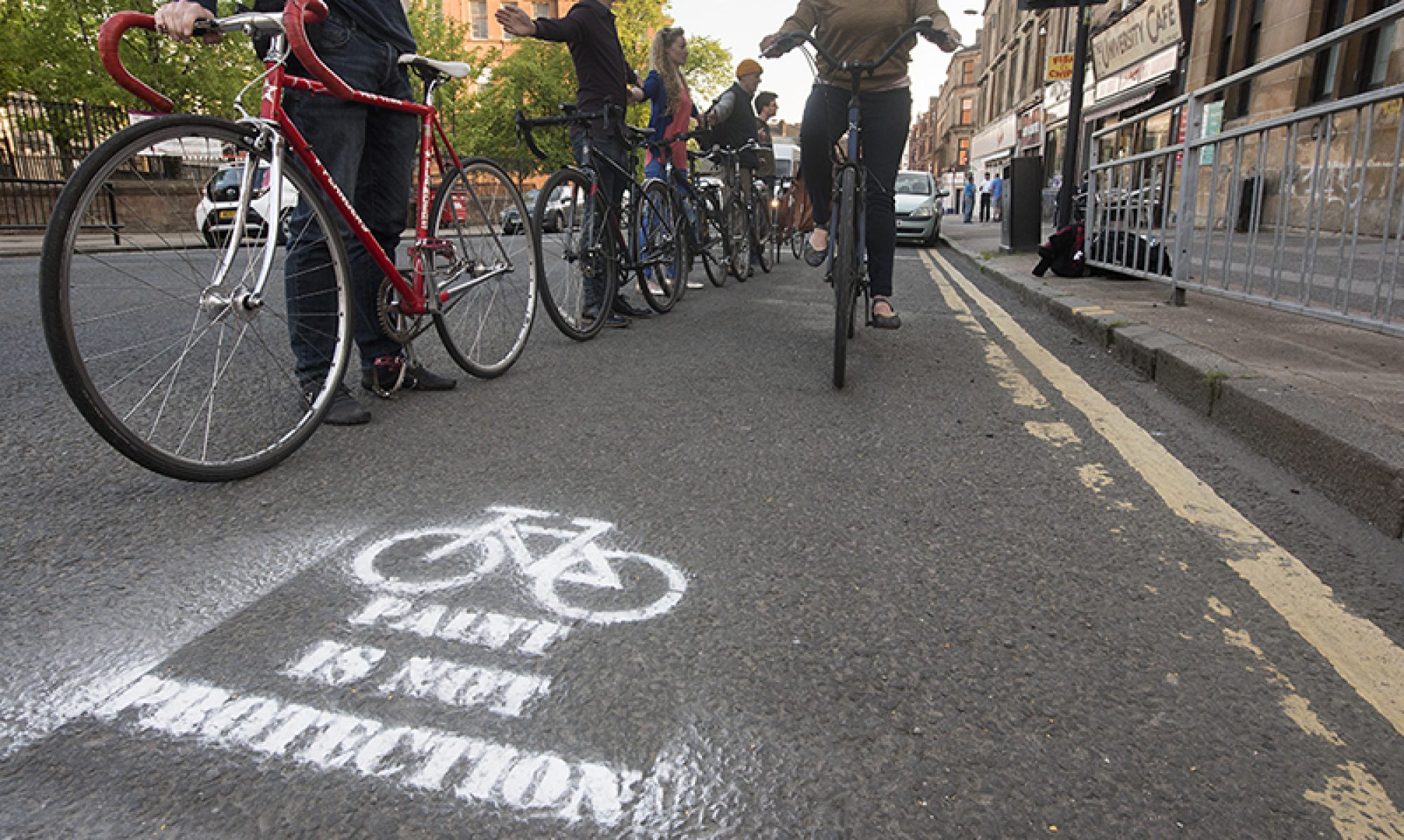
1.7: A77 Active Corridor (Ayr Road)

Council: East Renfrewshire.
Area: A77 west of Newton Mearns.
Subject: Phase 1 of this project extended a shared path from the M77 overpass past Malletsheugh Rd (site of at least one car crash, as seen on StreetView). Phase 2 would add a toucan crossing then 1-way lanes for about a quarter of a mile towards Newton Mearns (removing a central reservation – see visual in main image, at top of page). Also, proposals would convert a roundabout to a protected junction with traffic lights. This would be one of the first of this kind of protected junction in a Scottish town. As with previous consultations on Ayr Rd, the comments are polarised between road safety/active travel and convenience for driving/stereotypes about cycling. The new Williamwood Cycle Lane Campaign have asked people to support the proposals.
First featured: Digest 97, Item 1.7.
Website links: A77 Active Corridor consultation.
Deadline: 30 June 2022.
1.8: LDP2 – Supplementary Guidance Consultation (ERC)
Council: East Renfrewshire.
Subject: ERC is reviewing Supplementary Guidance documents to go with its Local Development Plan 2. They say: “Supplementary Guidance provides further detail about the policies and proposals of the LDP2 and forms a statutory part of the Adopted plan. There are 3 statutory Supplementary Guidance documents on which we are consulting, these are: Affordable Housing; Green Network; and Development Contributions.” The latter can include housebuilders creating paths to join existing networks. Stronger policy could mean improved links to new developments. There’s also a Householder Design Guide coming out separately to LDP2.
First featured: Digest 47, Item 1.5 (further detail in Digest 48, Item 1.4).
Website links: Supplementary Guidance Consultation (near foot of page).
Deadline: 20 July 2022.
1.9: Greenock to Battery Park SfP lane
Council: Inverclyde.
Subject: A Spaces for People temporary route between Greenock town centre and a coastal park. A council vote was 9:2 in favour of keeping the lanes for another six months, with a further review in September. Photos in the consultation survey show a mixture of on-road ‘soft’ segregation and painted lanes on footways and across side roads. While some of the junction and bus stop treatments may not be ideal, there seem to be decent protected sections too.
Website links: Greenock Town Centre to Battery Park – Community Engagement and Inverclyde Now article on council vote.
Deadline: No obvious deadline.
2: Consultation Feedback
2.1: GHA Parking Areas – City Centre Traffic Management Order
Council: Glasgow City.
Area: Townhead – side streets off Kennedy St and St Mungo Ave.
Subject: Glasgow City Council (City Centre) (Traffic Management) Order 2010 (Variation No.29 – GHA Parking Areas) Order 2022. In other words, parking restrictions for parts of Townhead. We had an email from the Head of Roads: “I am writing to notify you that the above named Traffic Regulation Order was made on 12 May 2022 which would introduce no waiting/no loading at anytime restrictions within the GHA parking areas. There was a change to proposals: Removal of loading restrictions on Dobbies Loan Place at its eastern point behind the shop premises to allow for loading to take place.”
Last featured: Digest 91, Item 1.1.
Website links: Final GHA parking areas plan (PDF).
2.2: Glasgow Low Emission Zone

Council: Glasgow City.
Area: Most of the city centre between the river and M8.
Subject: Glasgow’s Low Emission Zone came into effect on 31 May 2022. However, no enforcement will start until 1 June 2023 (or 1 June 2024 for vehicles registered to a residential property within the LEZ area). The final report says most objections to the LEZ came from the taxi trade, where hundreds of vehicles don’t meet the emissions standard. It remains to be seen how many vehicles will be upgraded over the next year.
Last featured: Digest 104, Item 1.1.
Website links: Final LEZ plans (PDF) and LEZ letter (PDF).
2.3: Clydesdale STAG – Part 2 Appraisal
Council: South Lanarkshire.
Area: Clyde Valley including rural towns and villages like Lanark, Carluke, Law, Biggar, Symington and Carstairs.
Subject: Scottish Transport Appraisal Guidance (STAG) is a formal process looking at road, rail and active travel improvements in an area. Clydesdale, like other rural areas, has had cuts to bus and train services, lacks a network of safe paths and has higher car ownership. Part 2 follows the Pre-appraisal (2017) and Part 1 Appraisal (2019). Active Travel Infrastructure is one of the options in the appraisal report, like links between Carluke and Lanark. Other proposals include reinstating rail links/stations, bus improvements, park & ride, etc. The next step of a final report with recommendations will have to wait until “funding becomes available.”
Website links: Clydesdale STAG article and Clydesdale STAG Appraisal reports.
2.4: SWG3 venue – bike parking

Organisation: SWG3 venue.
Area: Eastvale Place (at end of Kelvinhaugh St) between the railway lines.
Subject: Since the last issue, SWG3 replied to a tweet about their transport survey. Talking about bike parking, they said: “This is included in our current development phase in the yard and should be completed by the end of the year.” There are several planning applications for their site but they may mean one from May 2019 (which has since been updated – 19/01438/FUL). It includes adding bike parking spaces near the main gate on Eastvale Place and on an access road off Sandyford St (behind Glasgow Uni’s Maclay Residencies on Cooperage Place).
First featured: Digest 111, Item 1.2.
Website links: SWG3’s tweet and May 2019 planning application.