
In the Neighbourhood…
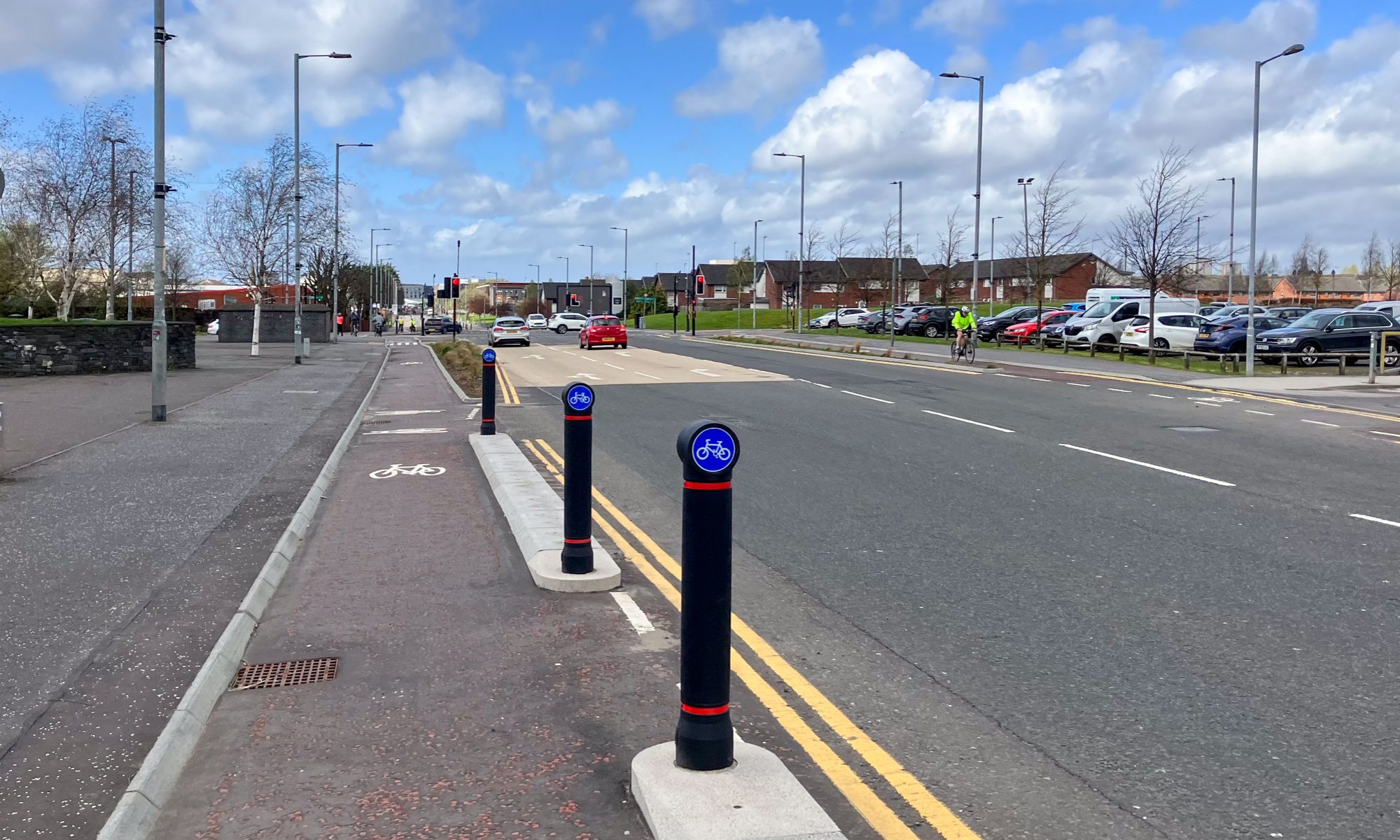
Another four consultations at once – this time, Liveable Neighbourhoods in Glasgow. Two on the Southside, one for the north-west and one for north-east. Also, new visualisations came out for some of the earlier LN projects (see featured images on this post). A few of South Lanarkshire’s consultations are ongoing and there’s a new one from North Lanarkshire.
Consultation events – Palacerigg, Cumbernauld has a drop-in event TODAY (1–8pm) and Mansewood to Shawlands LN has an event tomorrow (17 Feb, 4–7pm). See below for details…
1: Current Consultations
- Clydesdale Active Travel Studies
- Liveable Neighbourhoods – Pollokshields East to Gorbals
- Liveable Neighbourhoods – Mansewood to Shawlands
- Palacerigg Future Housing
- North East Districts: Townhead, Cowcaddens, Learning Quarter and Merchant City DRF
- NCN74 Uddingston to Bothwell realignment
- Liveable Neighbourhoods – Yoker to Whiteinch
- Liveable Neighbourhoods – Royston to Hogganfield
2: Consultation Feedback
3: Proposed Traffic Calming/Traffic Regulation Orders
1: Current Consultations
(in date order for responses)
1.1: Clydesdale Active Travel Studies
Council: South Lanarkshire.
Subject: A large rural area divided into southern, north-west and north-east areas for these projects. Like previous studies in South Lanarkshire’s towns, there’s a consultation map to comment on. Some areas have new active travel infrastructure, including Carstairs, with other routes like Leadhills–Wanlockhead to follow. This is a chance to look at gaps like Make Your Way’s NCN74–Douglas path, which missed out on funding. The map and surveys will inform reports and active travel network maps for each area.
Website links: Clydesdale Placecheck map (all areas), Northwest Clydesdale Active Travel Feasibility Study, Northeast Clydesdale Active Travel Feasibility Study, South Clydesdale Active Travel Feasibility Study.
Deadline: 24 February 2023.
1.2: Liveable Neighbourhoods – Pollokshields East to Gorbals

Council: Glasgow City.
Areas: Pollokshields East, Govanhill, Tradeston and ‘Greater Gorbals’.
Subject: A consultation on neighbourhoods that aren’t obvious bedfellows. A different grouping was used for the South Central Local Development Framework (SCLDF) last year. The southern bit missing is Polmadie, which was tacked onto the Langside to Toryglen LN. Govanhill is one of the most densely populated areas in the city. It contains most of Victoria Rd, with the South City Way, and part of Pollokshaws Rd. The Gorbals (and Hutchesontown) has been almost entirely demolished and rebuilt since the 1950s with mixed results. More recent regeneration has included the rebuilt footbridge to new flats in Oatlands and Richmond Park. Also, the Barclays campus in Tradeston with bike links to the South West City Way and along the former Clyde Place. However, this is a great opportunity for raising (literally!) the sunken south bank cycle path near St Andrew’s suspension bridge.
Website links: Pollokshields East to Gorbals LN consultation page.
Deadline: 26 February 2023.
1.3: Liveable Neighbourhoods – Mansewood to Shawlands

Council: Glasgow City.
Areas: Mansewood, Pollokshaws, Shawlands.
Subject: Southside areas east of Pollok Country Park. There’s the brand new South West City Way extension on St Andrew’s Drive. At the other end of the scale, the Auldhouse (Tollbooth) Roundabout is a road safety blackspot on one of many wide main roads off the M77 motorway. A lot of the main roads lack crossings, even at some entrances to the park like Pollok Ave. Some big developments are planned for both Shawbridge Arcade and Shawlands Arcade. Also, the former car showroom site on Pollokshaws Rd at Nithsdale Dr just got planning permission. It’s the junction where Ashley Lennon was hit and killed by a truck driver in May 2019 but no changes have been made to the road. The LN website asks for suggestions of local groups to work with but it’s not clear how this fits with other projects like Connecting Pollokshaws.
Consultation event – TOMORROW 17 Feb, 4-7pm at Nan McKay Hall, St John’s Rd, Pollokshields.
Website links: Mansewood to Shawlands LN consultation page.
Deadline: 26 February 2023.
1.4: Palacerigg Future Housing

Council: North Lanarkshire.
Subject: An early consultation on plans for a large housing estate at the southern edge of Cumbernauld. The area is bordered by a Site of Importance for Nature Conservation (SINC) to the west and Palacerigg Country Park to the east. It’s also near the northern tip of the proposed East Airdrie Link Road (which may be one reason that’s being built). Active travel links to nearby Cumbernauld train station, the country park and the wider town will be important but nothing about those so far.
Consultation event – TODAY 16 Feb, between 1–8pm at Muirfield Community Centre, 1A South Muirhead St, Cumbernauld G67 1AX.
Website links: Palacerigg consultation page and Palacerigg survey.
Deadline: 2 March 2023.
1.5: North East Districts: Townhead, Cowcaddens, Learning Quarter and Merchant City DRF
Council: Glasgow City.
Subject: District Regeneration Frameworks for four areas in the north-east of the city centre. These were developed by teams of European and local consultants after previous consultation in late 2020. Each document has a comprehensive plan for its area (50+ pages). These include some fairly radical changes, especially around the M8. Also, there is a refreshing focus on opening up active travel routes through current barriers (improving permeability). However, these may be challenging to deliver. So, a show of support in the consultation should help make the case stronger.
Website links: North-East Districts survey, North-East Districts Combined Regeneration Handbook, Cowcaddens Regeneration Handbook, ‘Learning Quarter’ Regeneration Handbook, Merchant City Regeneration Handbook, Townhead Regeneration Handbook.
Deadline: 3 March 2023.
1.6: NCN74 Uddingston to Bothwell realignment
Council: South Lanarkshire.
Subject: A long-awaited consultation about plans to divert a section of NCN74 at Strathclyde Park. The current route loops up the (steep) Furlongs, onto Bothwell Rd, up alongside the East Kilbride Expressway to Glasgow Rd, down Station Rd in Blantyre to the pedestrian bridge and up to Station Rd in Bothwell. These proposals would change this to a much more direct route from the Raith Interchange, up the steep, pot-holed Langside Rd and across the busy Hamilton Rd on the way to Station Rd. There’s a potential alternative to SLC’s plans (slightly longer but less steep/busy) by turning right onto Laighlands Rd/Bothwellpark Rd then across to Olifard Ave/Appledore Cres. Also, there’s the question of conflict with pedestrians past Strathclyde Park loch. Elsewhere, the survey has two options to transform the approach to Uddingston train station and some other welcome junction improvements.
Website links: Uddingston to Bothwell survey.
Deadline: 6 March 2023.
1.7: Liveable Neighbourhoods – Yoker to Whiteinch

Council: Glasgow City.
Areas: Yoker, Scotstoun, Jordanhill and Whiteinch.
Subject: A Liveable Neighbourhoods area in the north-west of the city. These areas featured in a recent cycling video by John Munro of Birmingham University. Within it, he highlighted the gap in cycling provision between the end of the old railway path at South St and the busy Thornwood Roundabout on Dumbarton Rd. Meanwhile, the former Jordanhill Training College site is one of the bigger new housing developments in the wider area. The MyGLN website seems to have been set up for this Liveable Neighbourhood and Royston to Hogganfield. It’s run by the companies Mott MacDonald, Urban Movement and New Practice. The latter recently paid tribute to Emma Newman on Twitter.
Website links: Yoker to Whiteinch LN consultation page.
Deadline: 19 March 2023.
1.8: Liveable Neighbourhoods – Royston to Hogganfield

Council: Glasgow City.
Areas: Royston, Sighthill, Germiston, Blackhill and Hogganfield.
Subject: Neighbourhoods in the north-east of the city between the M8 and the railway. Furthest west is Sighthill, which is nearing completion after a total rebuilt in the last few years. East of Springburn Road are Royston and Germiston and their main street, Royston Rd. It hasn’t got any cycling infrastructure on the flat but was the subject of a project by Rosemount Development Trust in 2021. Where Royston Rd climbs up to Blackhill there’s the Spaces for People cycle lanes. Another project, Flourishing Molendinar, have big plans for Blackhill, Cumbernauld Rd (by Hogganfield Park) and the bridge to Smithycroft/Riddrie. Hogganfield Loch is part of the Seven Lochs Wetland Park (PDF map). So, better links to the rest of Glasgow would have wider benefits for people going to/from North Lanarkshire.
Website links: Royston to Hogganfield LN consultation page.
Deadline: 19 March 2023.
2: Consultation Feedback
2.1: Paisley to AMIDS transport links

Council: Renfrewshire.
Subject: Route along the White Cart river between Paisley town centre and the Advanced Manufacturing Innovation District Scotland (AMIDS) next to Glasgow Airport. The riverside road and bridge now has planning consent from Renfrewshire Council’s Planning and Climate Change Board. While the roads seem to be the focus, there are cycling and walking links but they’re shared pavements.
Website links: Paisley to AMIDS planning announcement, AMIDS South project route maps.
2.2: New visuals of first four Liveable Neighbourhoods

Council: Glasgow City.
Subject: New visualisations of projects from the first tranche of Liveable Neighbourhoods. Carntyne Square is shown for Dennistoun to Cranhill LN. The Langside to Toryglen LN has a view of the Battle of Langside monument. There’s a view of the Dummy Railway path for Ruchill to Cowlairs LN. Most interesting is the view of Paisley Road West, Cessnock for the Govan to Kingston LN. It seems to ‘put a marker down’ for cycletracks on PRW. However, the recent Glasgow Bus Partnership report to GCC only mentioned bus lanes, not bike lanes. A bus lane is marked in the visual so let’s hope there’s room for both.
Website links: Liveable Neighbourhood Vision Starts To Take Shape (Re:Glasgow).
3: Proposed Traffic Regulation Orders
3.1: East Dunbartonshire TROs

Areas: Bearsden, Bishopbriggs and Kirkintilloch.
Subject: Orders about parking restrictions, electric charging and speed limits.
Website links: East Dunbartonshire TROs.
3.2: Glasgow City Traffic Calming/TROs
Areas: City-wide.
Subject: TROs: Laggan Rd filter is out for consultation until 24 February 2023.
Traffic calming: Three current schemes for Greenfield Avenue/Inveresk St, Waulkglen Road and Boghall Road.
Website links: Glasgow City Proposed TROs, Glasgow City Proposed Traffic Calming Schemes.